Buila Experience #1. Adventures in Romania's Smallest National Park - Jun 2022
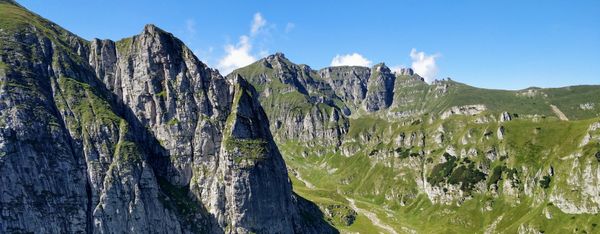
The Buila-Vânturarița massif has the shape of a ridge and is located on the edge of the Căpățănii Mountains, being a part of them. The maximum altitude is reached by the Vânturarița Mare peak (1885m), and the area of the national park around the massif is 4186 hectares. It is the smallest in Romania.
Buila-Vânturarița remained one of the few mountains on a wish list made many years ago that I didn’t get to visit yet, somehow. Being a mountain dominated by deciduous forests, I had set my mind that I must arrive here either in autumn, to catch the show of colors, or in spring, to enjoy all the shades of fresh green.
Finally, tired of waiting, we decided to go to Buila-Vânturarița at the first opportunity, whatever the season, so we planned to get there in the extended weekend 10-13 of June.
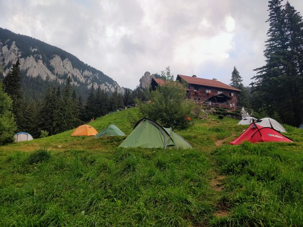
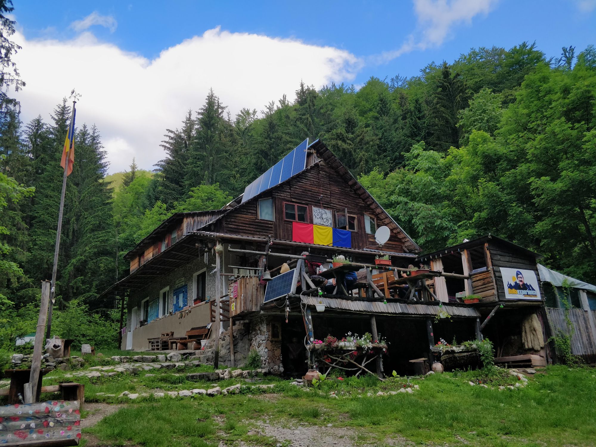
We chose to camp in the Cheia Cabin enclosure - famous for the beauty of the area and the hospitality of the lodger - a choice that turned out to be a very good one.
The First Adventure: The Road to Cheia Cabin

We knew that to get to Cheia Cabin you have to drive almost 30km of forest road. I had read about people who made their way in a small car, and they said it was possible if you were careful.
However, when we called the owner of the cabin to book the places for our tents, we also asked about the road, and his recommendation was clear: the road is not for small cars; you need an SUV or an off-road.
Fortunately, as never before, the car we were going to drive was actually an SUV.
The day of the departure has come. We started from Cluj later than we planned, and Waze was telling us that we would arrive around 10 p.m. I didn't manage to contact our host, to inform him of the delay.
I sent him text messages hoping he would see them and wait for us.
Everything was ok until Râmnicu-Vâlcea. But then, after a few kilometers, the forest road began.
At first, the road was decent, but with every kilometer it seemed to get worse and we had to go slower and slower. It was already dark, and to make matters worse, it started to rain. At first we were worried about how we were going to set up the tents in the rain, but we soon realized that the weather, along with the darkness and the road were slowing us down considerably, and we were in danger of finding no one awake at the cabin.
You know what it's like when it's dark, it's raining, you've been driving for hours on an endless forest road, you don't know what's ahead, there's no signal, and your estimated time of arrival keeps increasing instead of decreasing? We were supposed to arrive at 10 p.m., but at 11:30 p.m. there was no cabin in sight, and we just arrived at a place where the road disappeared into the river.
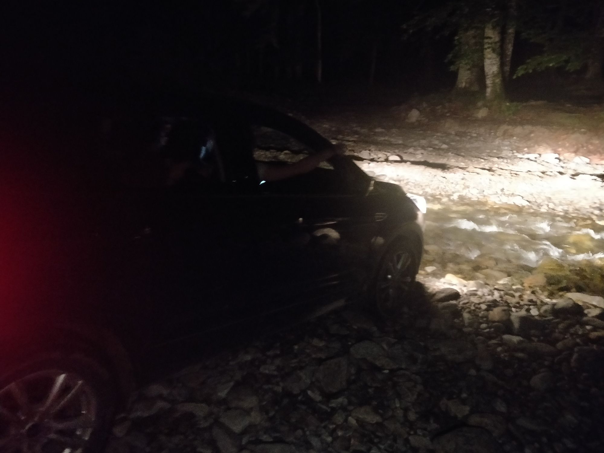
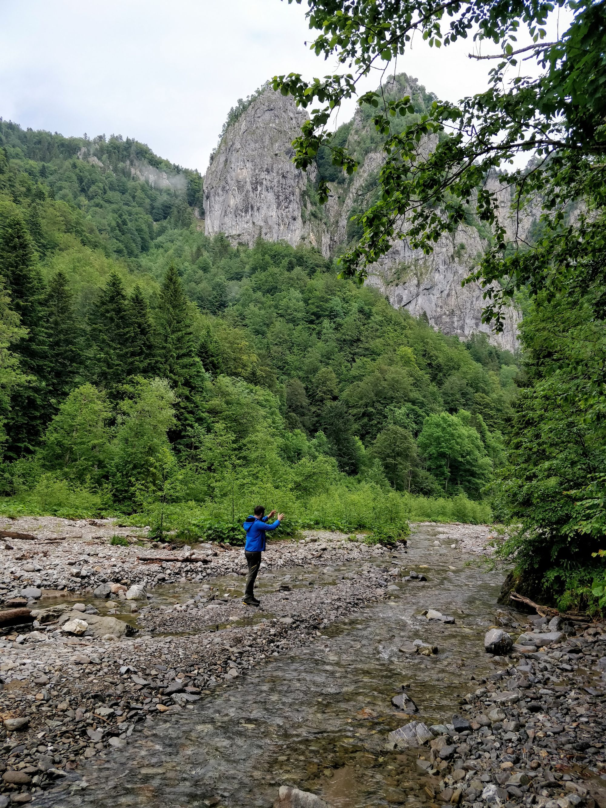
After scrabbling around through the night and fog, we see on the other side of the water something that might look like a road. As it's the only option, and it's too late to turn back, we pick up our feet and wade through the water.
But in a few minutes the road comes out of the forest again on the river bed, and this time we are in even more trouble than last time. There is no way. Did we take a wrong turn somewhere? Aren't there any other roads through the forest that we missed? It looks like the road goes through the river, but this time it doesn't cross it, it goes along with it!
After more searching and going back and forth, we all get out of the car except for the driver - because we don't know how deep the water is - and guide him to the river bed that we think would be passable for a car. And then we take off our shoes - because we didn't find a place to cross with our shoes on - and follow him.
Our intuition regarding our way through the river was right, and immediately we are back on the forest road. And in a short time we feel the pressure melt away: we arrive at the cabin.
It's 00:00. Fortunately our host is still awake. More than that, he waited for us with a large plate of crepes 😯.
Even better, we were allowed to sleep in the cabin for the first night, so that we wouldn't have to put up our tents at that hour, in the rain. Thank you!
Day 1: Cheia Gorges and the Goats' Ledge
Technical Details
Today we start from Cheia Cabin and explore the Cheia Gorges until the last viewpoint, then return.
It's a short, acclimatization route, but a challenging route in some places, due to the scree, the steep climbs and descents, and the precipices it passes.
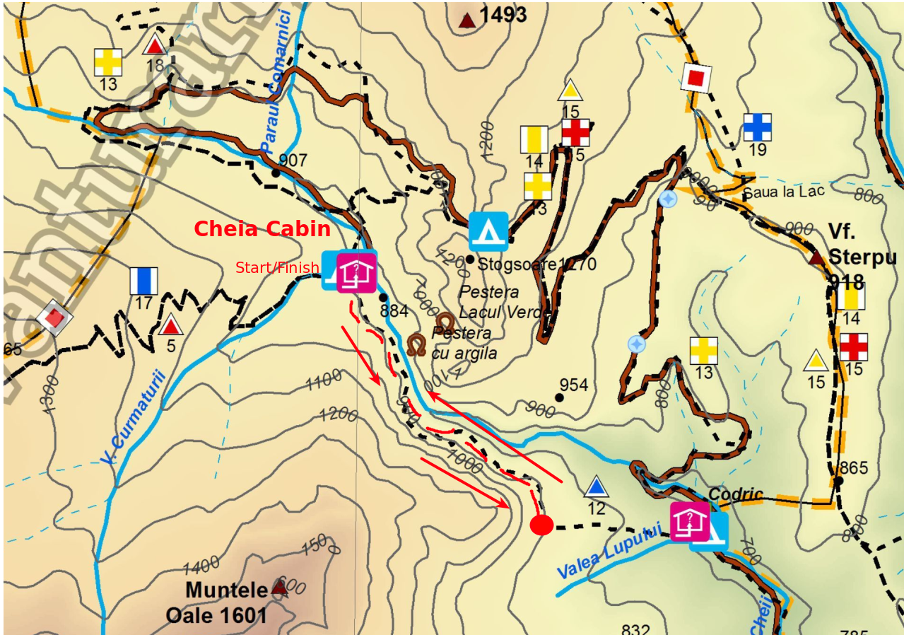
You can find the complete map of the Buila-Vânturarița Massif here.
Parking: Cheia Cabin
Route: Cheia Cabin - Goats' Ledge - The Last Viewpoint - Return.
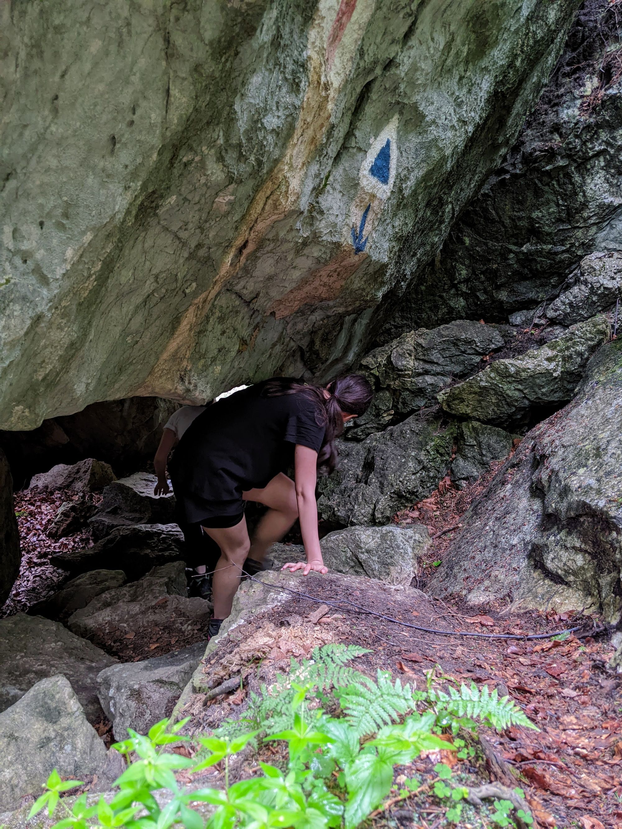
Markings: Blue Triangle
Length: ~4km
Height Difference: 280m
Duration: 2h 30m
Water Sources: Cheia Cabin
Camping: Cheia Cabin
Tracking: AllTrails
The Hike
We didn't set an alarm last night: today is a day of rest and accommodation. That's why the chosen route is a relatively easy one.
However, the light wakes me up at a much earlier hour than I expected. I stopped being grumpy, however, when I raised my head a little, and looked out the window. Wow! The view I have here, from the bed, instantly refreshes me!
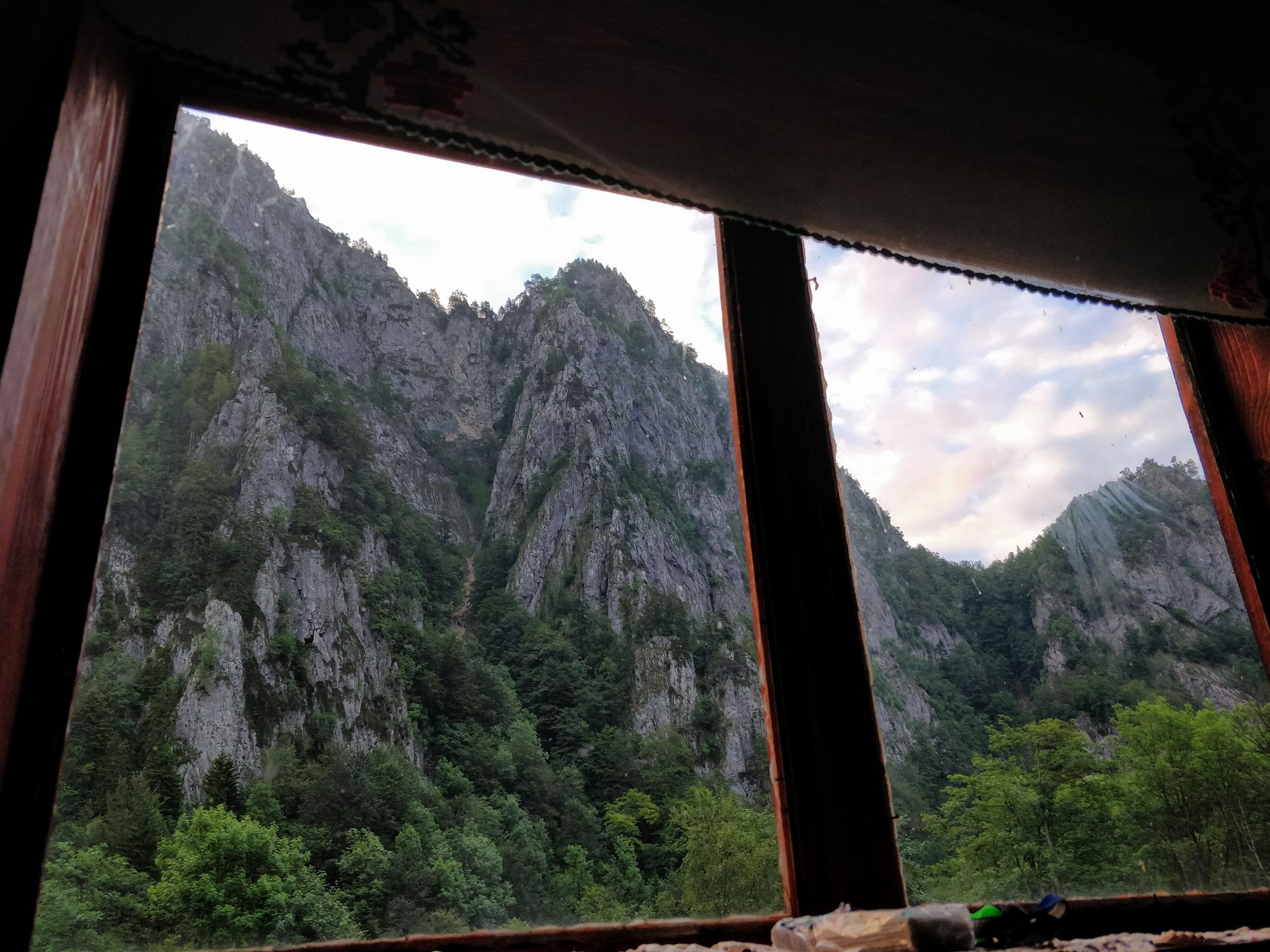
Last night when we arrived here there was nothing to see. But I didn't expect anything like this. The day starts promisingly!
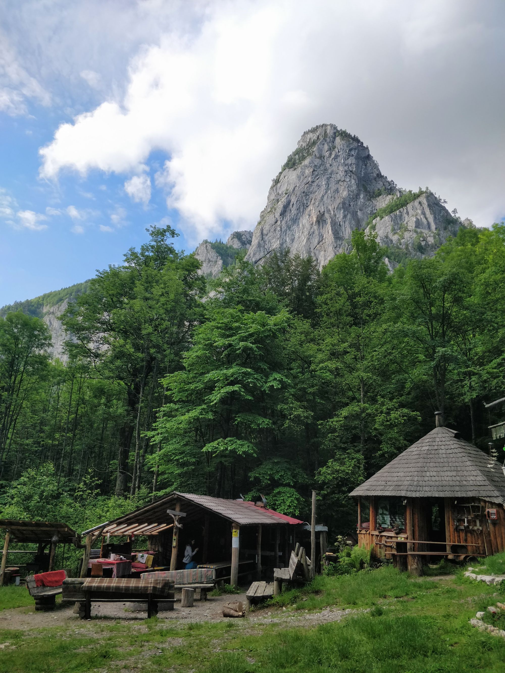
We wake up and gear up without haste. We give ourselves time to admire the surroundings. The cabin, like the owner, is very welcoming. Through the work of Mr. John and his friends, we have gazebos, tables, benches, some electricity, a bathroom and others.
Around 10:20 we set off on the route to Cheia Gorges. Normally, the route is a circuit. You can go all the way through the gorges, and then return on the forest road. But we don't like the idea of walking for two hours on the road. On top of that, rain is in the forecast for the afternoon, so we want to be able to get back quickly in case anything happens.
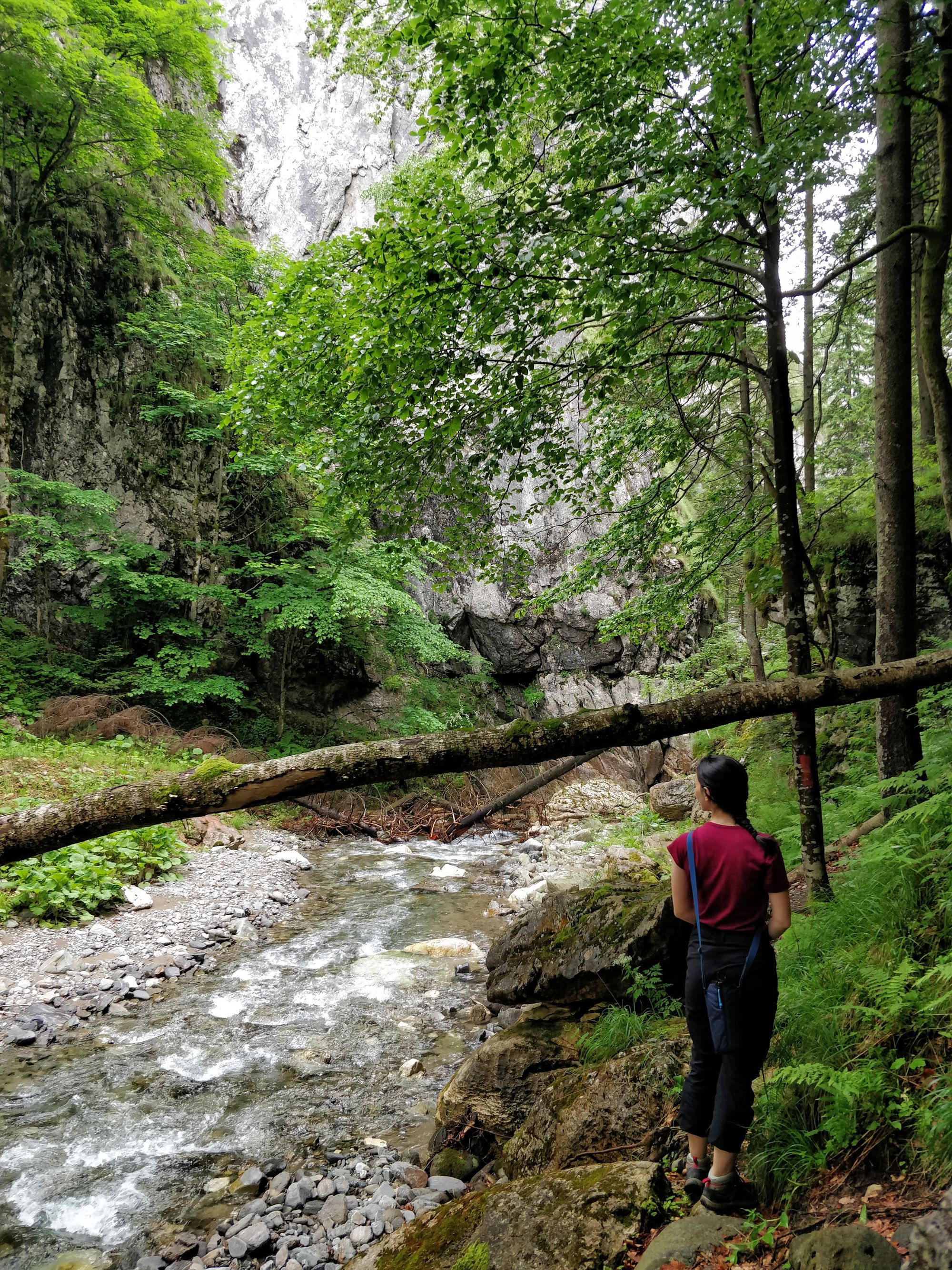
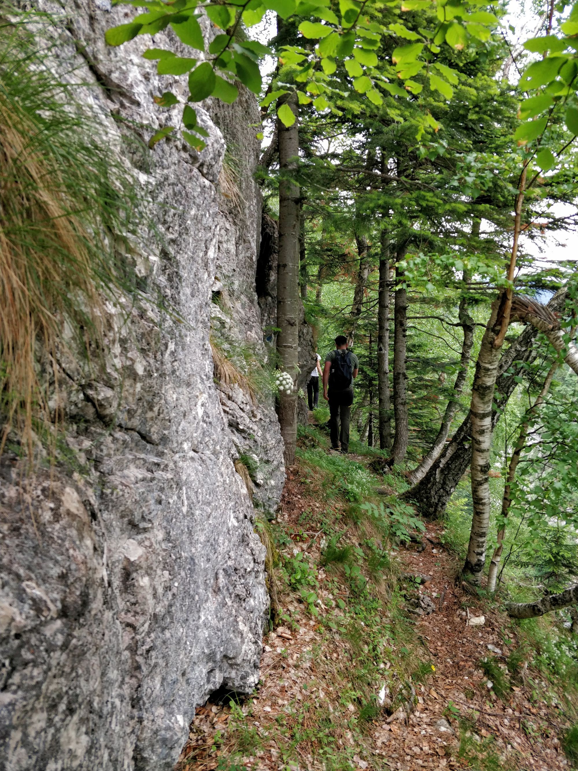
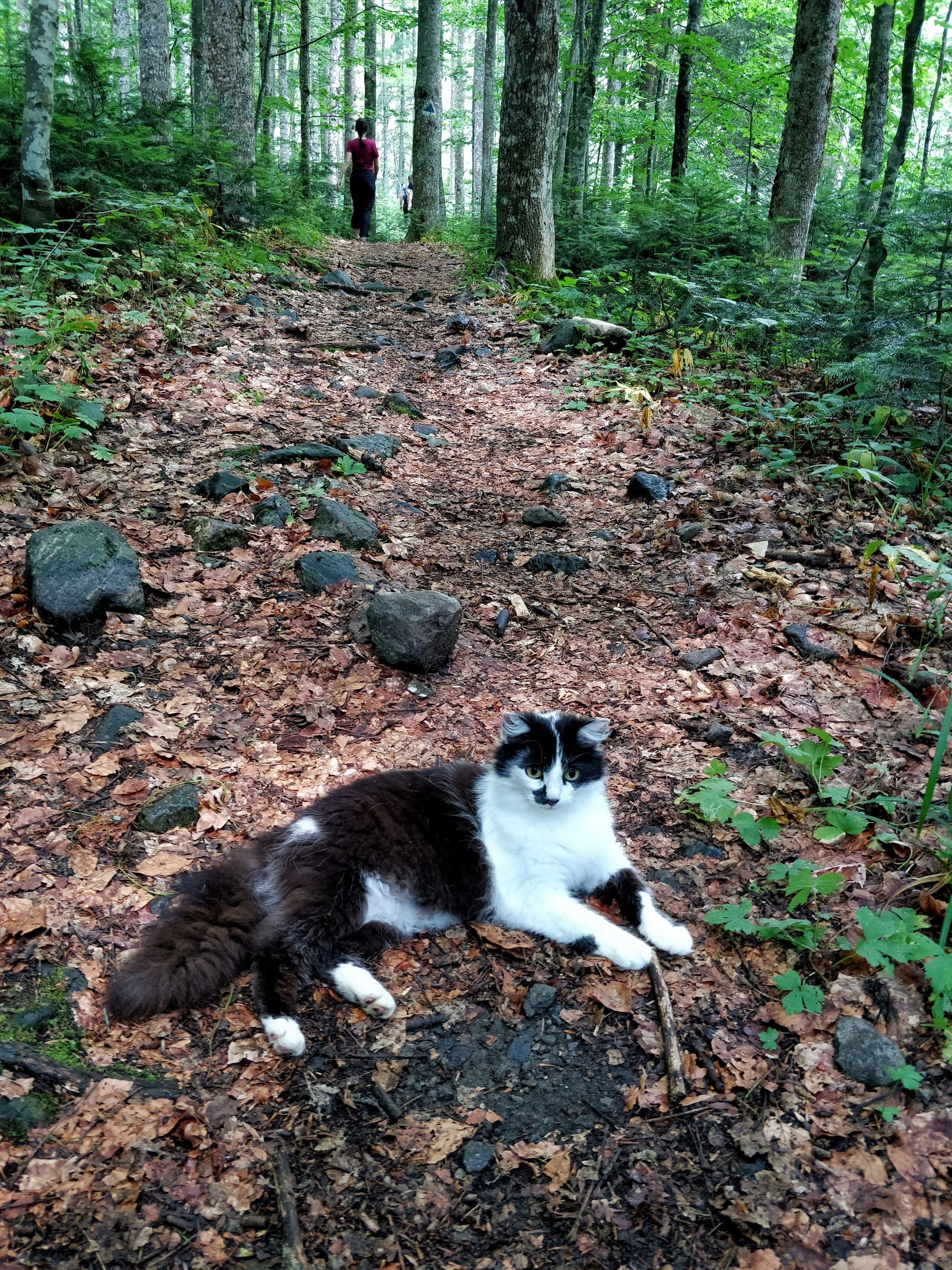
The route starts with a path that slowly approaches the river and, from time to time, lets us marvel at the high walls of the gorges.
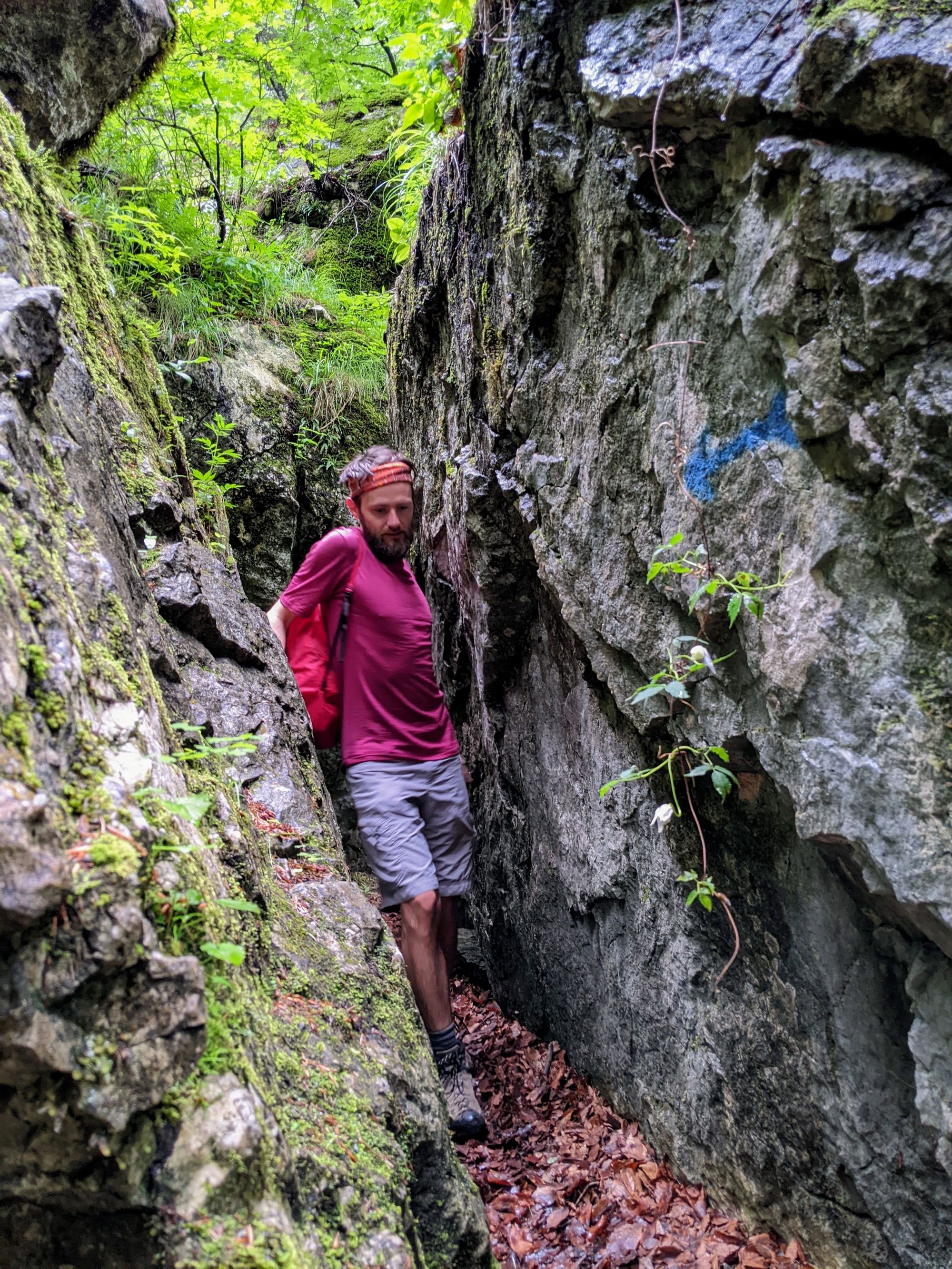
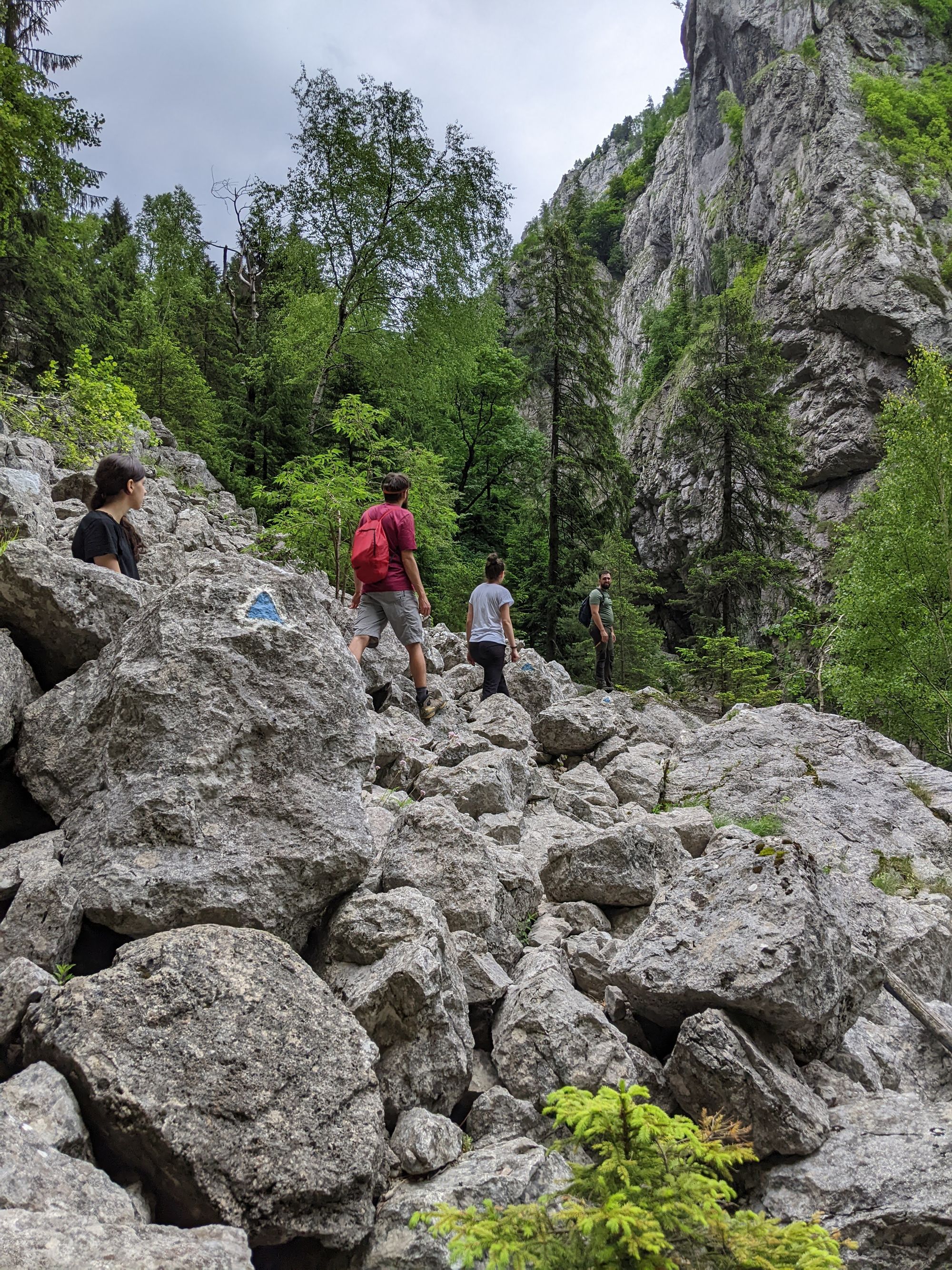
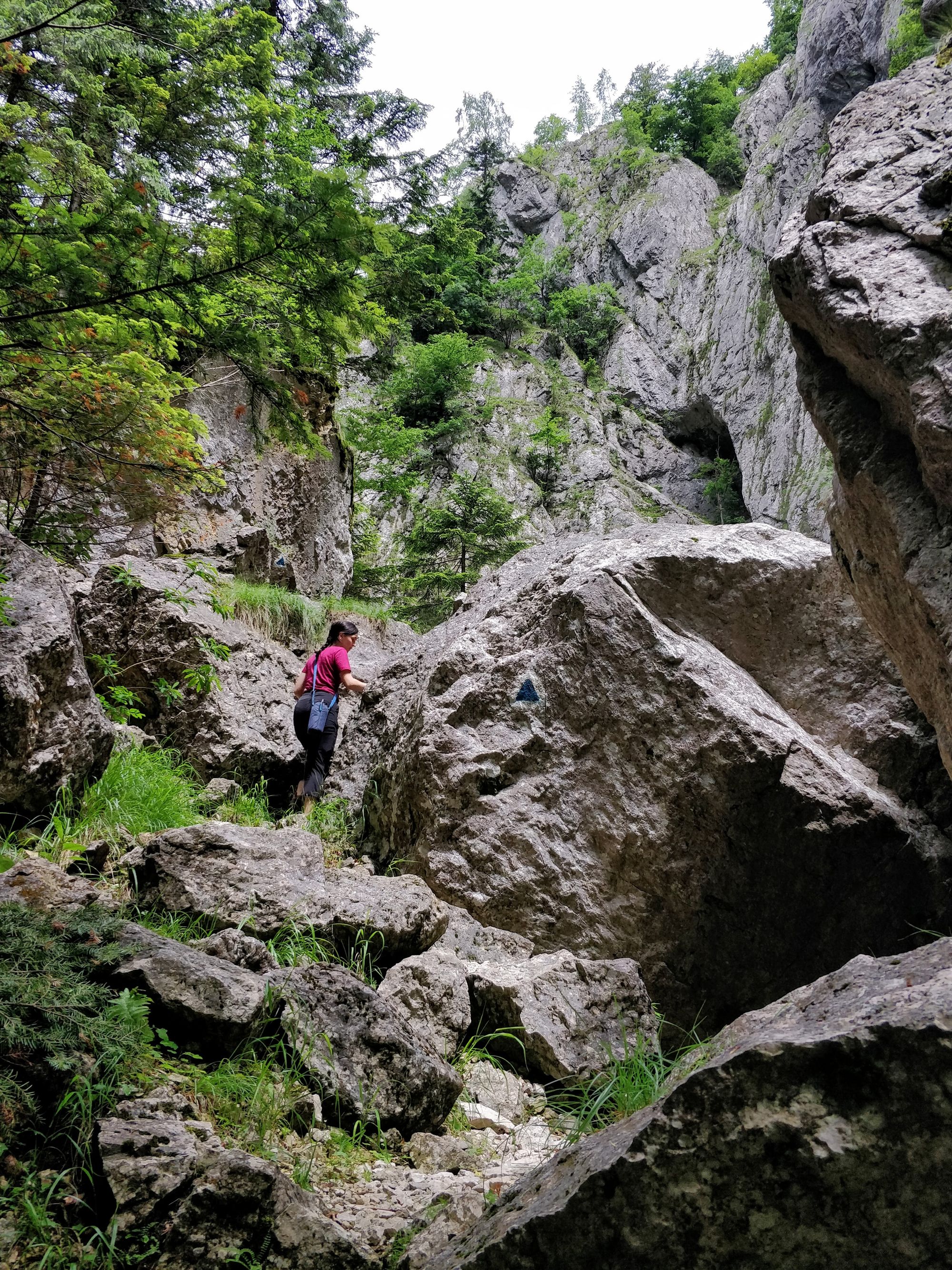
At different points in our way, the route is sprinkled with interesting little obstacles. Big boulders have to be overcome sometimes by getting on top of them, sometimes by going through narrow cracks and sometimes by sliding underneath them.
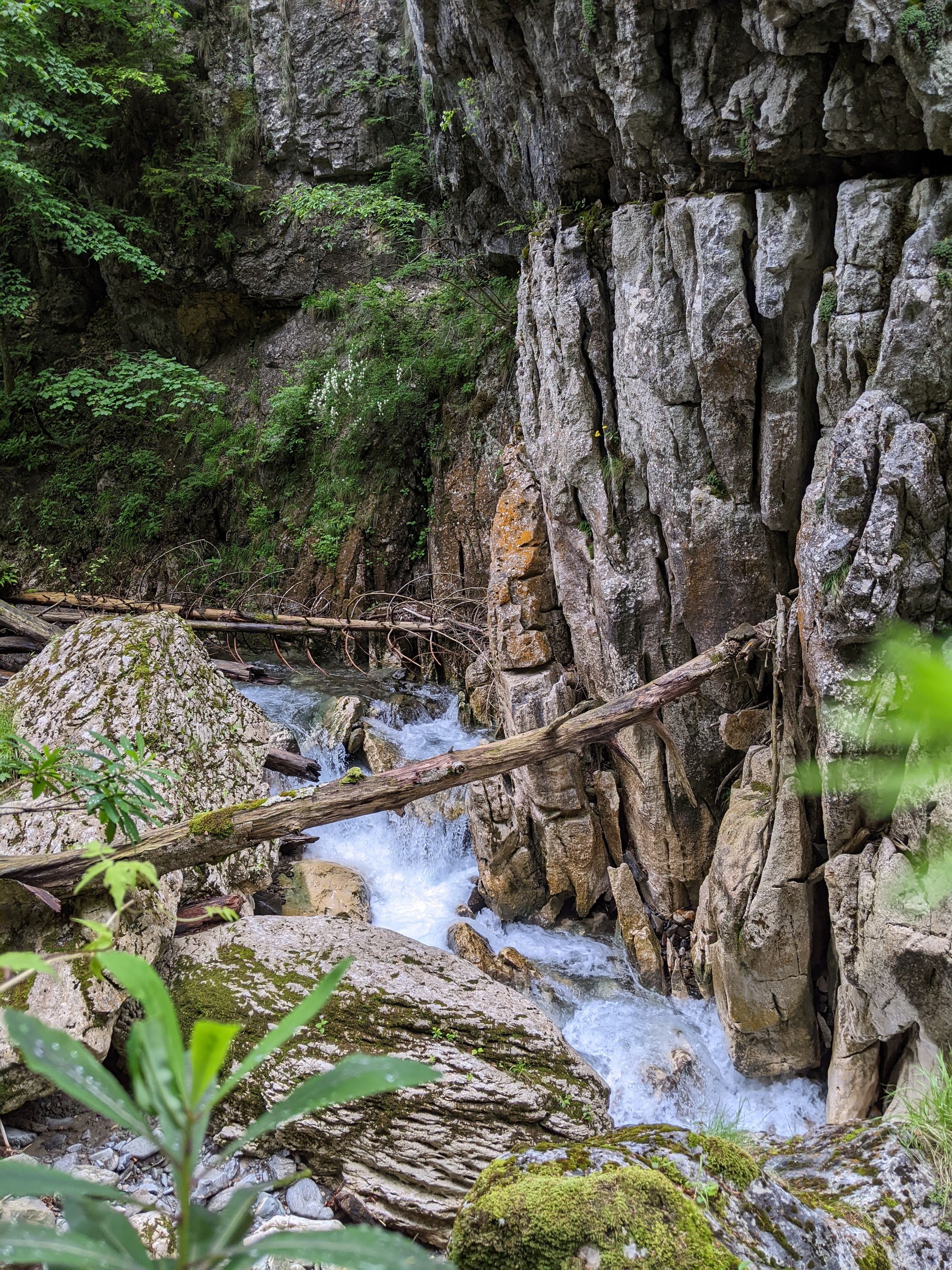
We continue to go up and down the rocks, sometimes closer, sometimes further from the river on our left. We encounter waterfalls more and more often, or places where the river passes at high speed, making lots of noise.
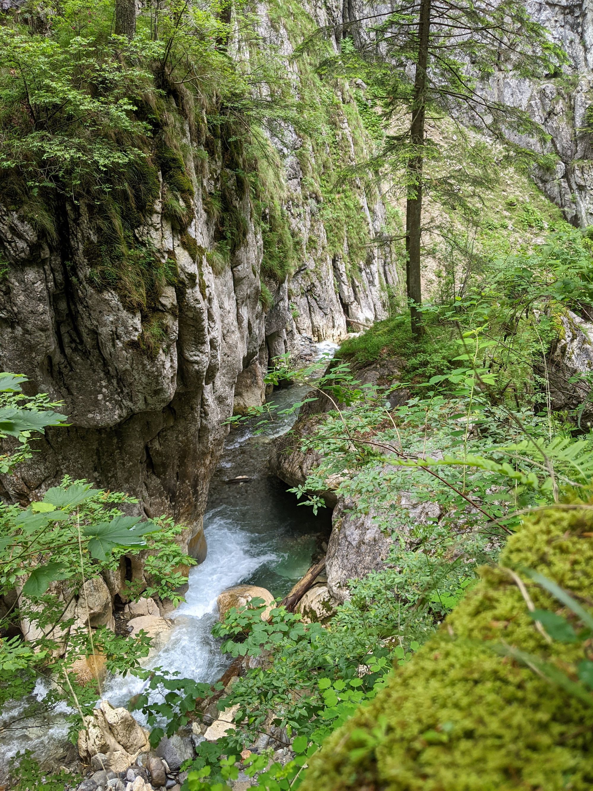
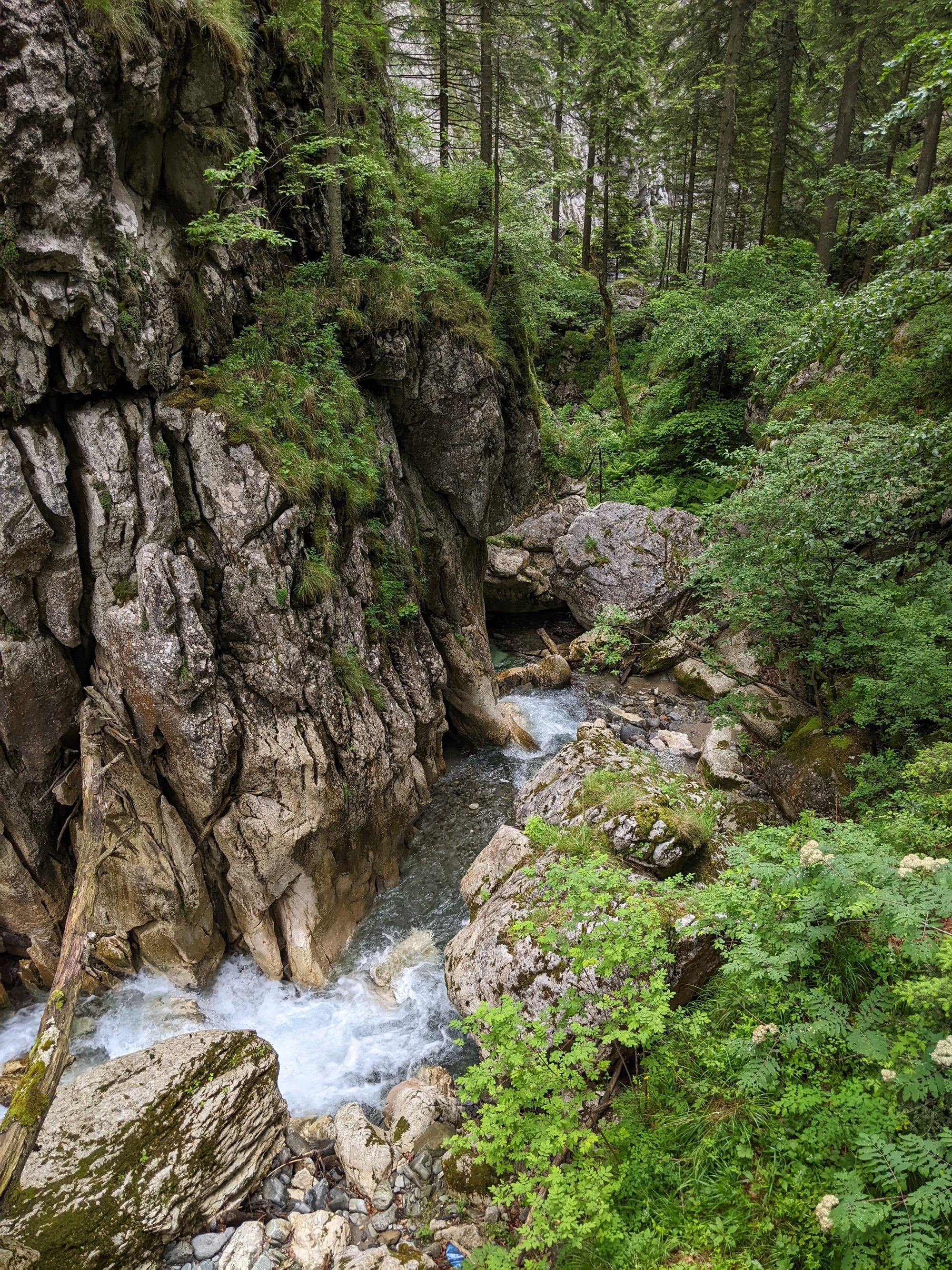
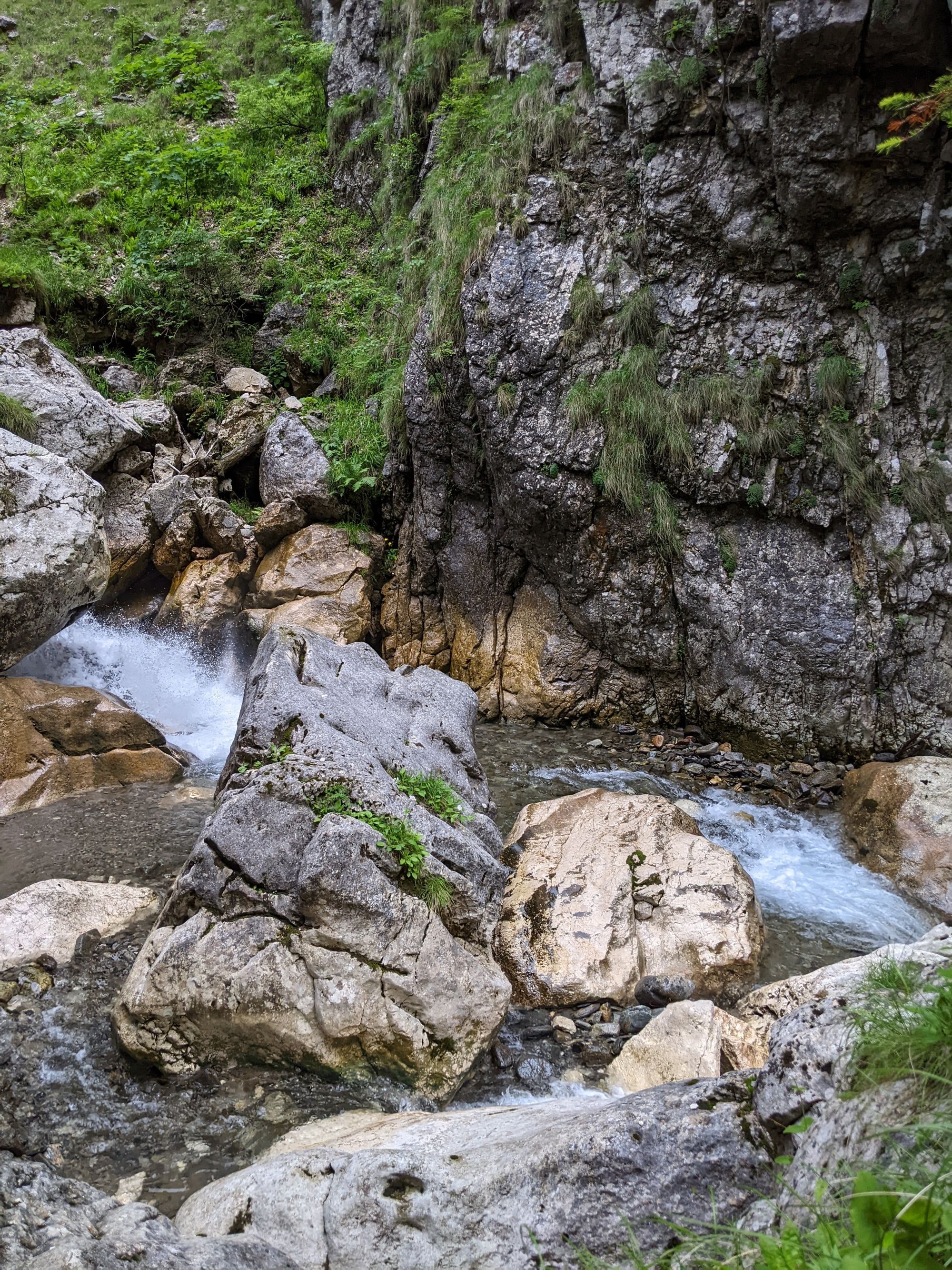
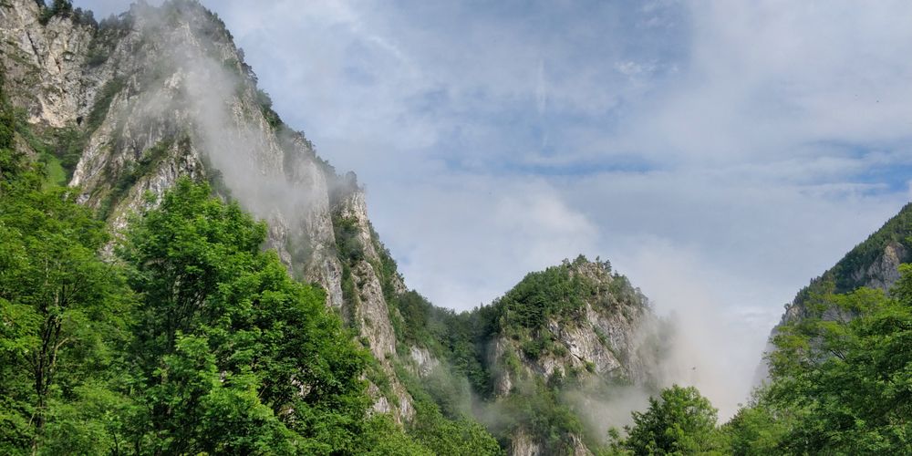
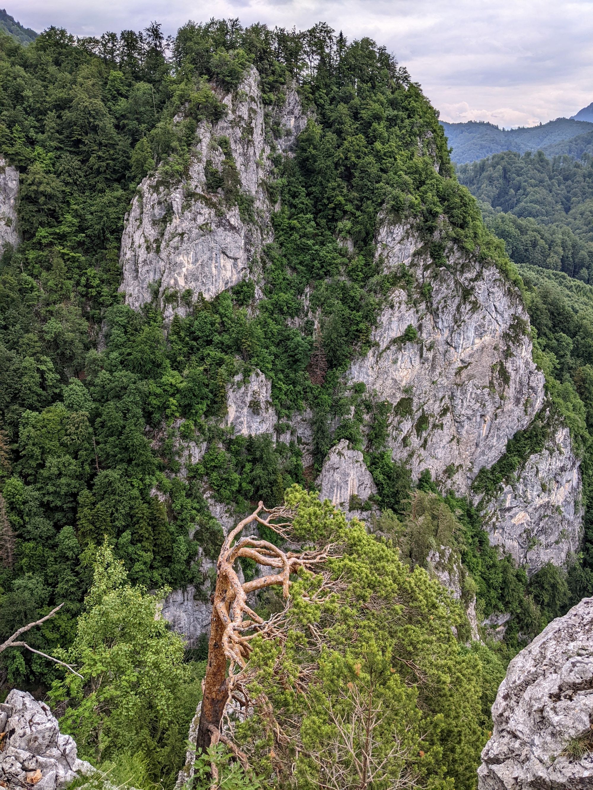
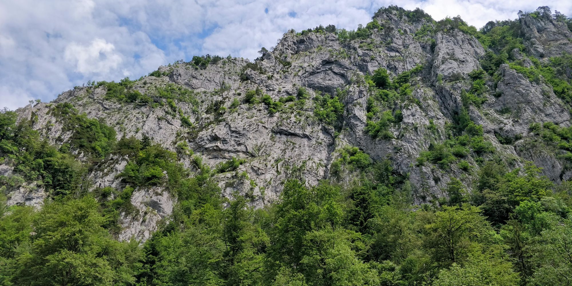
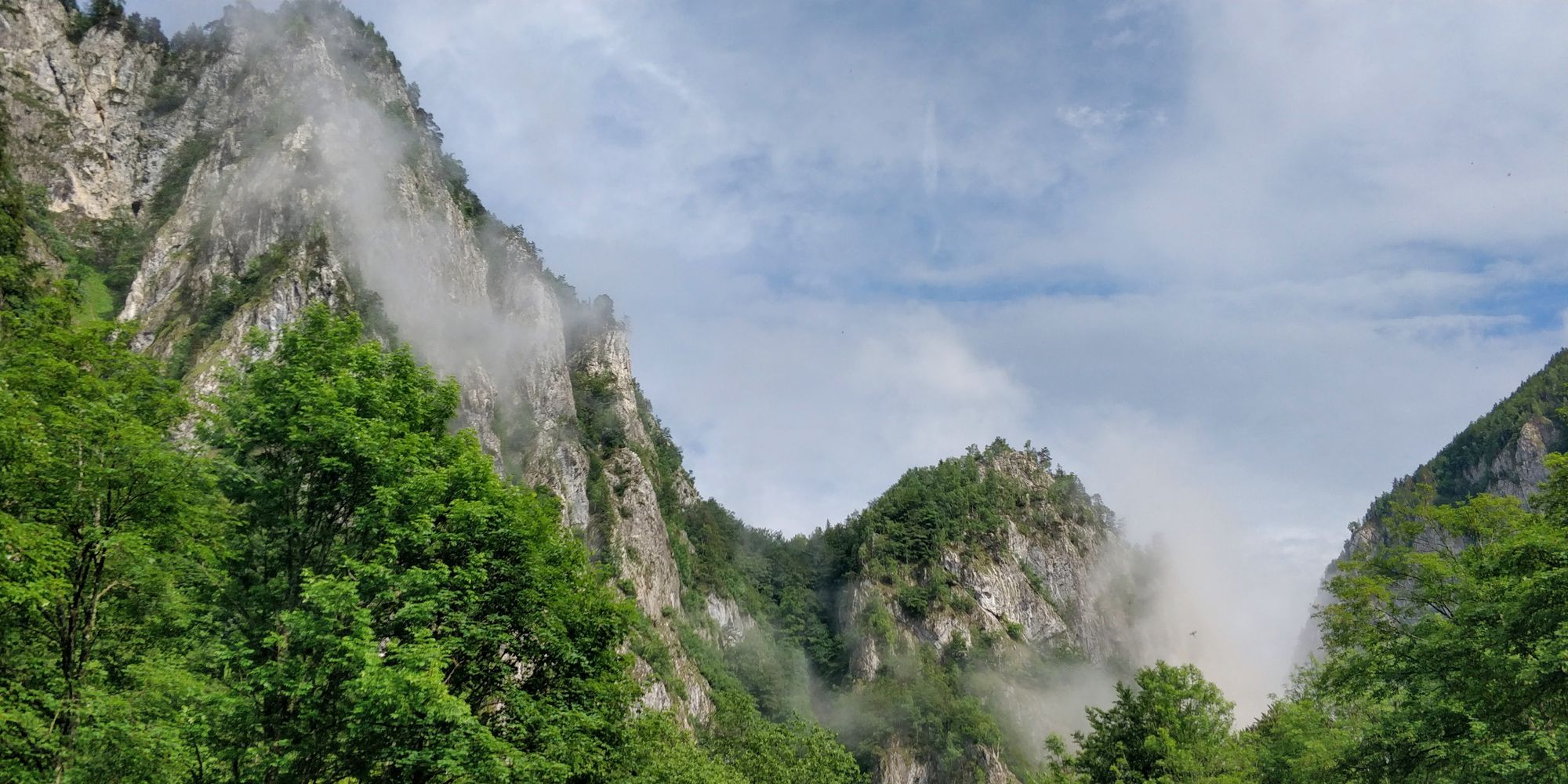
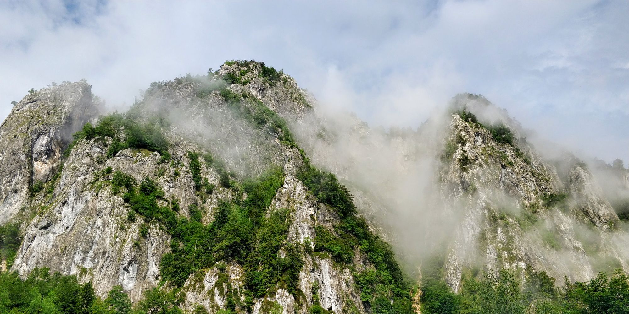
From place to place we can admire the high, stony gorge walls, the top of which we can barely see.
The water carved rock often takes imposing shapes.
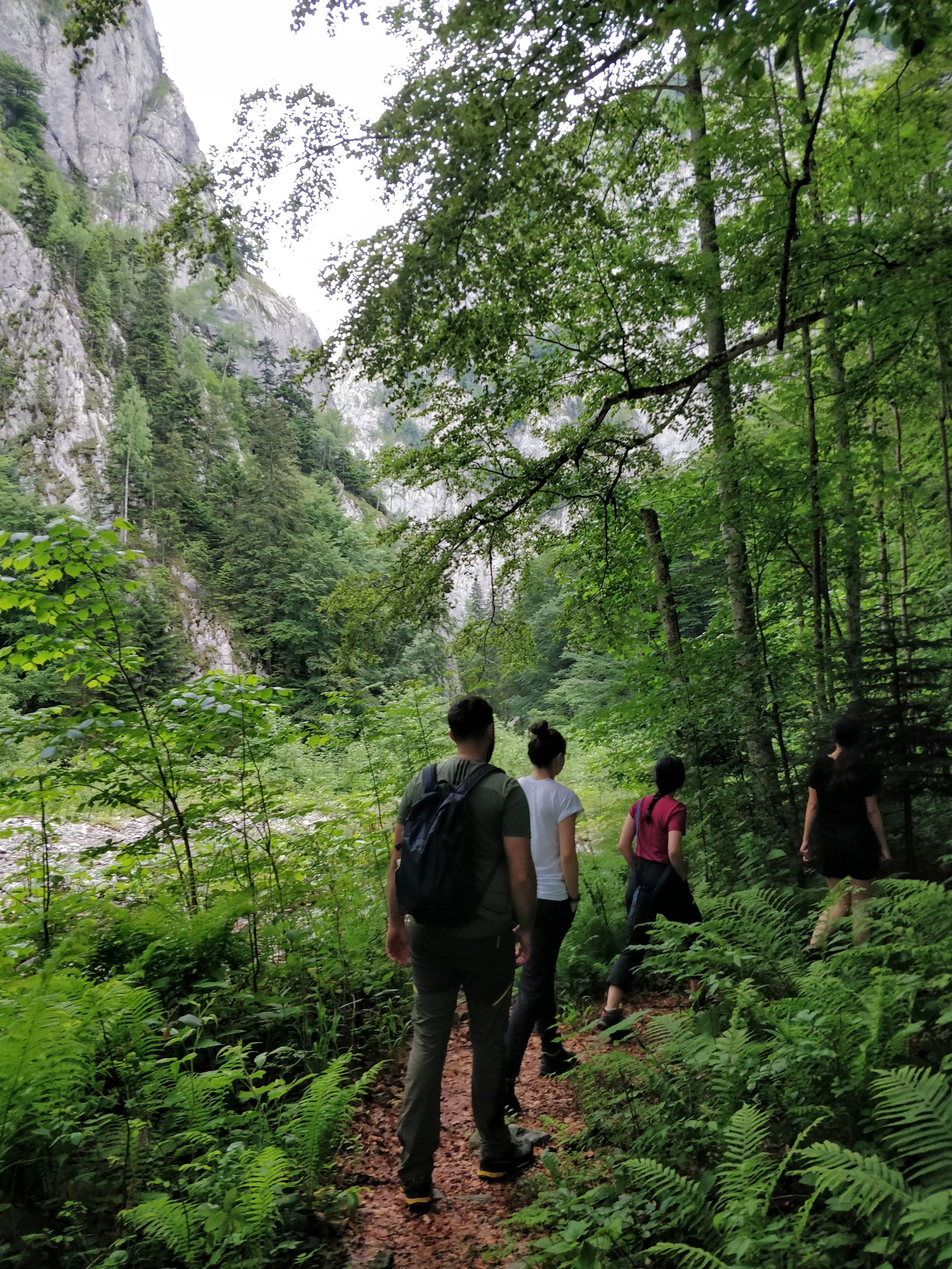
The trail continues to be delightful. The rocks above steal our gaze, and the rocks below demand our attention and get our blood pumping.
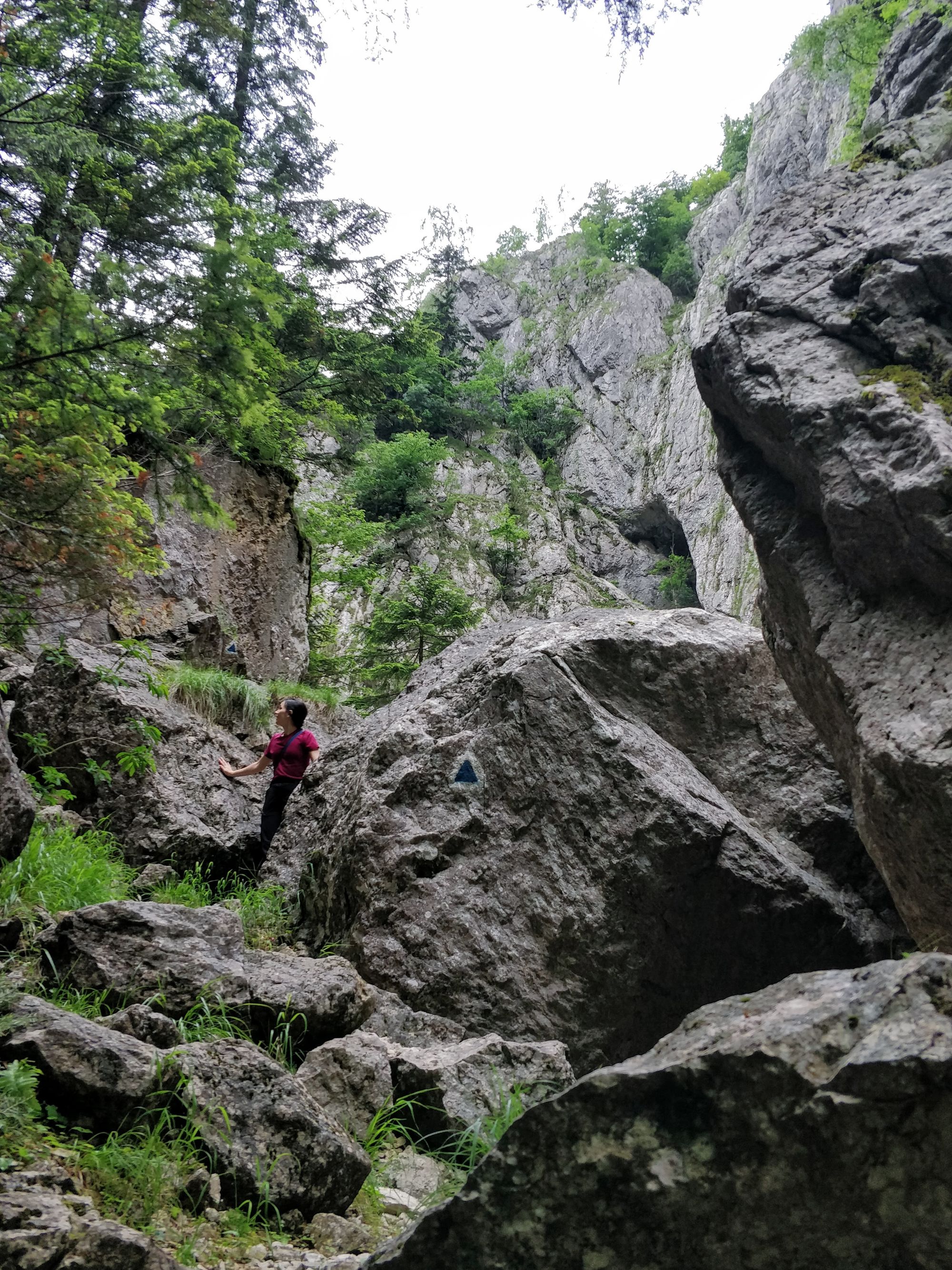
We soon reach a noisy waterfall. From here the gorges open, and we can see a part of the Goats’ Ledge, which we are going to climb.
Shortly after we pass the waterfall, the route deviates from the river to the right, and we start to climb the Goats’ Ledge. After a sustained climb, we have the opportunity to see the waterfall from above.
But we’re not done climbing. We continue past the rock wall, on a veritable and demanding scree.
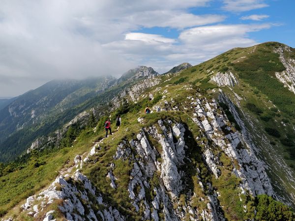
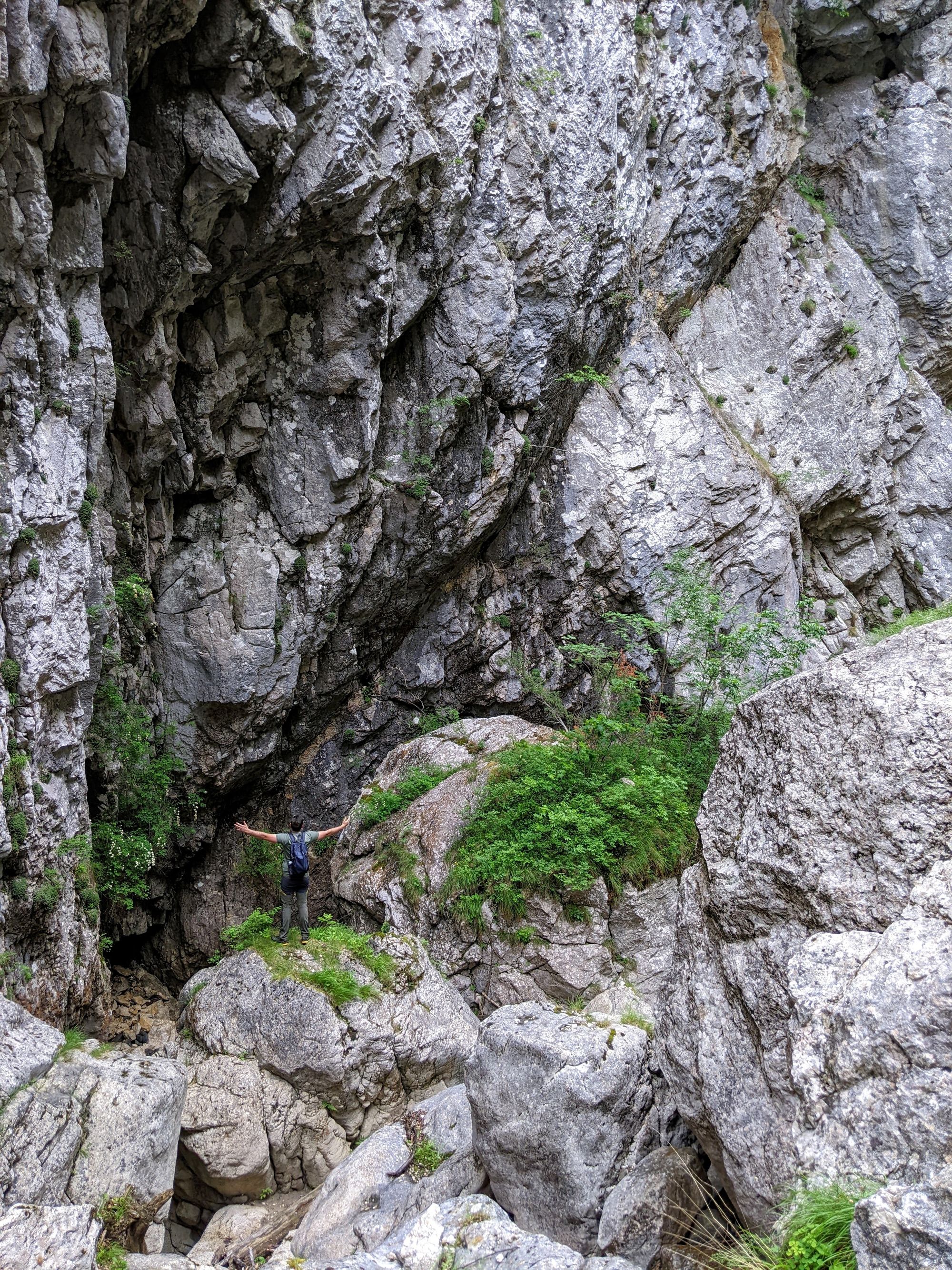
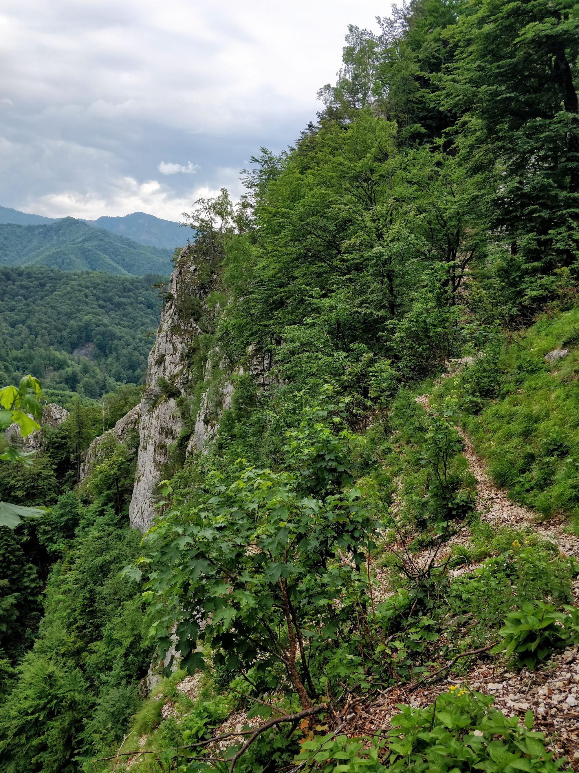
Arriving high on the ledge, the views are as we expected: spectacular. The trees near the path give you a sense of security, but it's better not to look through them if you have altitude sickness.
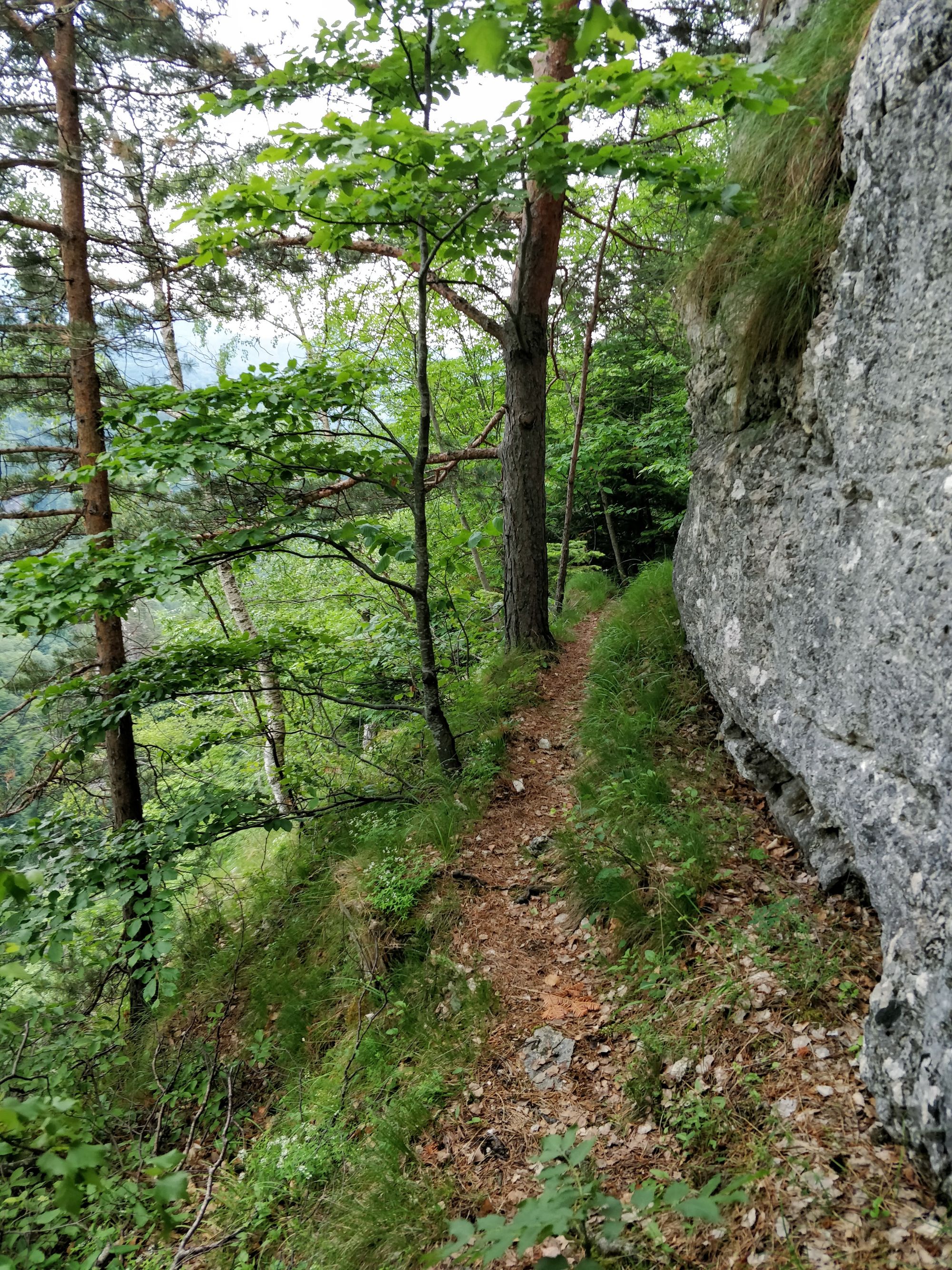
From now on there are no big altitude differences, only small climbs and steep descents. Otherwise, the path runs smoothly between the wall and the precipice.
At 11:45 we reach the last viewpoint, before starting the descent to the road. It took us 1h 25m to get here, including short breaks.
With one eye on the clouds, one on our path and our ears pricked up in case of thunder - because it is supposed to rain from noon - we take a few minutes to admire and enjoy our snack. Then we start, carefully, on our way back.
Descending the scree was easier than we expected. Indeed, our biggest fear was having to go downhill on slippery rocks in the rain. Fortunately everything was OK.
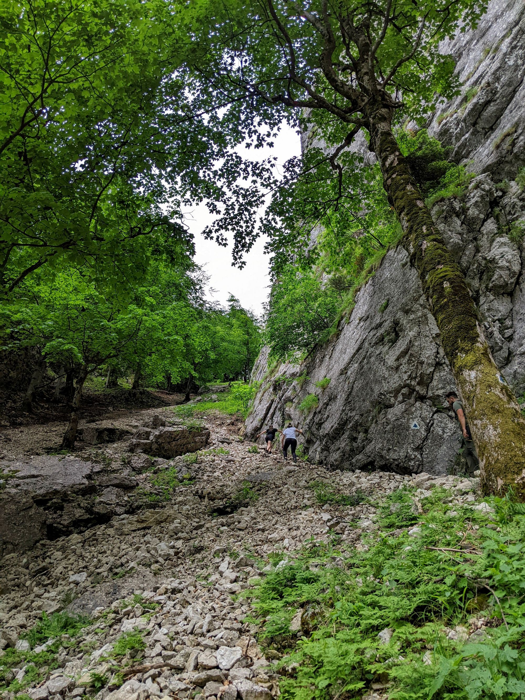
Soon we return to the river.
The route is, of course, spectacular on the way back too. It was a good decision to return to the cabin this way.
Around 1 p.m., instead of the announced rain, the sun came out with a very hot blaze. As we were already close to our destination, we decided to cool our feet in the river before we arrived.
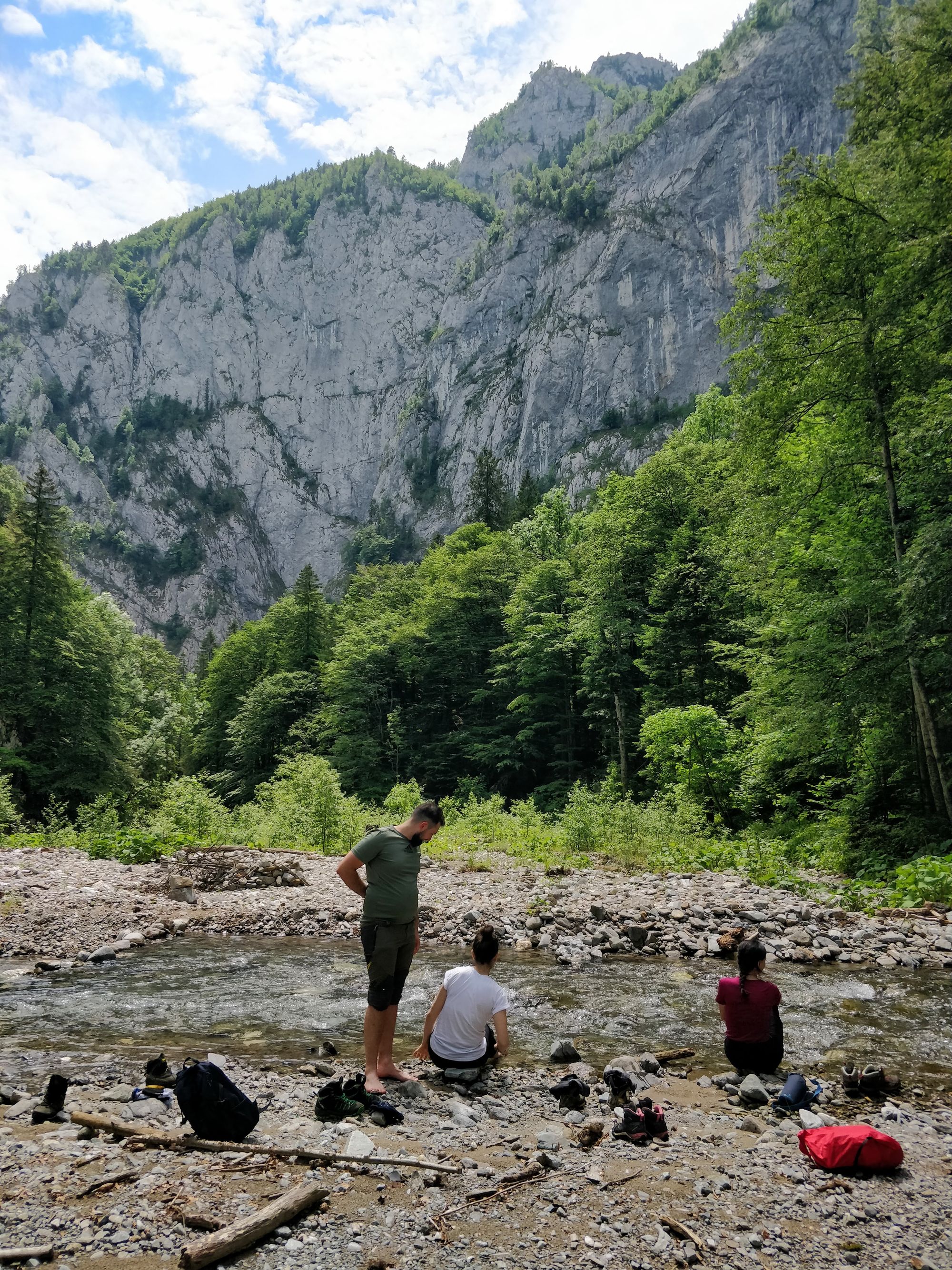
We cool down, guarded by the high and rocky walls of the gorges, then we walk the last short stretch to the cabin.
On the path, we meet one of the local guards, who counts the tourists returning from the trail.
We arrive safely at the cottage. Today's route is done, but it's not even 2 o'clock. What do we do?
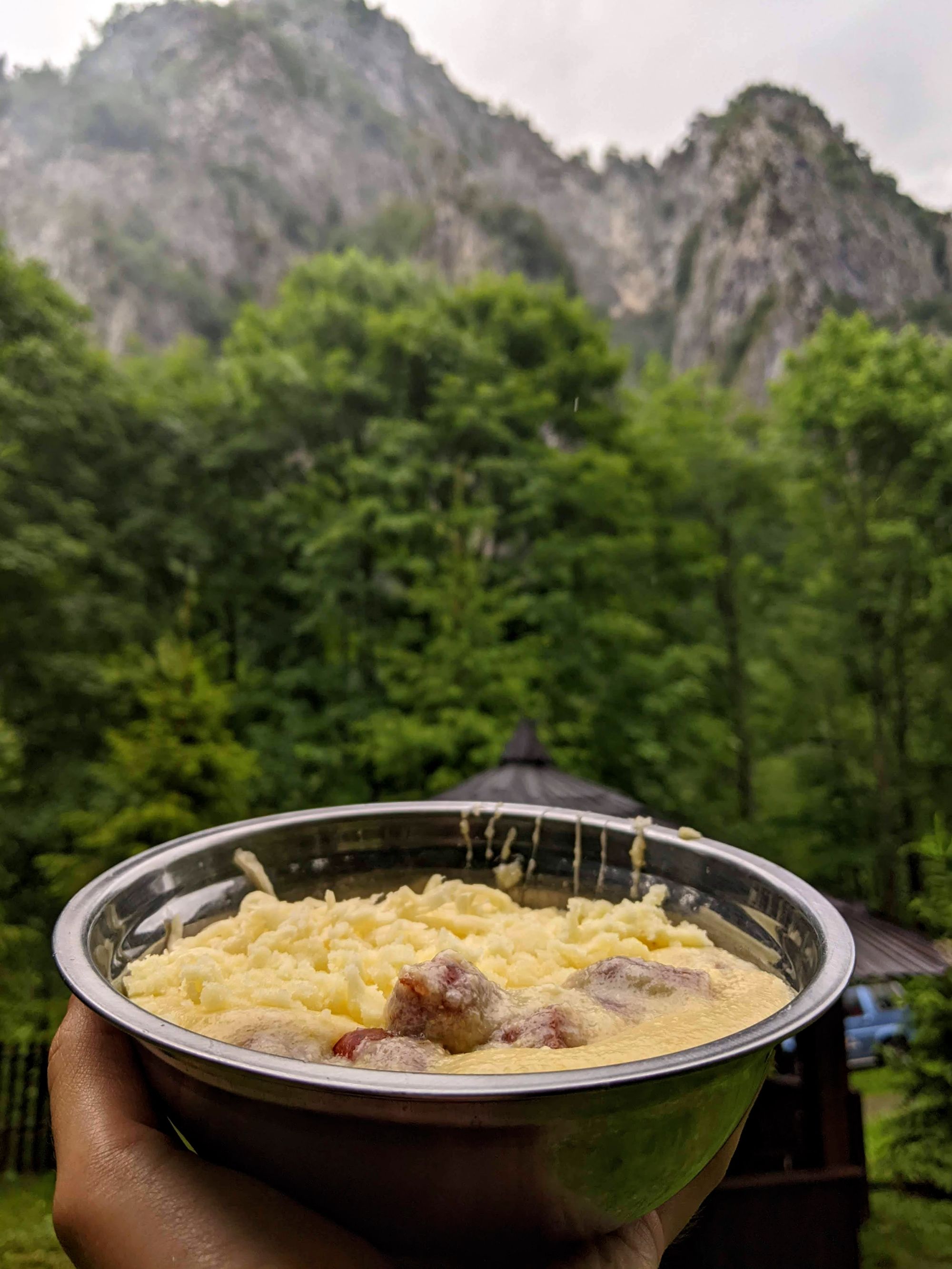
By the time we washed and changed, the rain began pouring. So all we can do now is cook, stay out of the rain, and relax.
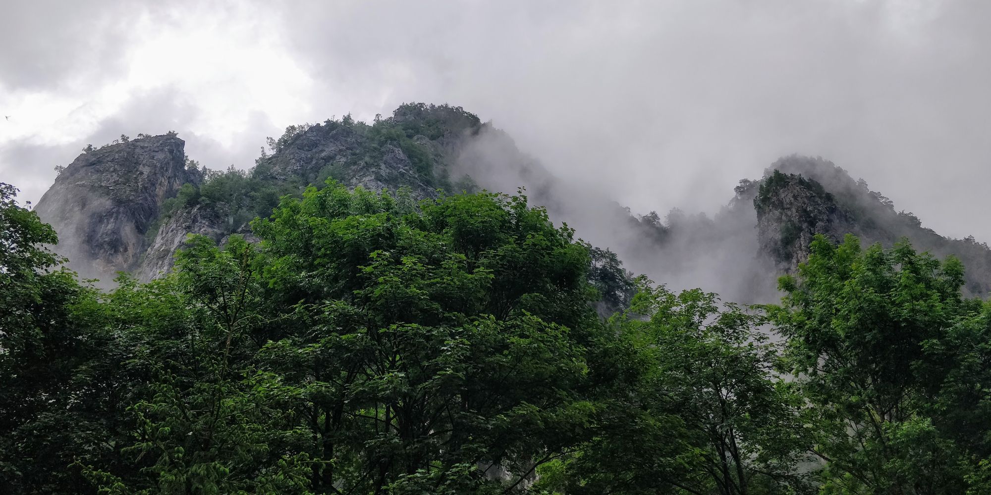
After the rain, food and rest we enjoy the fog and vapor show.
The view from our camping site is fantastic!
We end our day with a walk on the road, to see the place we didn't see well enough last night, when we drove along the river.
Indeed, the road goes along with the river for several tens of meters. The road seemed much more mysterious at night. But now, getting to know it, we understand that it can be crossed with care.
The cabin yard turned into an anthill. It's already weekend, and people from all over the country have filled the enclosure and dotted the yard with tents. They cook, tell stories, laugh, sing. The travelers are feeling good and it's a great atmosphere.
We, however, go to sleep as soon as it gets dark. Tomorrow we have a longer route to do, and we have to wake up at 5!
Conclusions
The first day in Buila was a dream. Our trip here was worth it even for that alone. The cabin seems taken from a legend, and the route through Cheia Gorges is spectacular.
If you've read this far and enjoyed the story, feel free to share it with other people you know would enjoy it, too.
We will come back to you with the next day's hike, in which we approach the ridge of Buila. If you want to receive the story of the next day's route by e-mail, look for the subscribe button.
Until then, have you been to Buila-Vânturarița? What trails did you do? What do you recommend?
We look forward to hearing from you on Facebook/Instagram/Twitter, in the comments section below, or in a private message.
Till’ next time!