Three blue coves in one day: Cala Llebeig, Cala del Moraig and Cala de los Testos (Apr 2021)
Between Valencia and Alicante, Spain protrudes into the Mediterranean Sea forming a peninsula that resembles a shark fin, or a flipped "v".
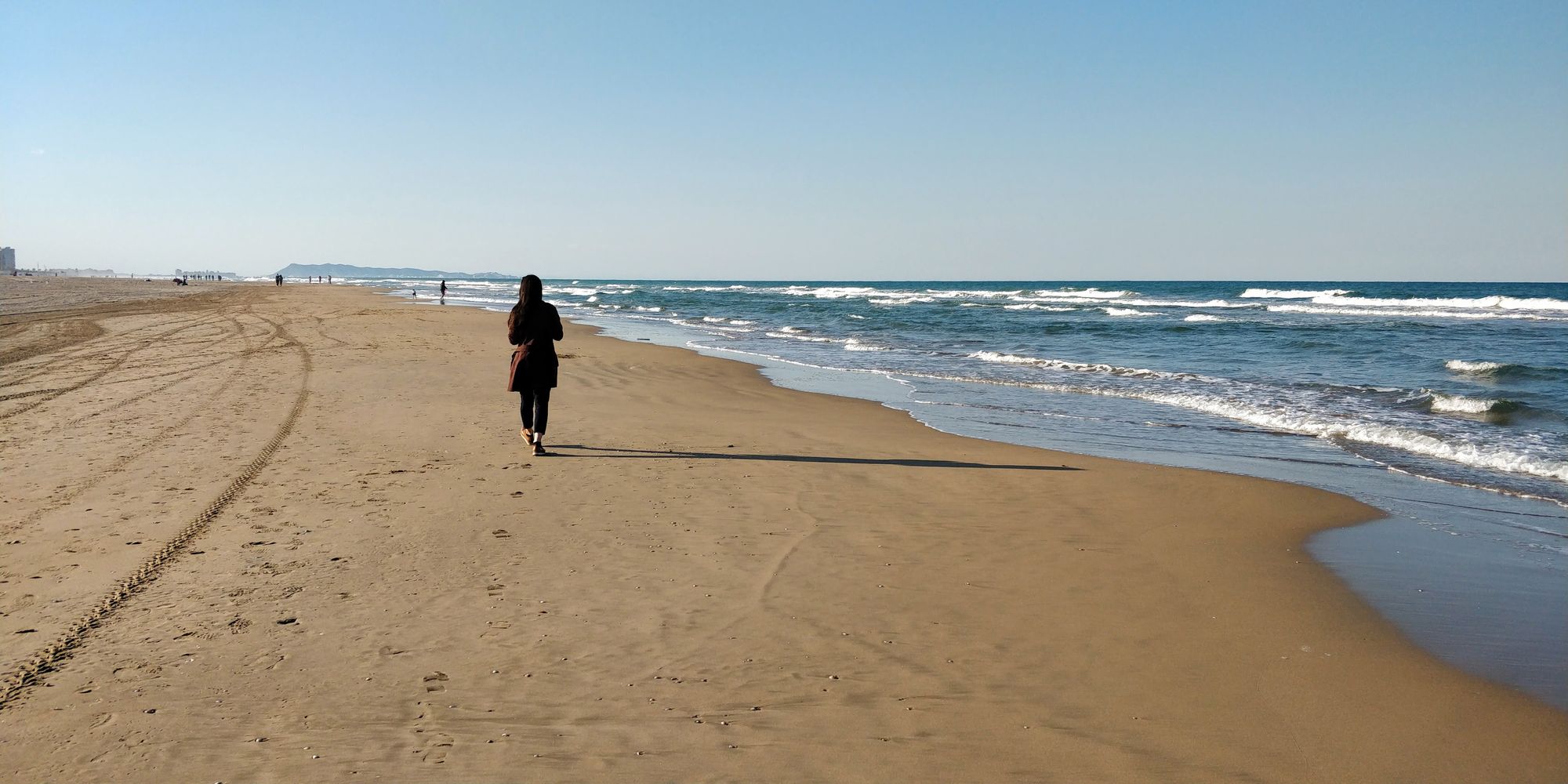
The northern edge of the "v" begins with the Albufera Natural Park (where paella was invented), and is dominated by wide, long, smooth beaches with fine sand. Platja de Gandia, where we are staying for the spring, is located in this area.
As we approach the top of the “shark fin”, more precisely in the area of the town of Denia, the cliff begins to rise, the sand is replaced by rocks, and the landscapes are more and more spectacular. You can see the transition in the story of Cova Tallada, whose route starts right from Denia.
After passing Cabo de la Nao, which is the tip of the "v", you will find sandy beaches, but the southern edge is generally dominated by rocks and high cliffs, which form imposing bays.
Right after the tip of the “shark fin”, to the south, one can find the three coves we set out to explore today: Cala Llebeig, Cala del Moraig and Cala de los Testos.
Technical details
The chosen route is a round trip.
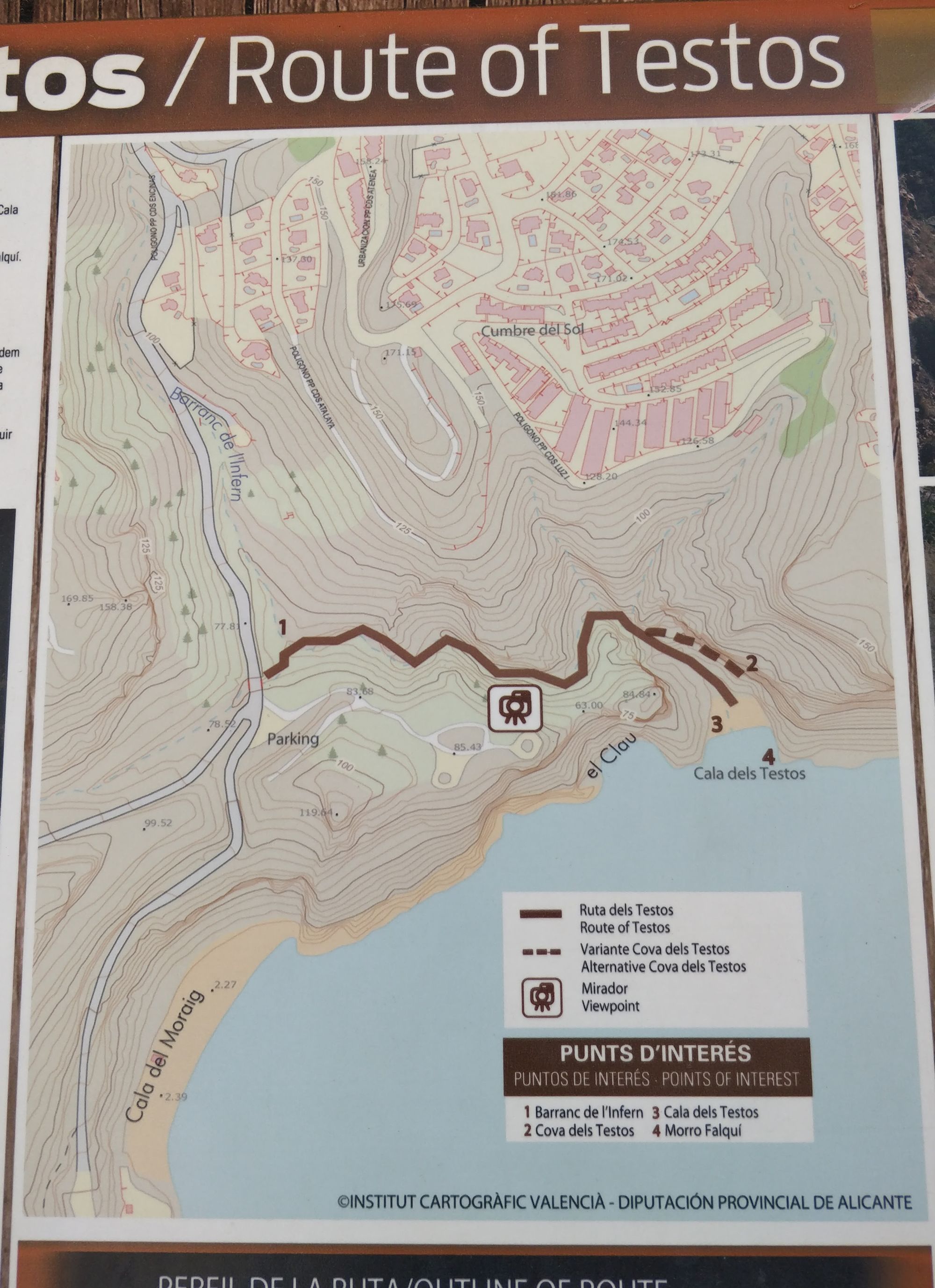
We park the car here, and begin from the starting point of the SL-CV 50 route. We follow the route to Cala Llebeig, then on the edge of the precipice to Cala Moraig. From there we descend to Cala de los Testos.
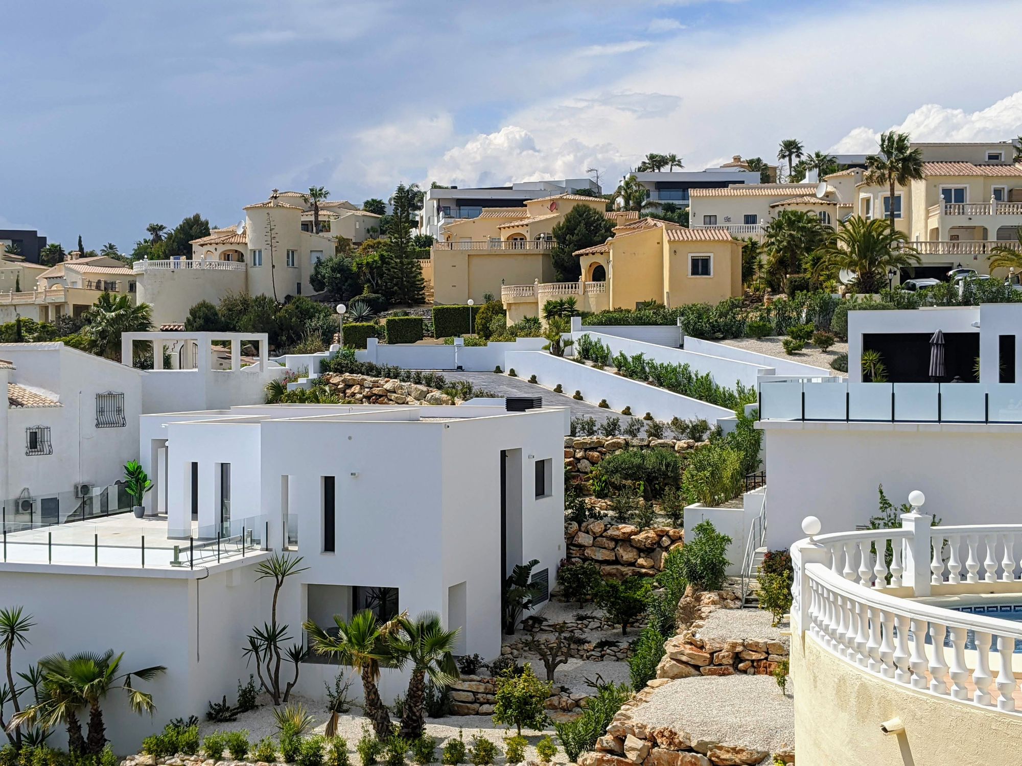
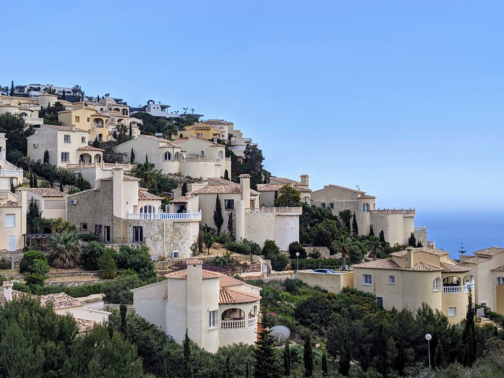
On the way back we chose to return through the streets of Cumbre del Sol, enjoying its beautiful houses.
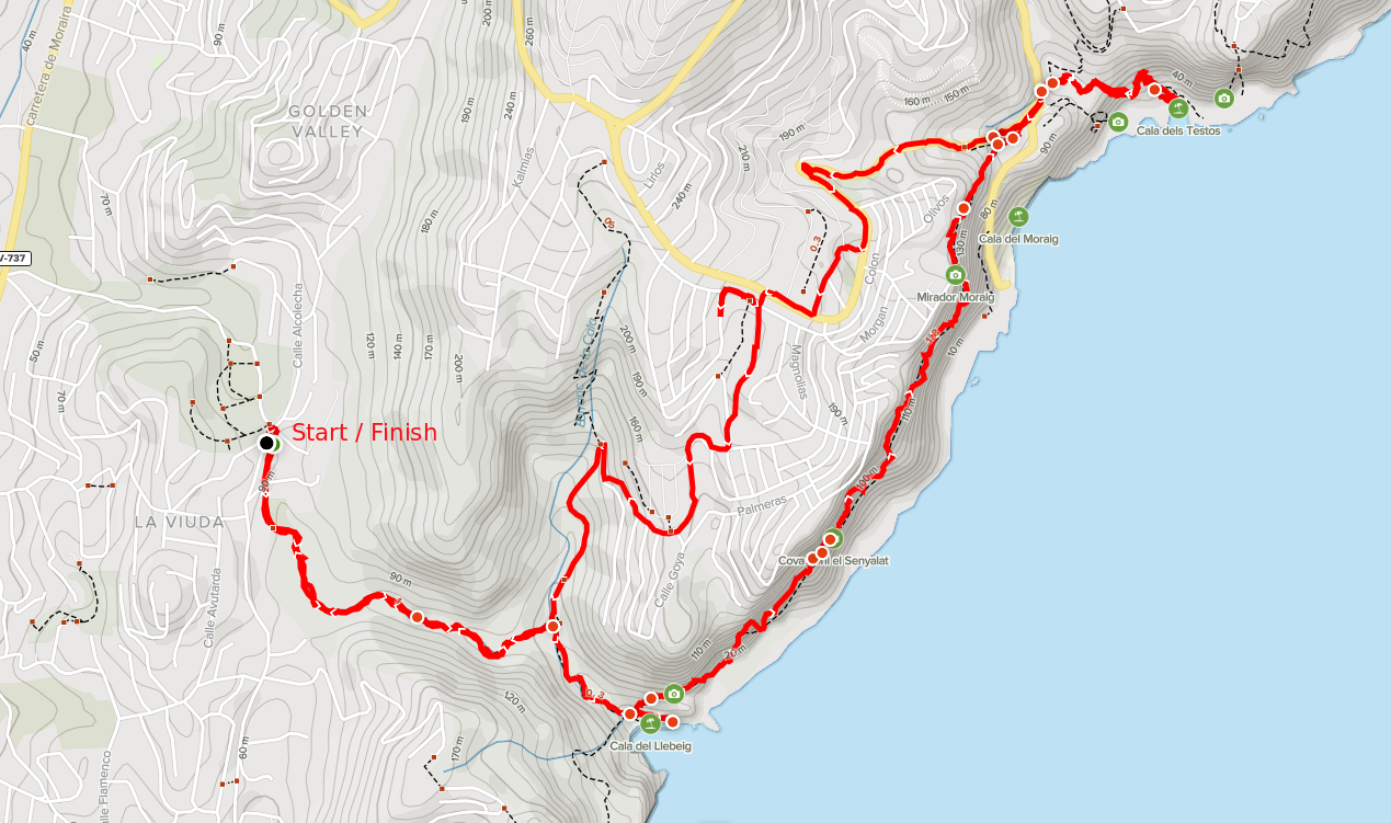
Parking: here
Route: Starting point SL-CV50 - Cala del Llebeig - Cala del Moraig - Cala de los Testos - Urbanizacion Cumbre del Sol - Starting point SL-CV50.
Markings: first portion: white-green
Length: 10.5 km
Height Difference: 650m
Duration: 4 h
Water Sources: None
Tracking: AllTrails
The route
After a relaxing hour of driving on the Mediterranean Highway, we reach the starting point of the SL-CV50 route, where we find a parking space on the side of the road. It's 12 o'clock.
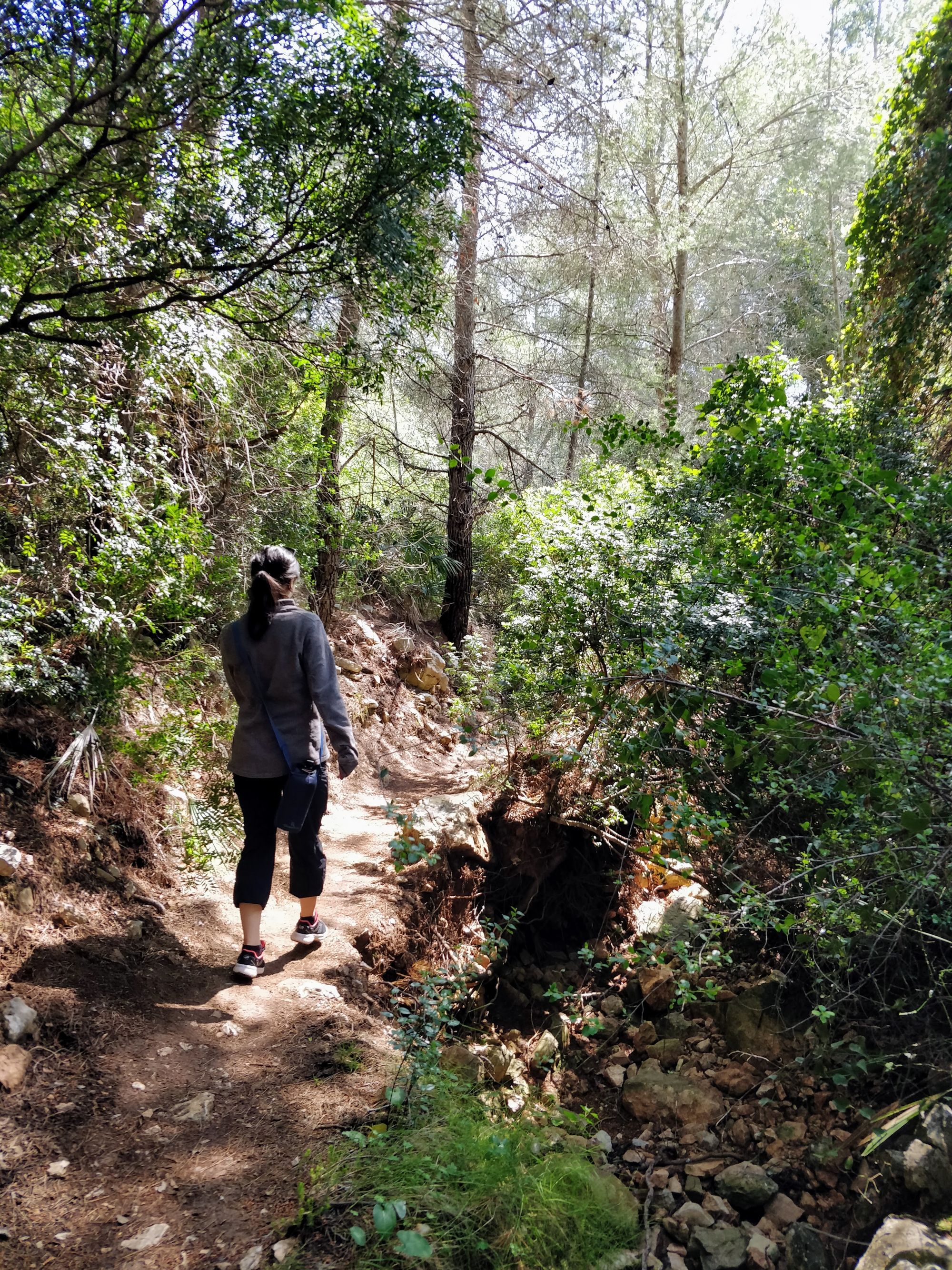
We start going through the houses, passing by the orange grove, then going through the forest to the first destination: Cala Llebeig.
We are enjoying the coolness of the forest and admiring the plants that, although green all throughout the winter, still seem to have come to life.
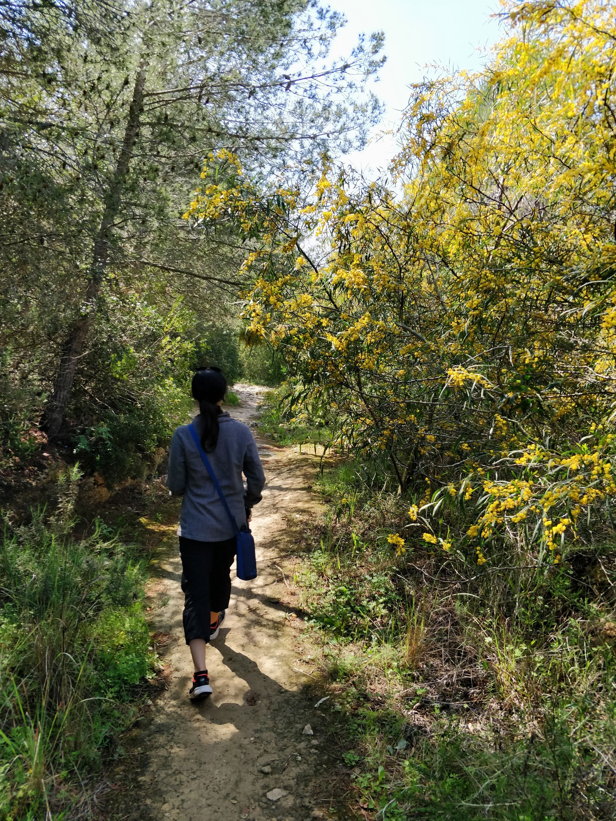
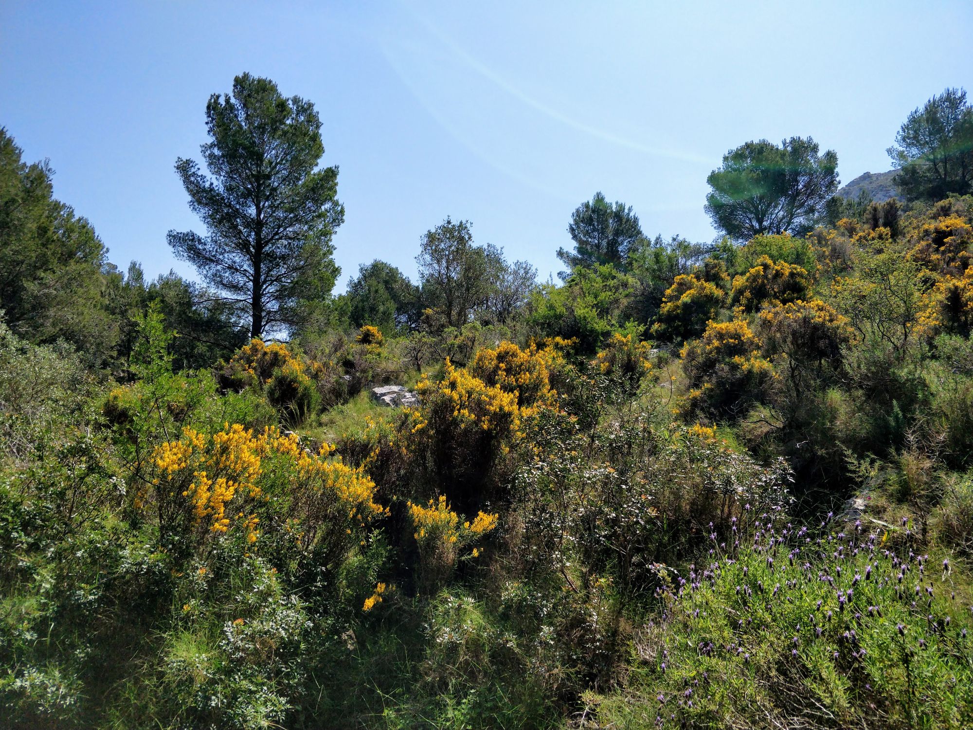
After 25 minutes of shade, we reach the intersection of the route coming from Puig de la Llorença, Benitatxel. From here we continue in the sun for another 15 minutes, accompanied by the houses on the cliffs, to Cala Llebeig.
Cala Llebeig is beautiful, but we did not expect to find so many people. The Spanish people know how to enjoy the beautiful landscapes they have. Even if that means that the hiking trails will be busy, especially when the weather is nice.
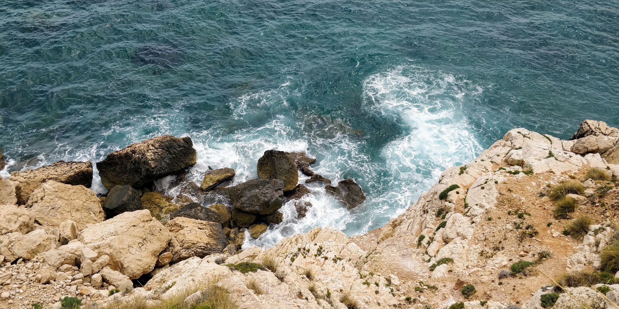
We however find a secluded place from where we can admire the waves breaking on the rocks with loud noises.
After we got enough of the lovely view, we set off on the route to the next destination: Cala Moraig.
To reach the next cove, we turn around a bit, and start a steep climb, which gives us a new view of the small bay.
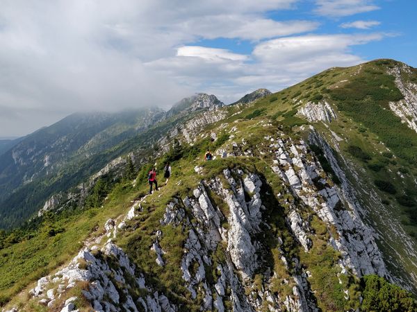
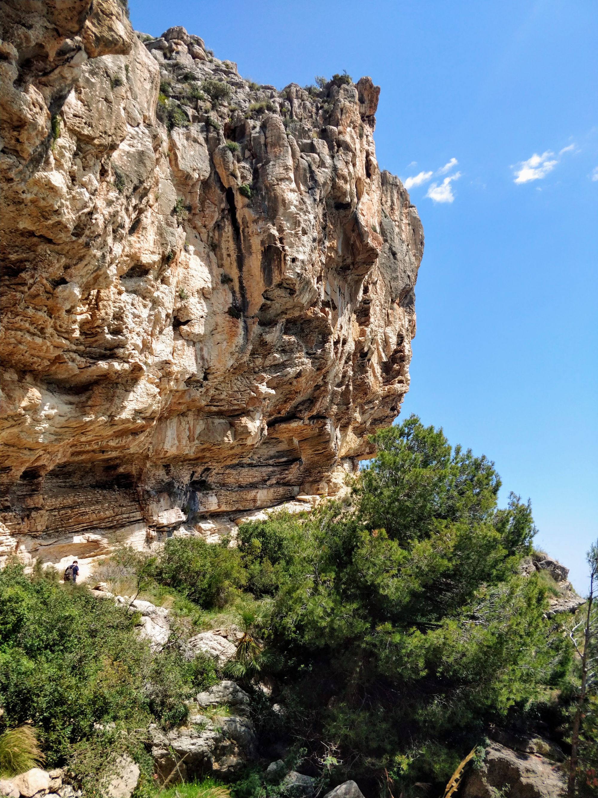
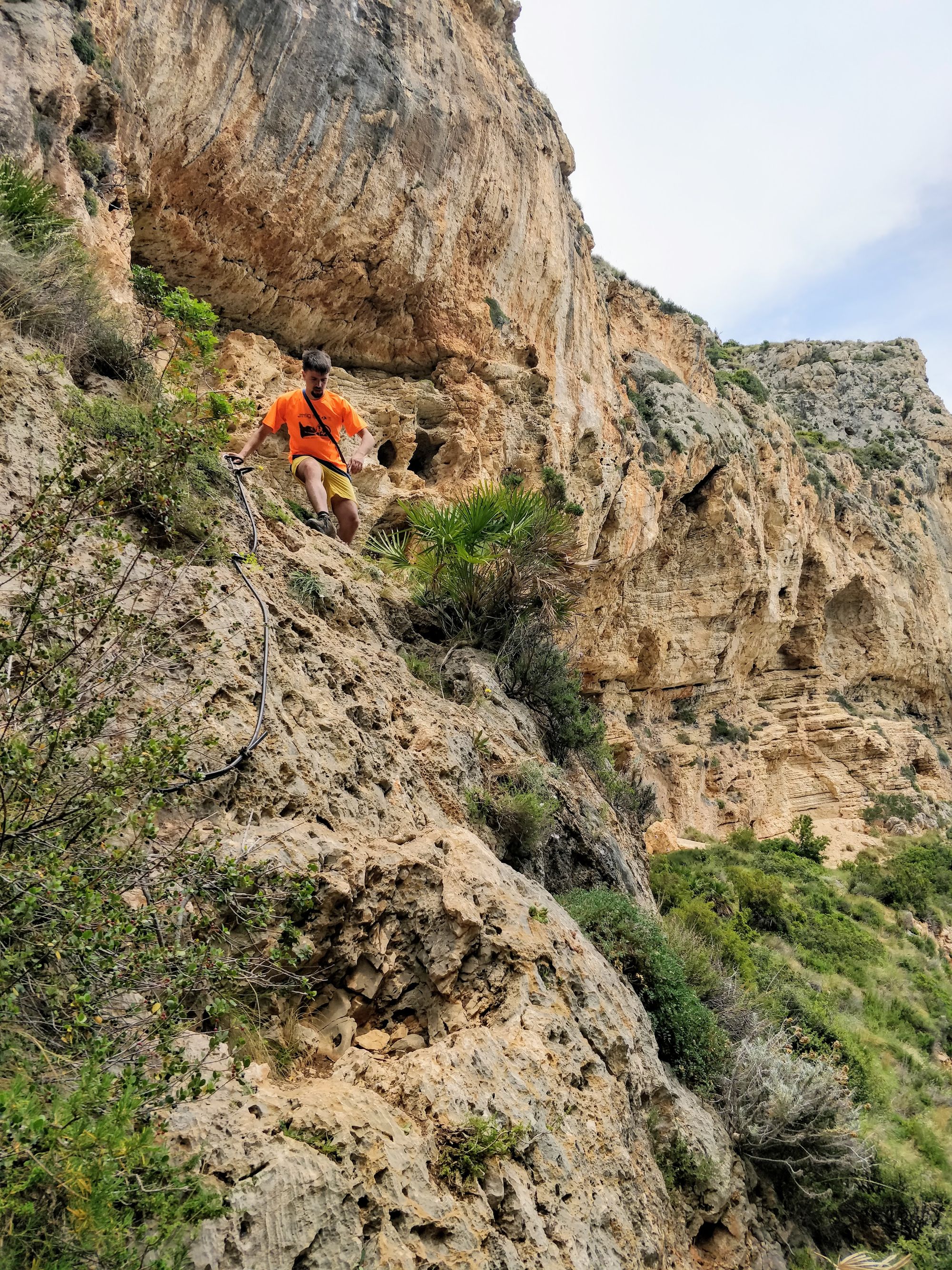
From here begins an interesting portion of the route. The path continues on high grounds, but in some places it is narrow and exposed. This sometimes makes us a bit nervous when we meet other hikers, but it's great!
We continue like this for about an hour. The path is sometimes narrow, sometimes wide. We are sometimes closer to the abyss, sometimes farther.
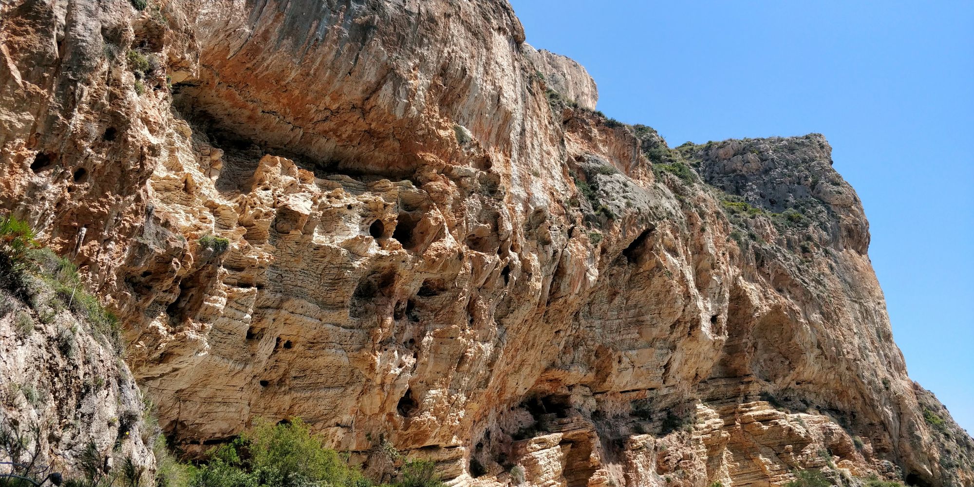
Soon, a huge rock wall meets us on the left, which accompanies us until we get to Moraig.
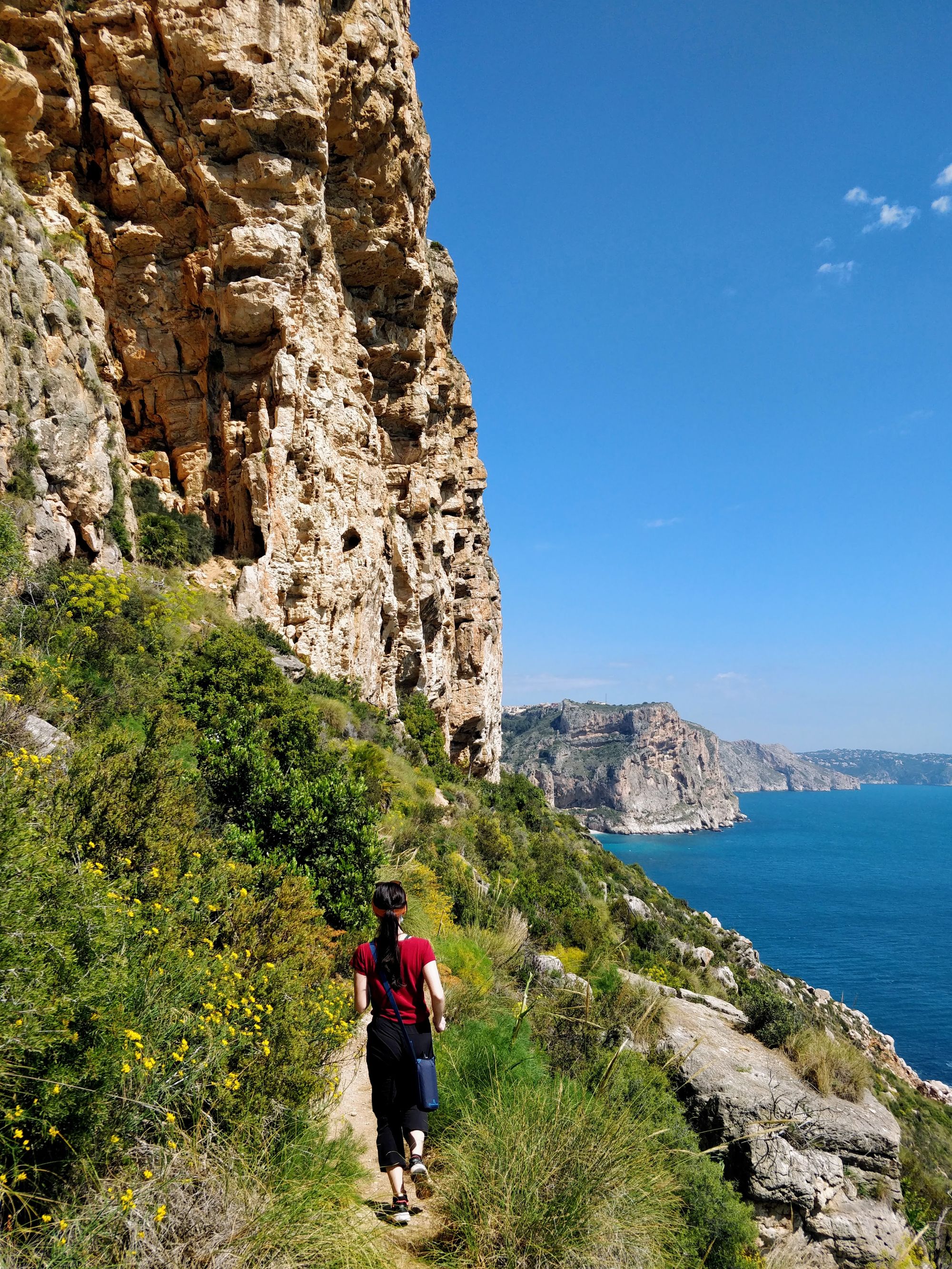
The route is spectacular and soothing. The waves are at a fair distance now and are roaring slowly. They are accompanied from time to time by the sound of a boat or of an airplane.
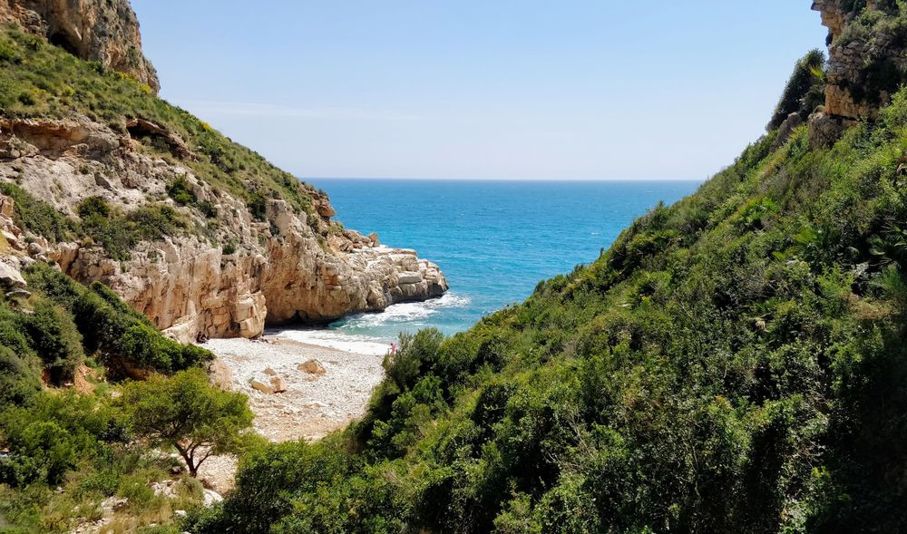
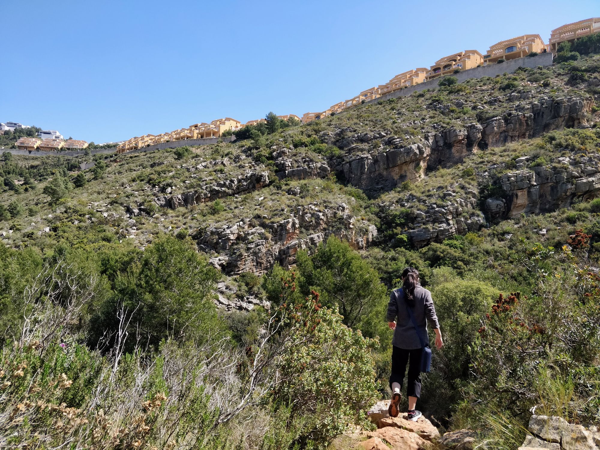
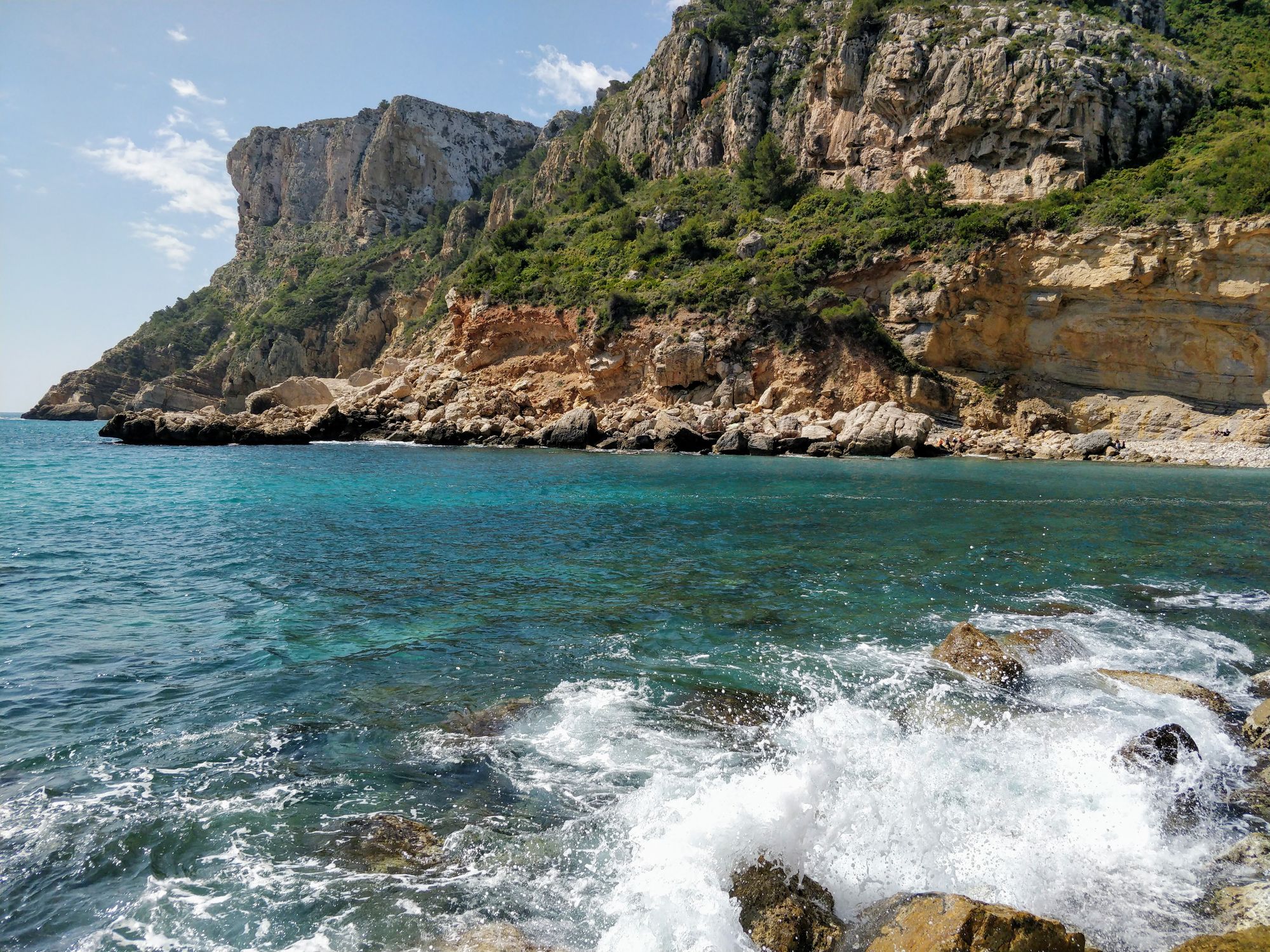
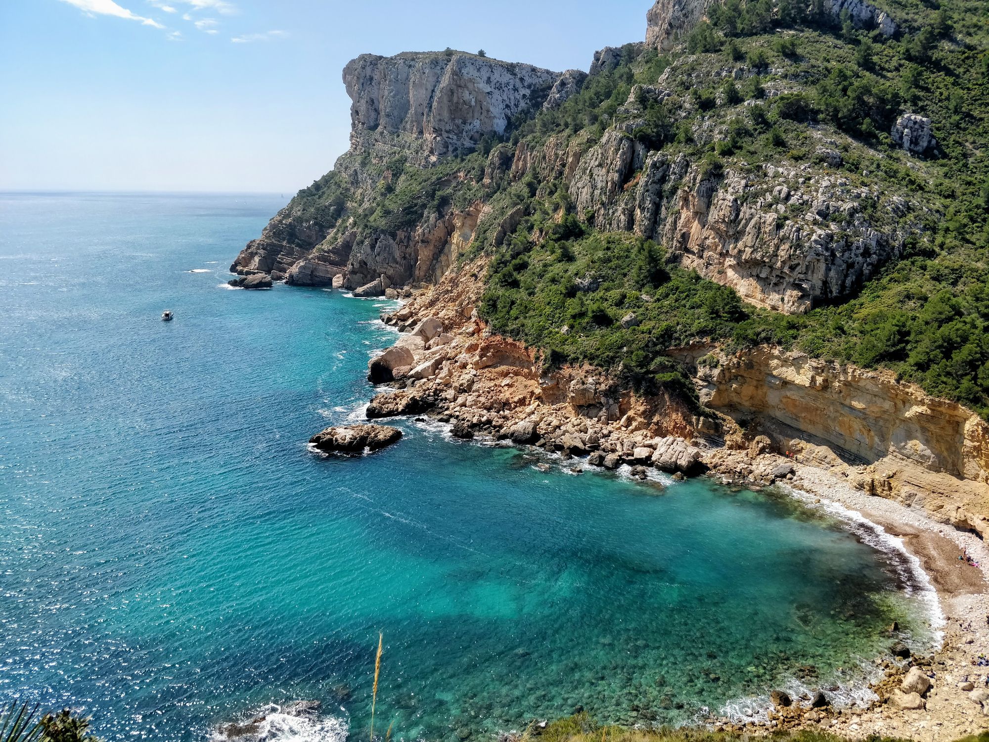
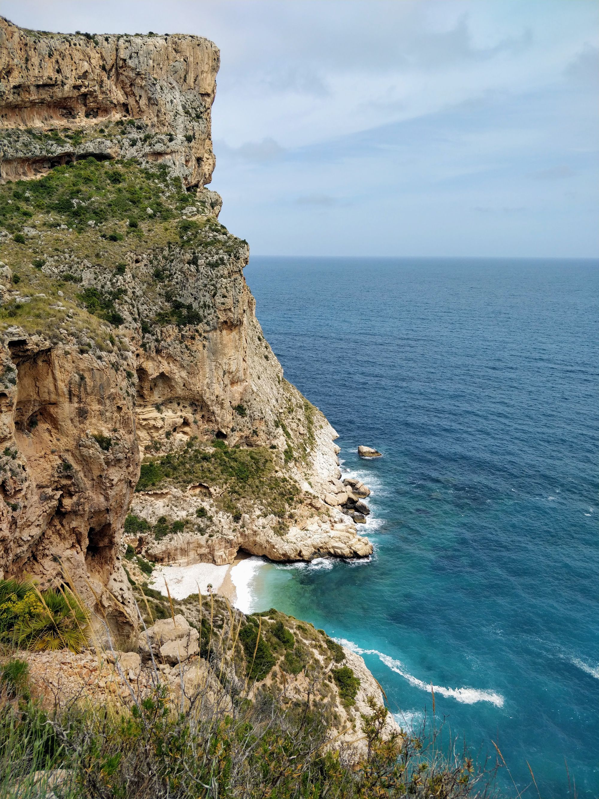
Soon we notice some houses located on the cliffs, and the color of the water near the rocks indicates that we are approaching a new bay.
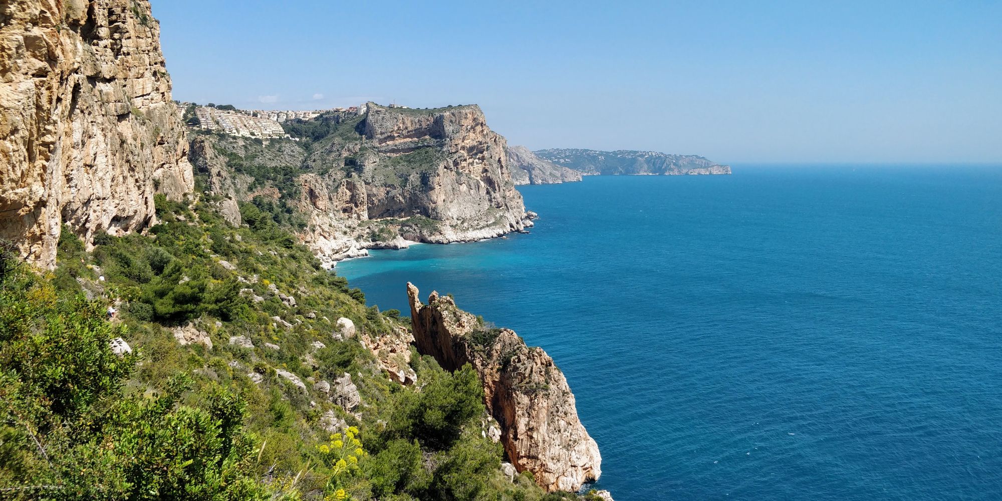
There’s no rush, but we soon reach a place from where we can see Moraig Cove from above. The area is not the wildest, but it is lovely.
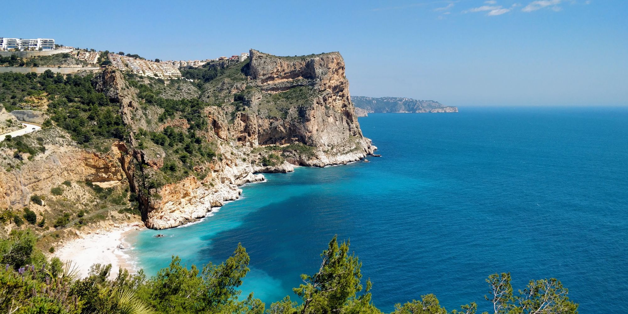
We can't wait to get to the water. Even if we don't plan to take a dip in the sea, we still want to cool our feet.
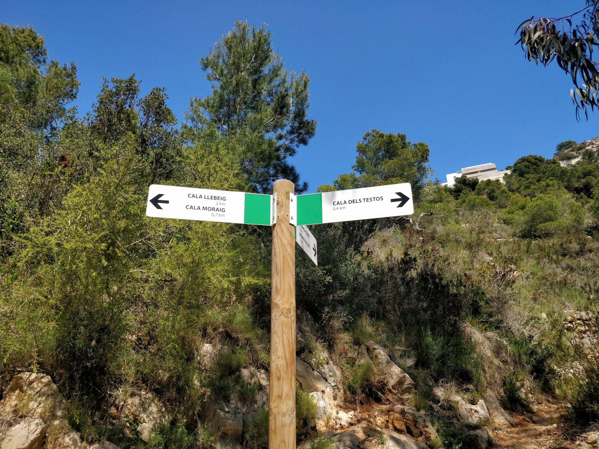
But when we got to the intersection, we encounter a pleasant surprise. There's another cove here that we didn't know about. And it looks interesting: Cala de los Testos (Test Cove).
Of course we're going to see it. And we will not regret it.
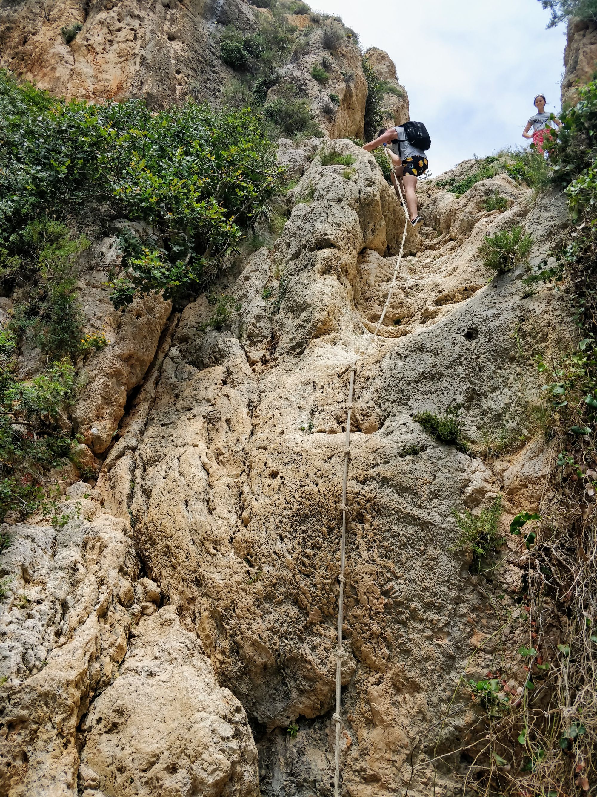
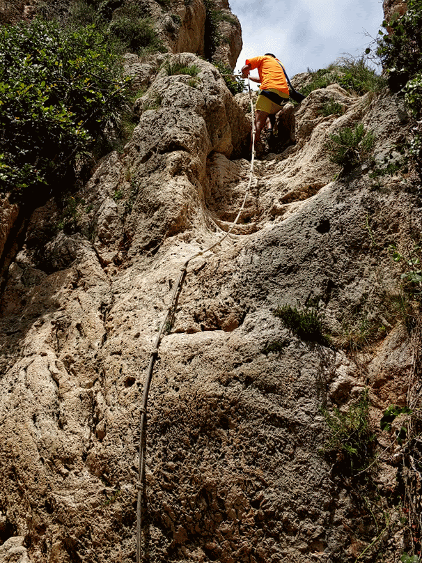
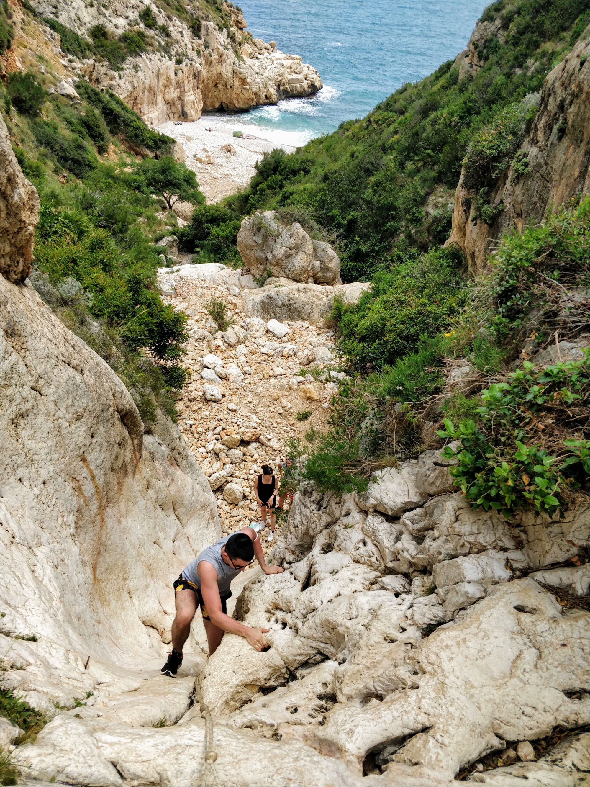
The descent to Cala de los Testos begins slowly, on the bed of a dried river. Then the riverbed becomes slightly steeper and full of boulders, as if the river were to begin to pick up speed.
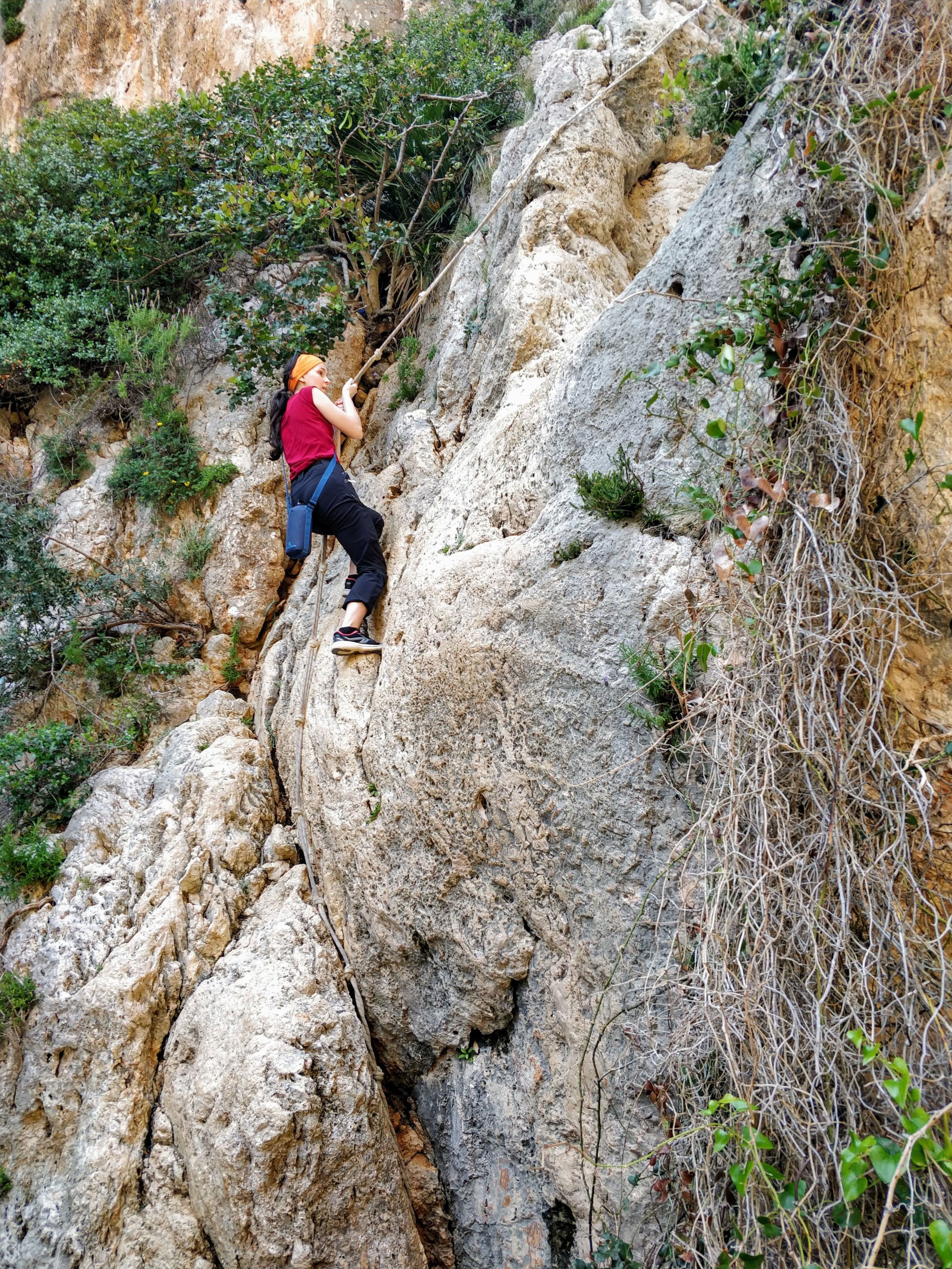
The best of surprises was when we saw that the river also had some waterfalls, which we were able to descend with the help of some attached ropes!
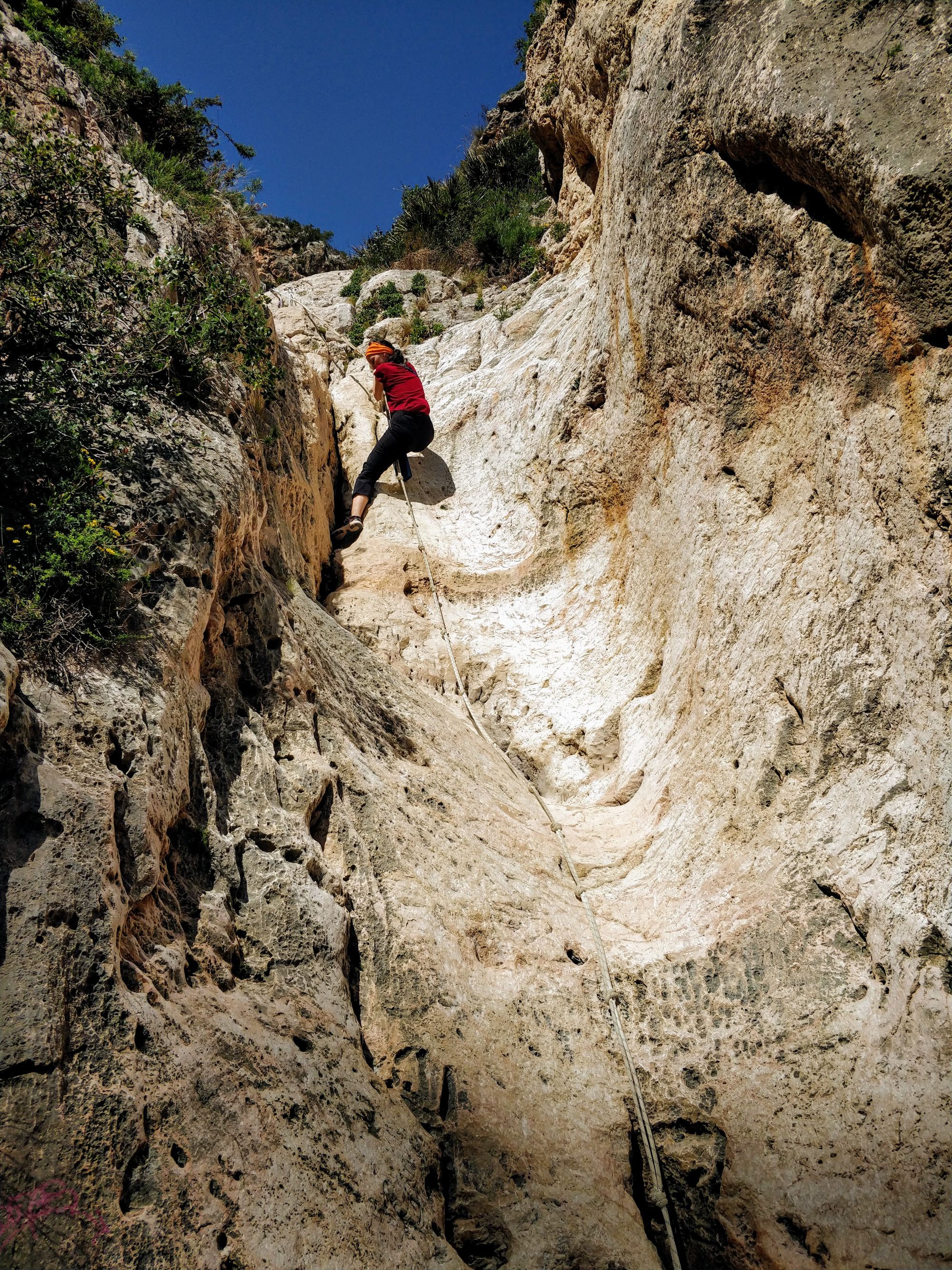
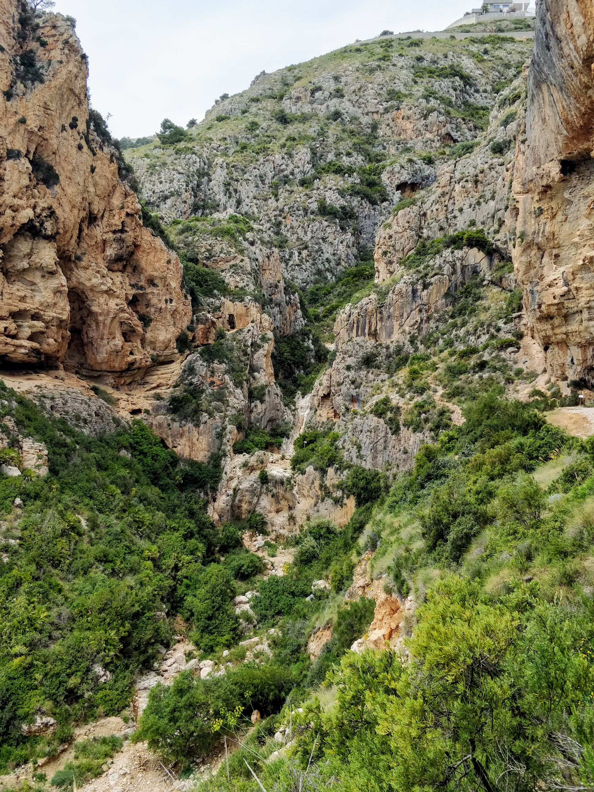
To our left and right there are some giant rock walls. And below, along the river, you can see the sea, after a few more waterfalls.
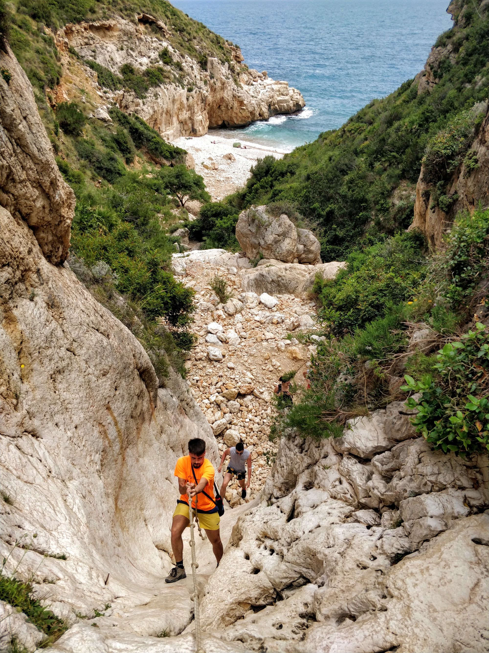
The bay looks very nice. But until we get to it we have to descend carefully, on the ropes, two more waterfalls.
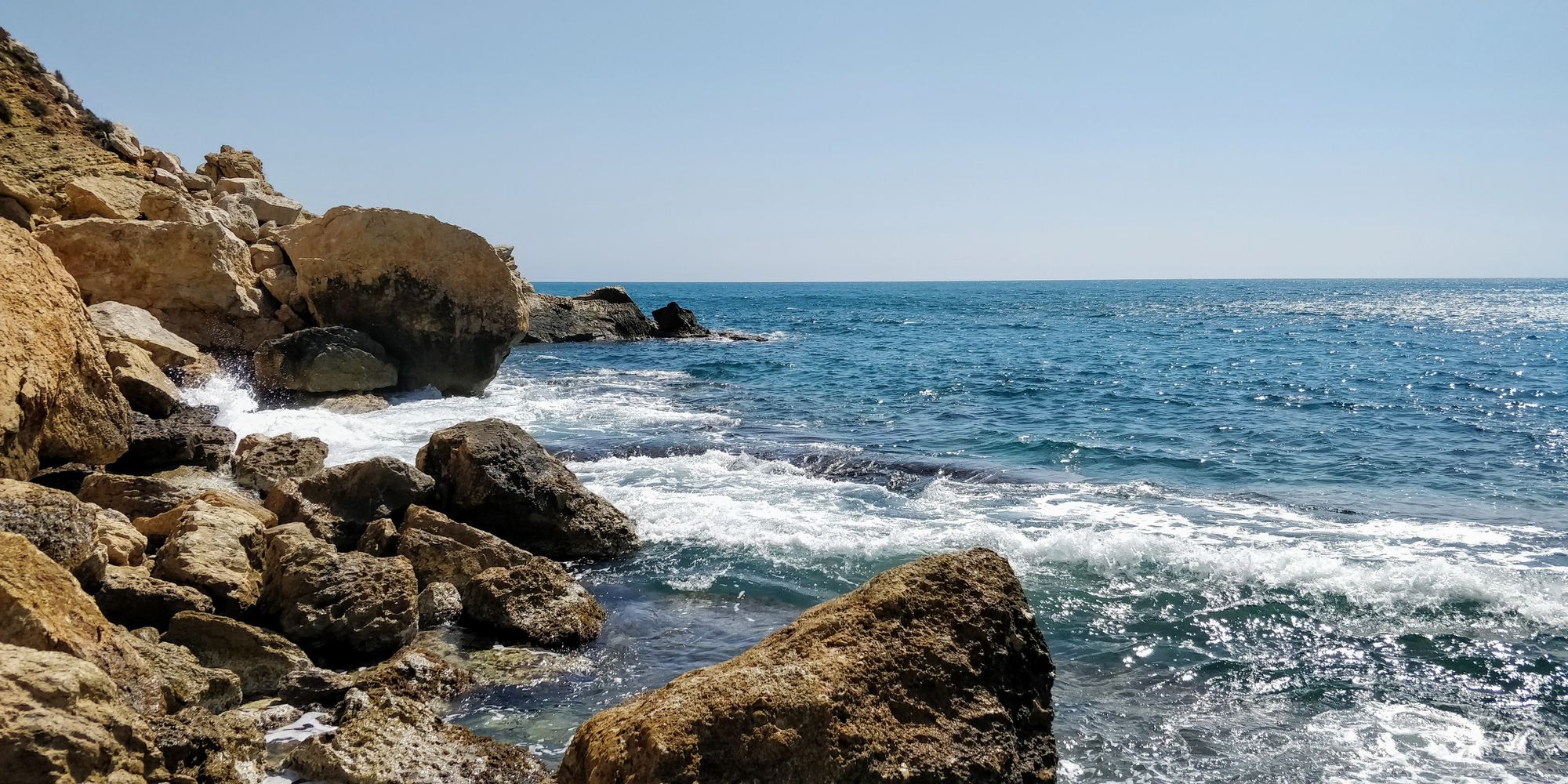
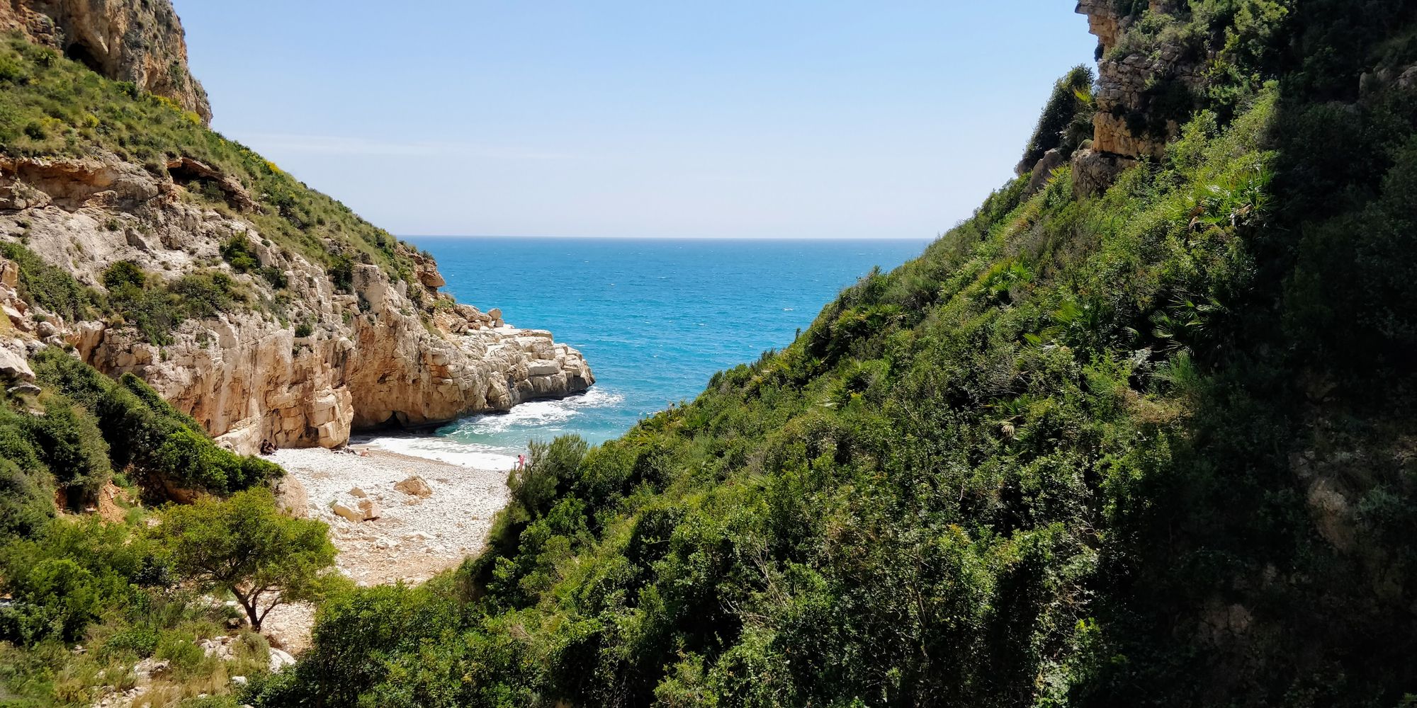
We get down, and we feel like we've discovered a treasure. The little bay is wonderful. The waves hit the rocks making a deafening noise. Then they go back and come again. The sea is incredibly clean and blue. It's like we're in a story.
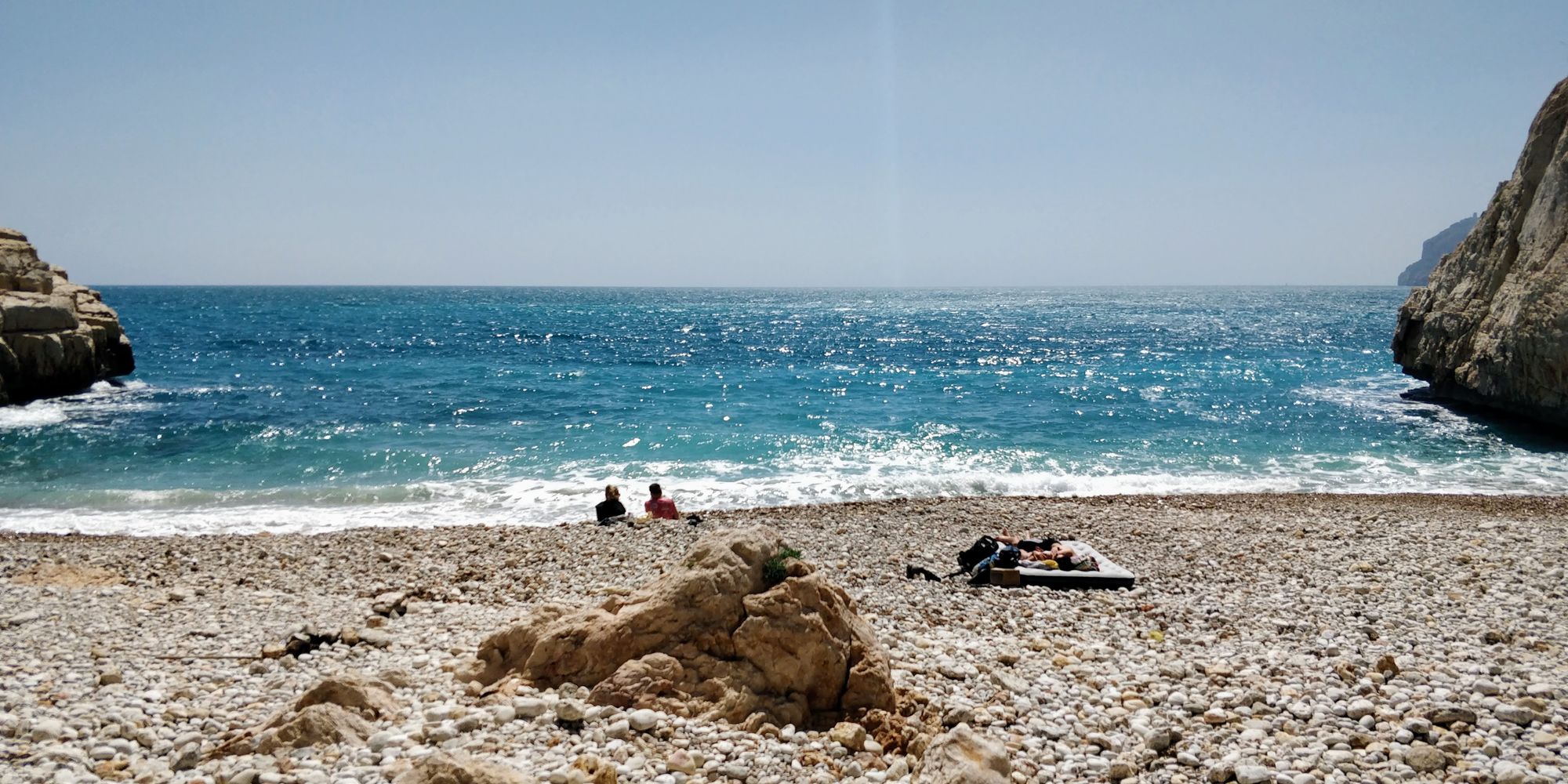
We stand here, bewitched, for a long time.
Then we go back to the car, through the neighborhoods of Cim del Sol. It must be nice to have a house here :).
We finish the route in a hurry, rushed by the black clouds that can only mean thunder, lightning and heavy rain. Fortunately, we arrive at the car on time, and a relaxing journey home awaits us.
The return to Cala de los Testos
One month later, we receive a visit from our younger siblings in Spain. It's a perfect opportunity to return to Cala de los Testos.
This time we drive to the parking lot near Cala Moraig and Cala de los Testos, and go straight down to the latter.
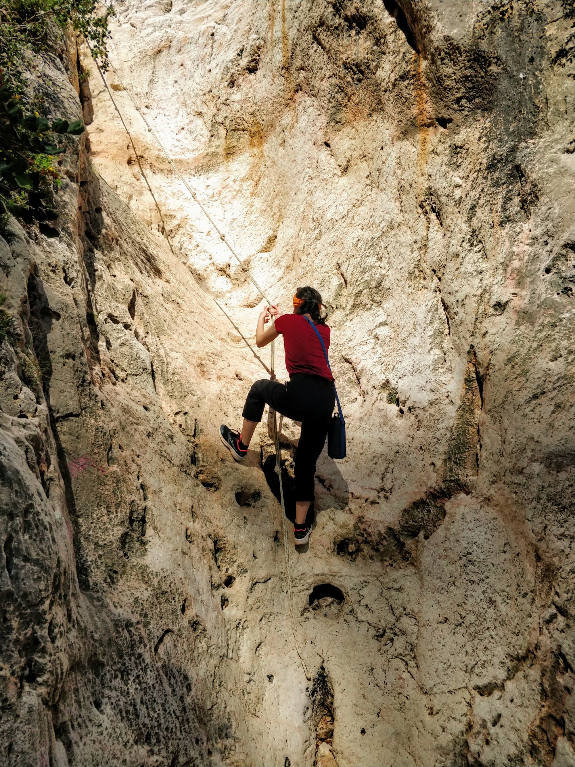
It was challenging for us all to get down on the ropes, but just as entertaining as last time.
This time we explore the area a bit more, and find a cave where we can take shelter in the shade, and some of us even dare to get in the water.

On the left side of the descent, we find a path that climbs through the rocks. From above, we have a beautiful view of the access to the small bay. You can see the places where the ropes are needed.
We spend some time enjoying the view we have of the rocks and then make our way to the ropes and return.
Conclusion
The route to Cala Llebeig, Cala Moraig, and Cala de los Testos is short and easy, but wonderful.
The stretch between Cala Llebeig and Cala Moraig is spectacular, and Cala de los Testos is memorable.
It's definitely worth seeing them if you get the chance.
And if you pass through the area during the hot summer season, don't forget to take your bathing suits and a towel.
Have you been to any of the three bays? Or other ones in the Valencian Community? What else have you seen around here? What experiences have you had? What tasty food did you eat? What impressed you the most?
We want to go back someday, and look for ideas.
We are looking forward to your messages on Facebook / Instagram / Twitter, in the comments section, or in a private message.
Till’ next time!