Buila Experience #2: Circuit on the Ridge. Pahomie Hermitage - Ștevioara Saddle - Buila Peak - Buila Saddle - Pătrunsa Hermitage - Pahomie Hermitage (Jun 2022)
Off the beaten track, at the end of long forest roads or interminable trails, the Buila-Vânturarița massif watches over the wooded Subcarpathian hills and over the Olt valley.
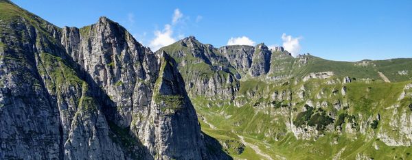
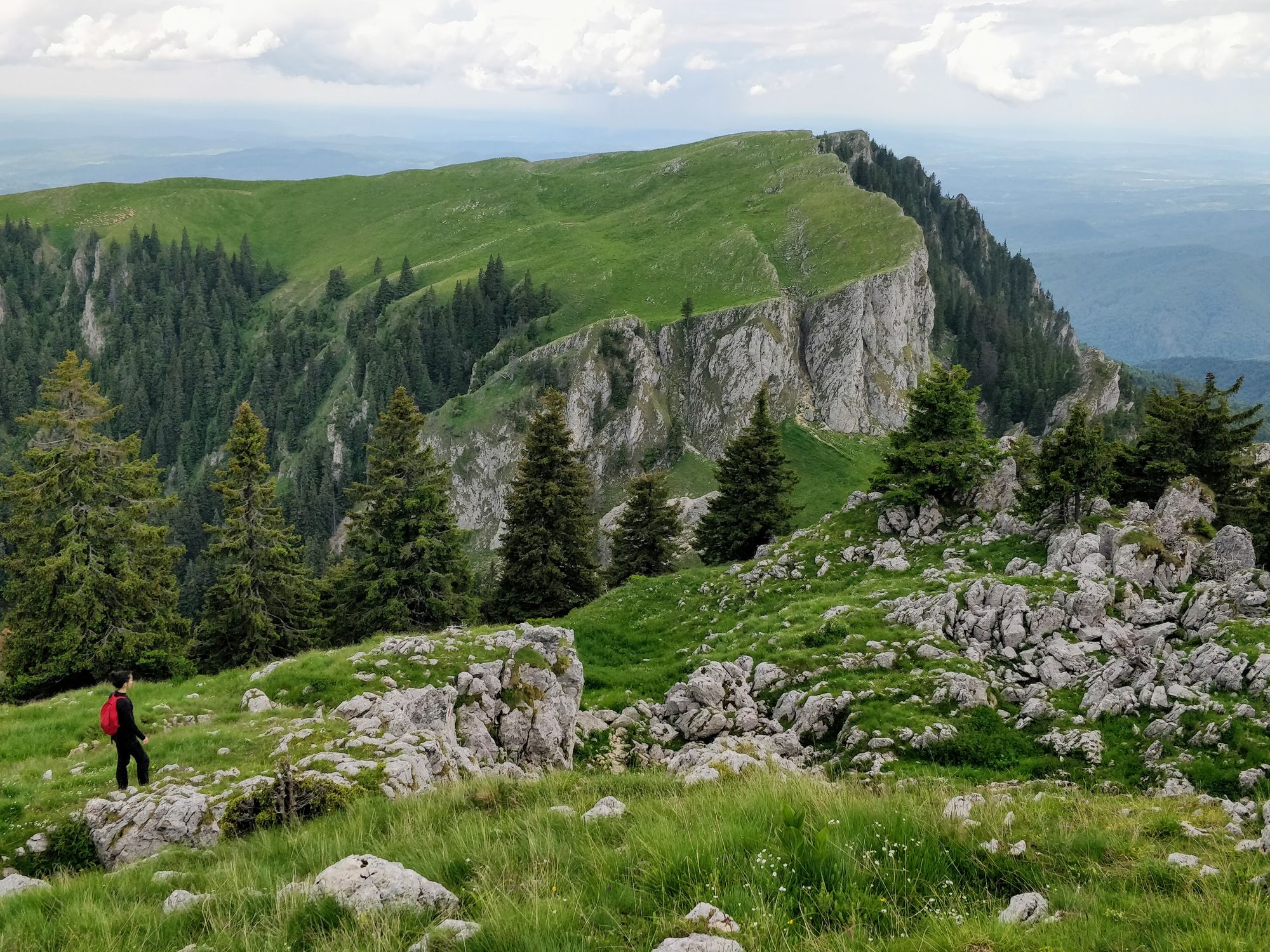
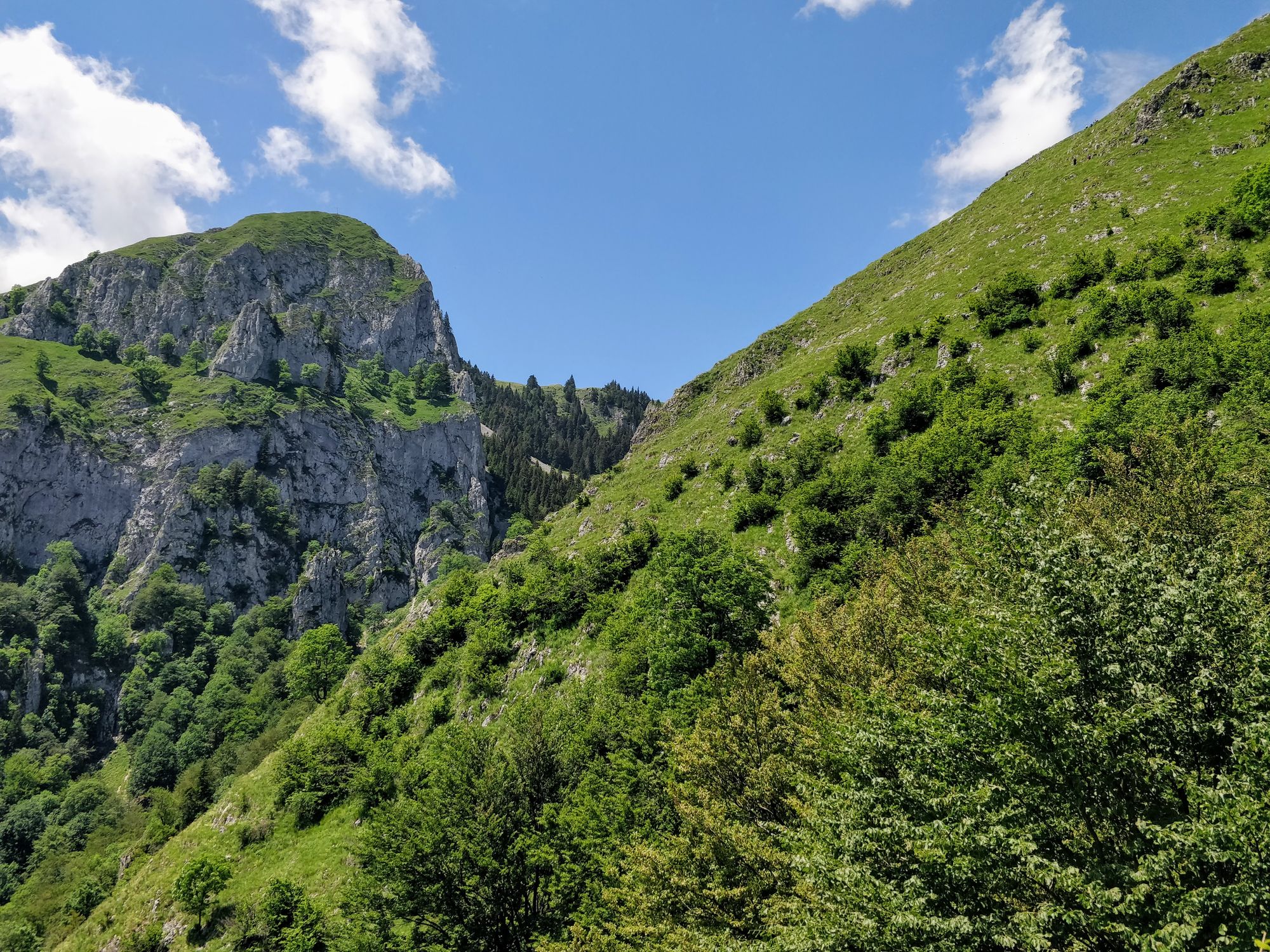
The Buila-Vânturarița ridge is not large. It cannot be compared, for example, with Piatra Craiului Mountains - although it is similar to an extent.
But it is not small either. It is bigger than Piatra Secuiului in Trascău or other smaller ridges. Its peaks reach 1848m - Buila, 1866m - Vioreanu, and 1885m - Vânturarița.
What makes it charming, though, is not just the fact that it is hidden, or its size. But the alpine landscapes that it offers are indeed special!
All things considered, when you arrive in Buila-Vânturarița, you have the impression that you have found a hidden treasure.
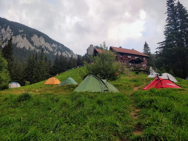
We have been at Cheia Cabin for two days. Yesterday we enjoyed a relaxing but spectacular route through the Cheia Gorge. Today we are preparing to tackle the ridge!
Technical details
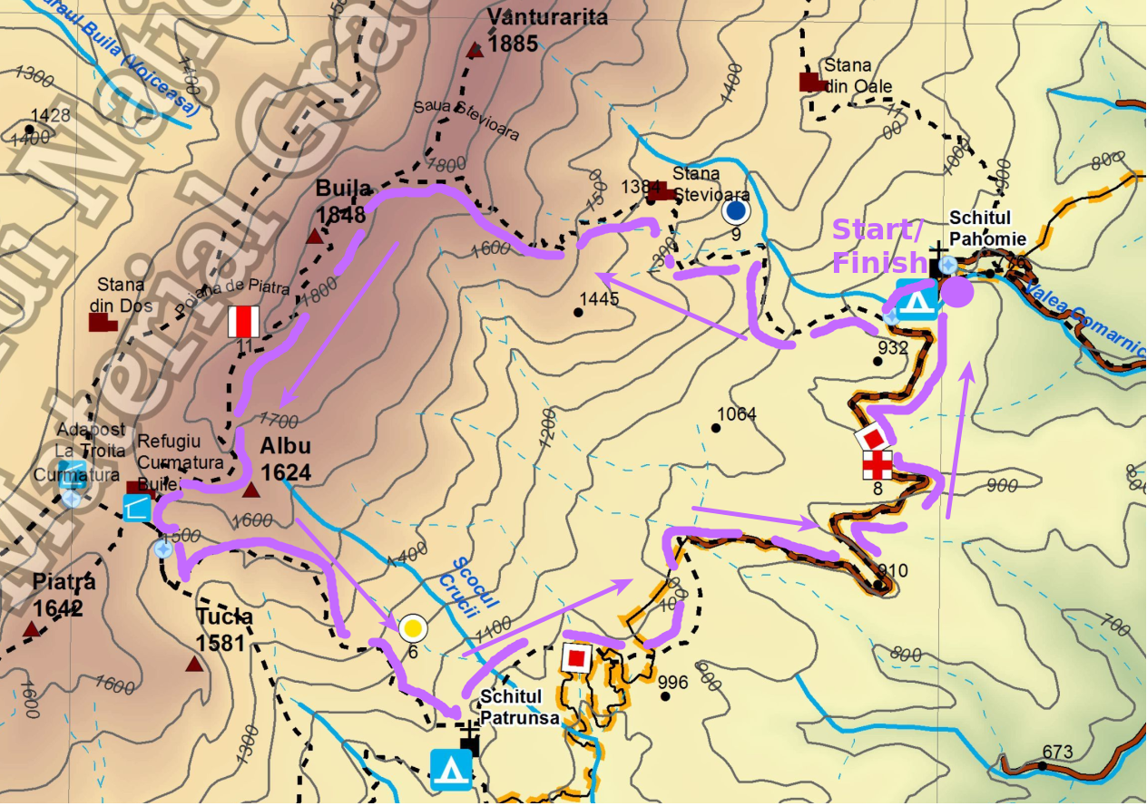
Our hike begins with 16 km of forest road traveled by car, from Cheia Cabin to Pahomie Hermitage, from where we will start a circuit route.
From Pahomie Hermitage we climb following the blue dot to Ștevioara Saddle. From there we continue on the ridge, following the red band to Curmătura Builei (Buila Saddle). And from Curmătura Builei we go down the yellow dot to the Pătrunsa Hermitage, from where we return on the road to the Pahomie Hermitage.
The complete map of the Buila Vânturarița Massif can be found on the national park website.
Parking: A little above the Pahomie Hermitage
Route: Pahomie Hermitage (830m) - Ștevioara Saddle (1795m) - Buila Peak (1848m) - Curmătura Builei (1550m) - Patrunsa Hermitage (1020m) - Pahomie Hermitage.
Markings & Duration:
Pahomie Hermitage - Ștevioara Saddle: 2h 30m, Blue Dot
Ștevioara Saddle - Curmătura Builei: 1h 10m, Red Band
Curmătura Builei - Pătrunsa Hermitage: 1h 50m, Yellow Dot
Pătrunsa Hermitage - Pahomie Hermitage: 1h 30m, Red Cross
Length: 14.3 km
Height Difference: +/-1153
Total Duration: 7h 30m, breaks included
Water Sources:
- Pahomie Hermitage
- Pătrunsa Hermitage
Camping: Cheia Cabin (we came and returned by car)
Tracking: AllTrails
The route
It's 5:30 in the morning. You can still feel the atmosphere of last night's party in the air, which was interrupted by the cabin owner at one point.
The birds are singing accompanied by the sound of the Cheia river, and in this quiet and peaceful mood we are getting ready. We hop in our car and start our drive to the Pahomie Hermitage.
We want to finish the route before the rain comes: it is predicted to come in the afternoon, so we start early.
The road to Pahomie is long, and when we get there, we have to wait a little longer: we have to remove some pesky ticks. We also grab a quick snack, to avoid starting the climb on an empty stomach.
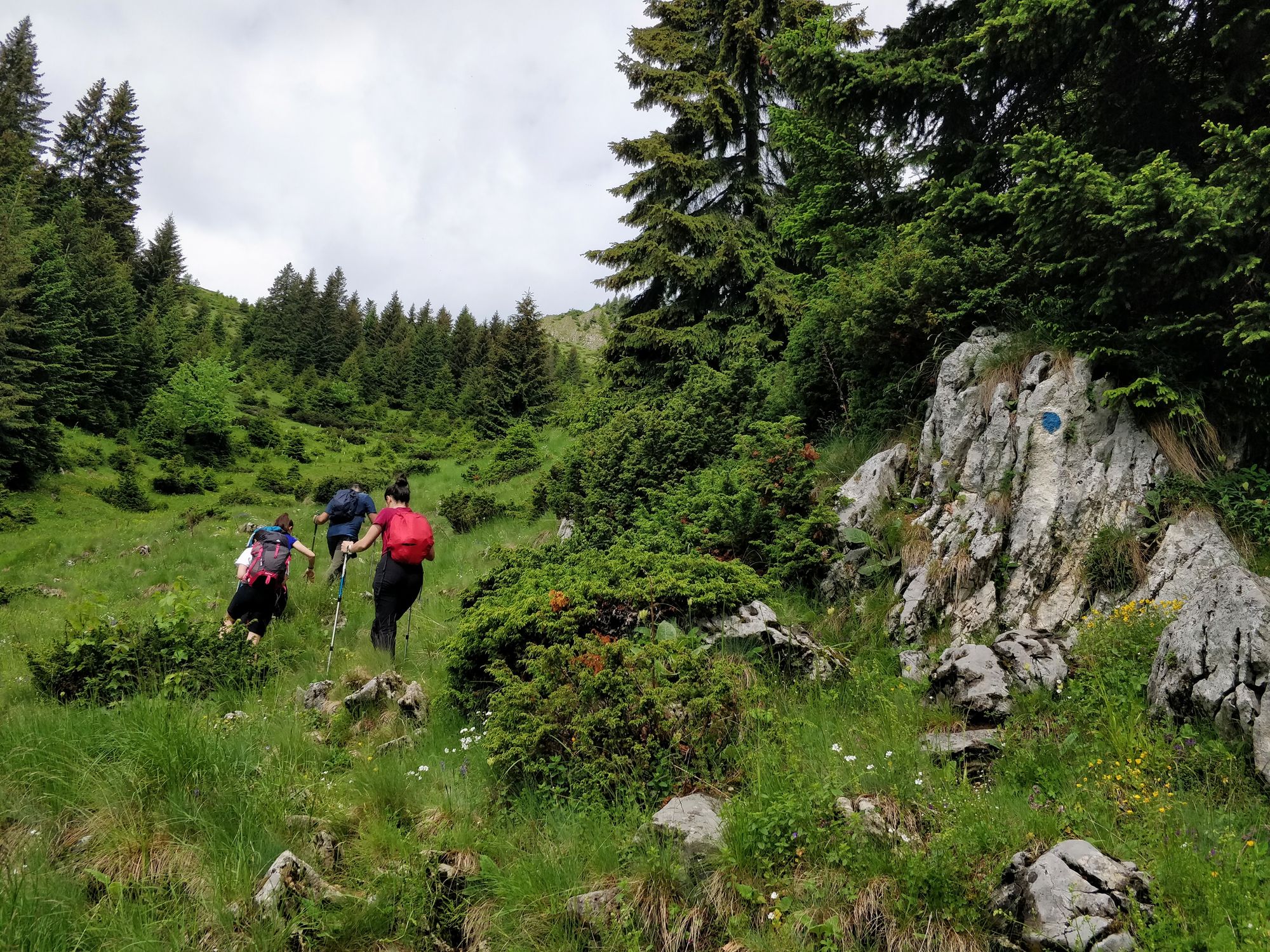
At 8:15 we start moving, and five minutes later, the climb through the forest begins. The climb is serious and sustained: in the first four kilometers we have to climb a 1000 m level difference.
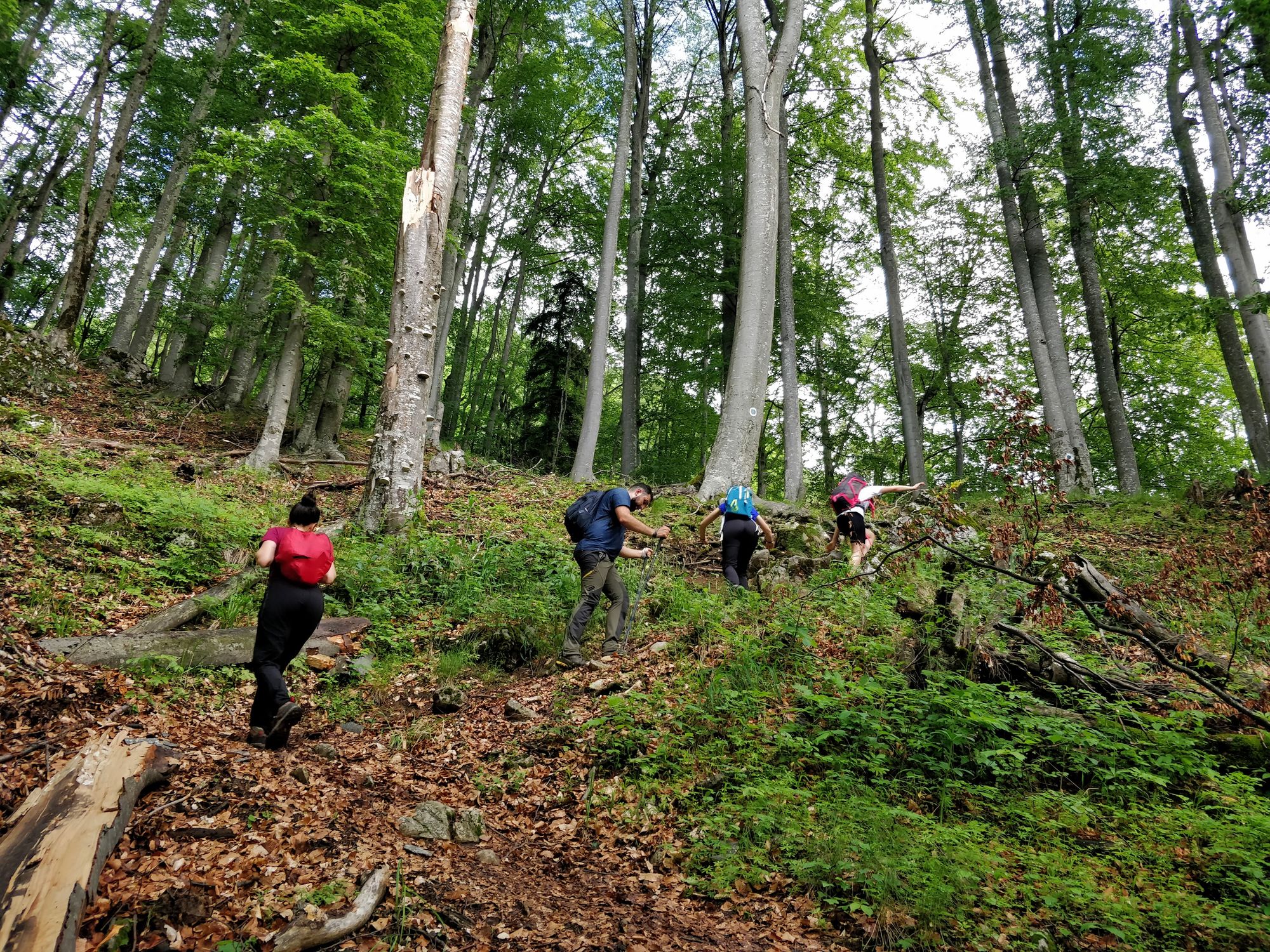
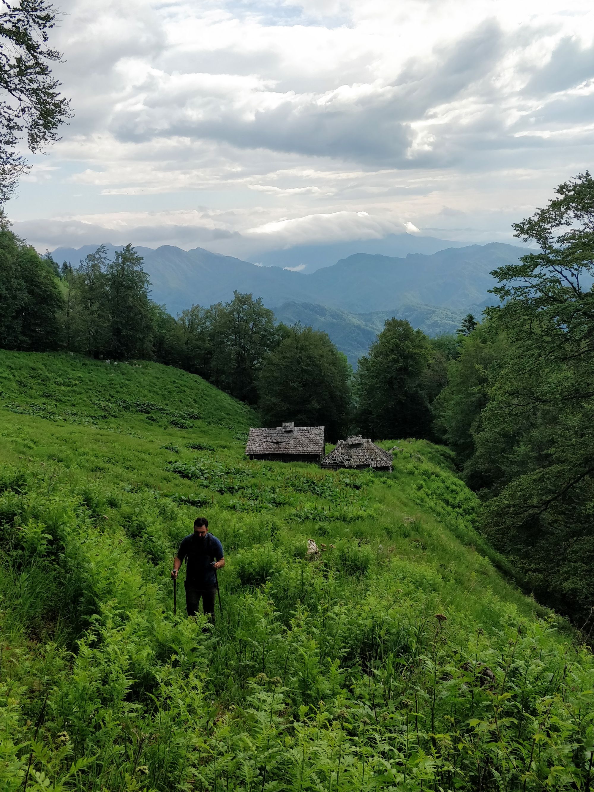
We climb without problems, and one hour and twenty minutes after the start (9:35) we arrive at the clearing where Ștevioara Sheepfold is located.
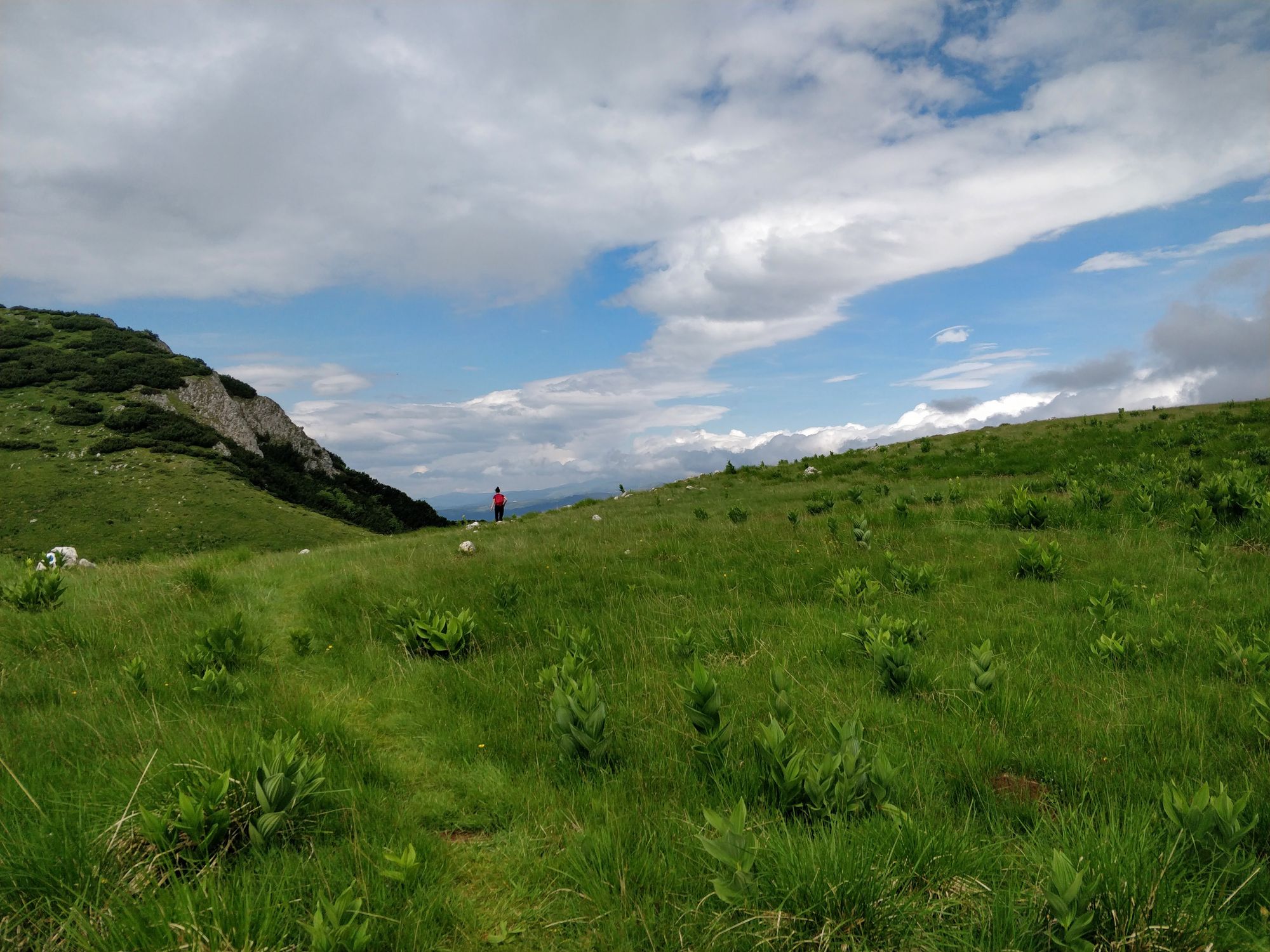
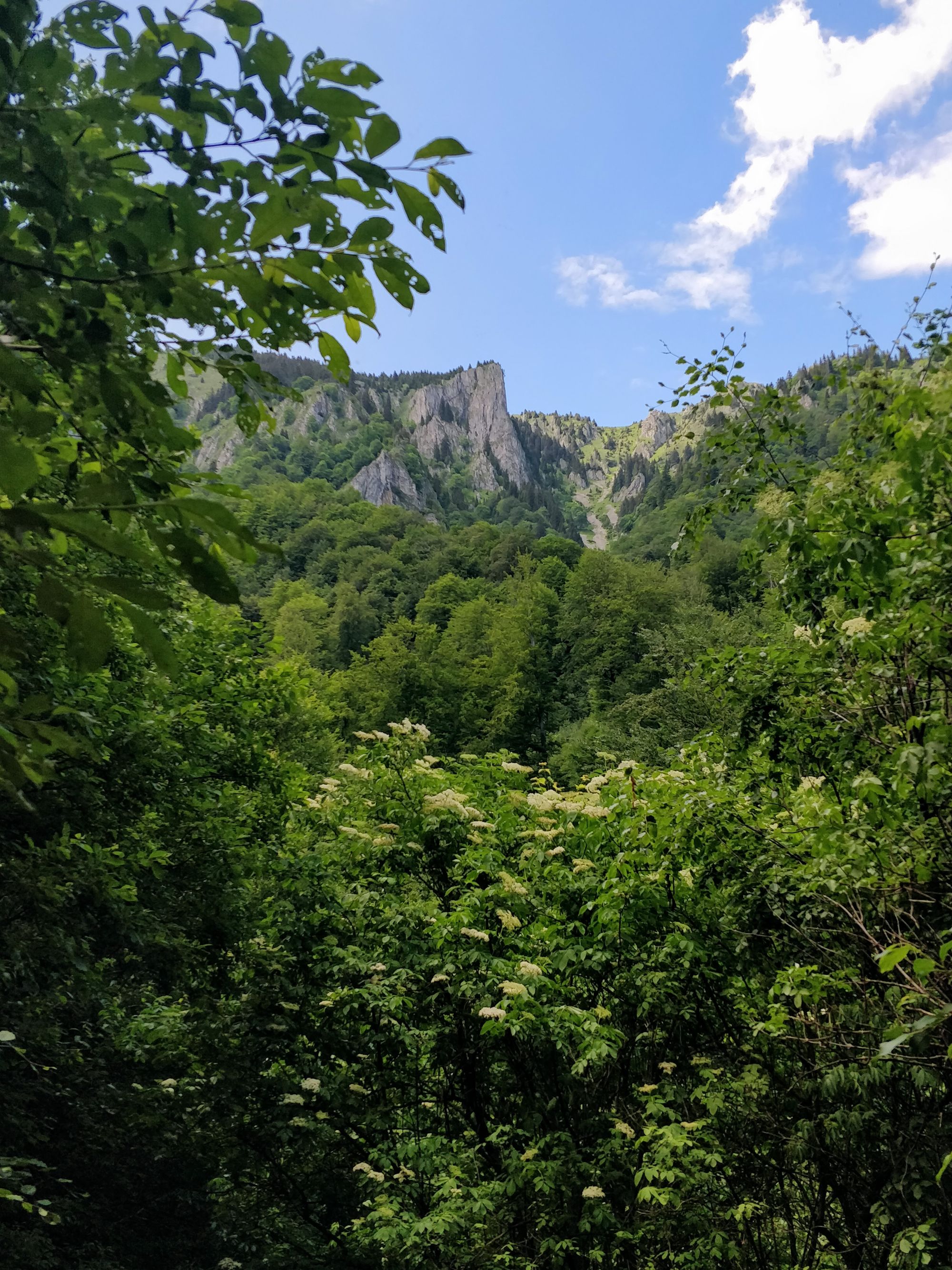
Here the forest allows us to see the top of the ridge, but also the beautiful mountains and hills around.
From here we still have to climb about half of the length, but soon we come out of the forest and the views energize us.
The view from the valley is also a feast for our eyes.
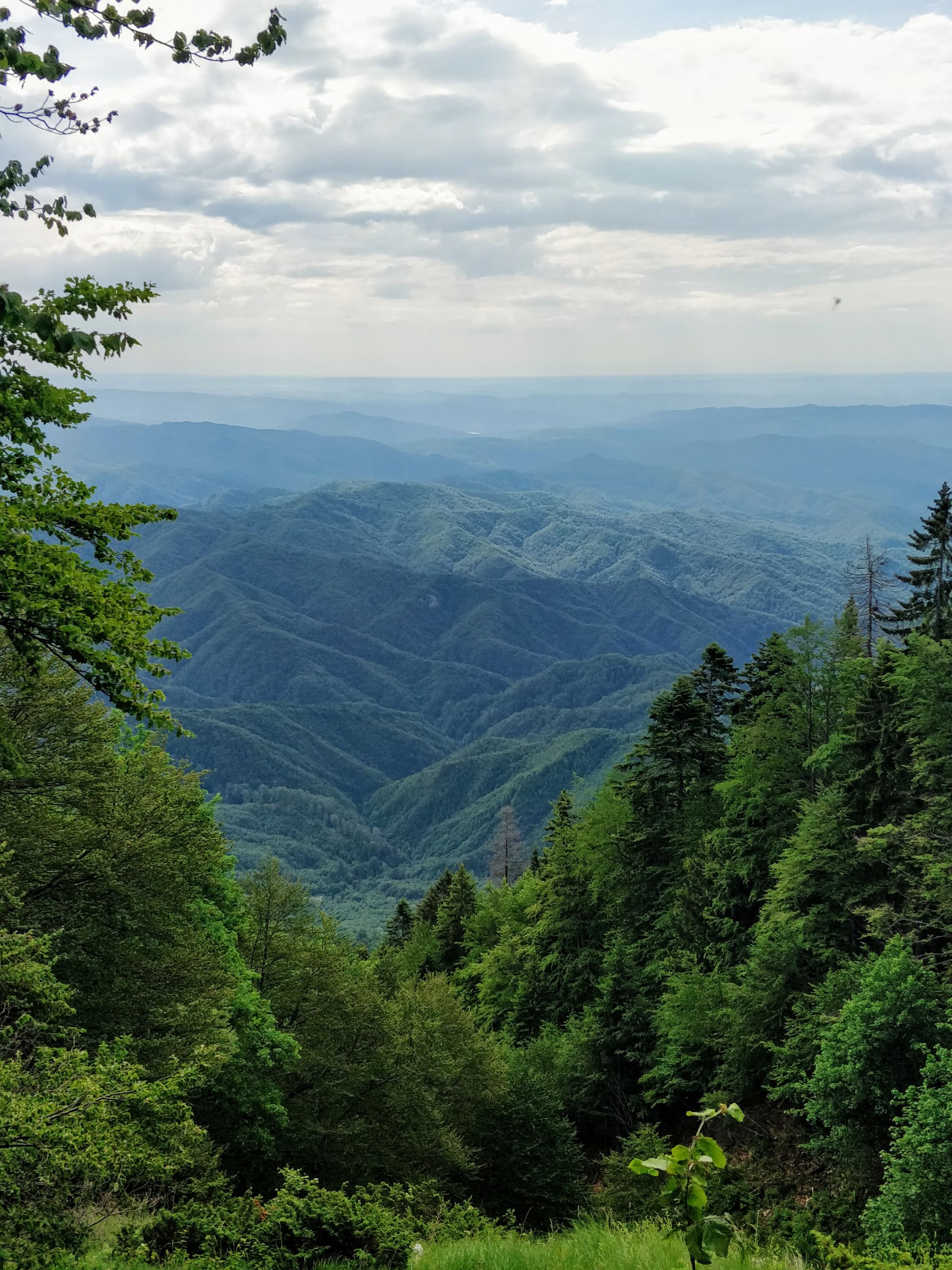
We continue to climb as the fog lifts. Soon we recognize the Cozia Massif on the horizon, and beyond it, still shrouded in fog, are the Făgăraș Mountains.
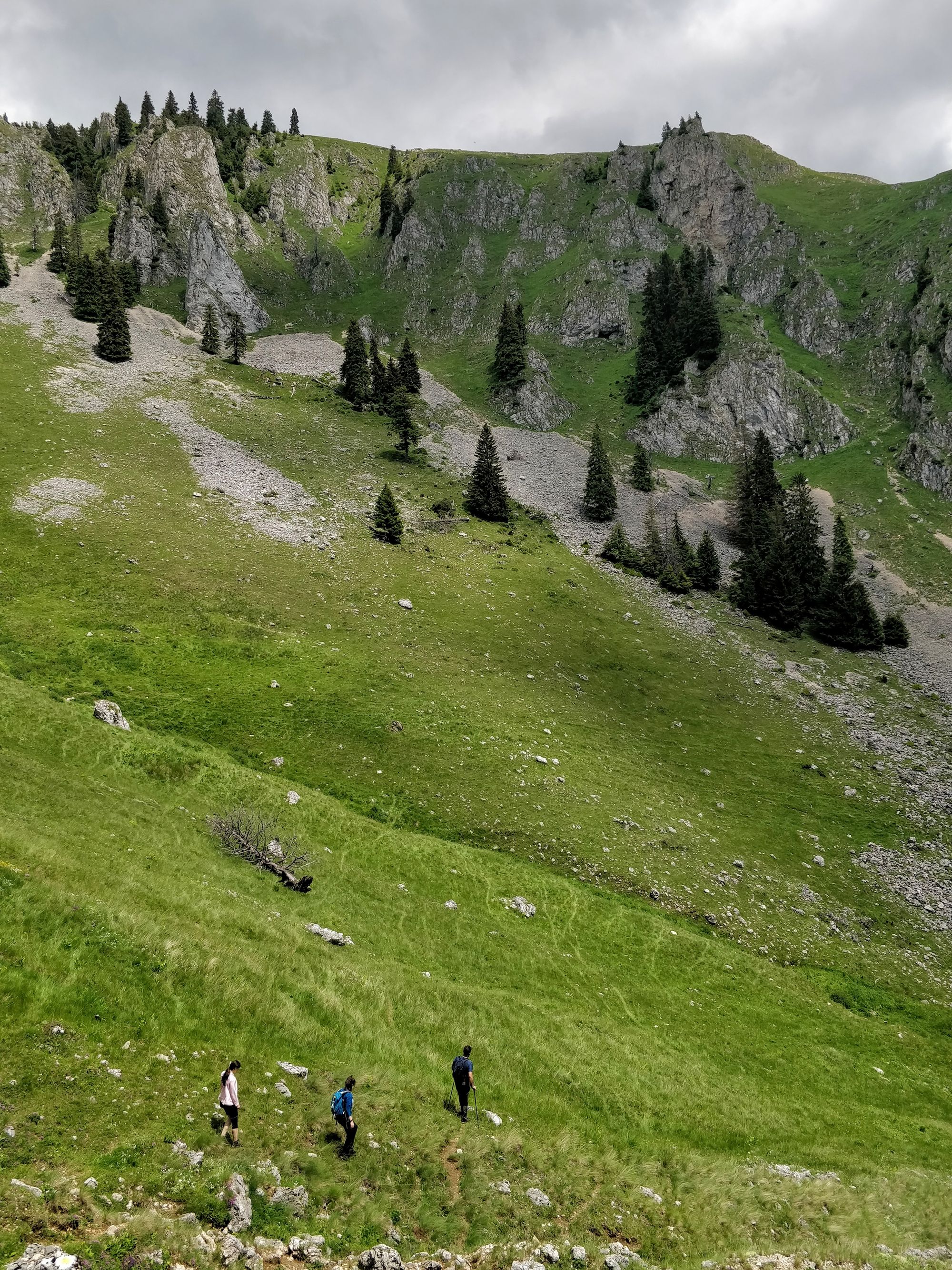
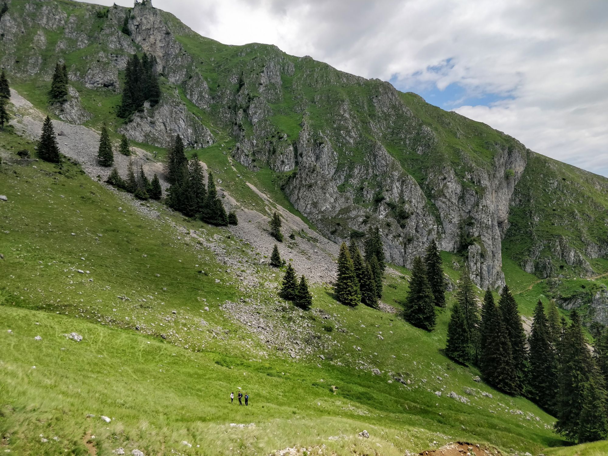
We continue to climb. We admire a herd of black goats. We keep going. We eat another apple. We keep wondering. Some, instead of getting tired, pick up speed.
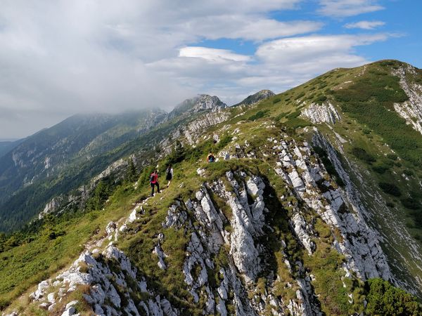
And just like that, at 10:45, after 2h 30m from the start, we find ourselves in Ștevioara Saddle.
Here we admire our surroundings, we catch our breath for a few minutes, then start our way to the top.
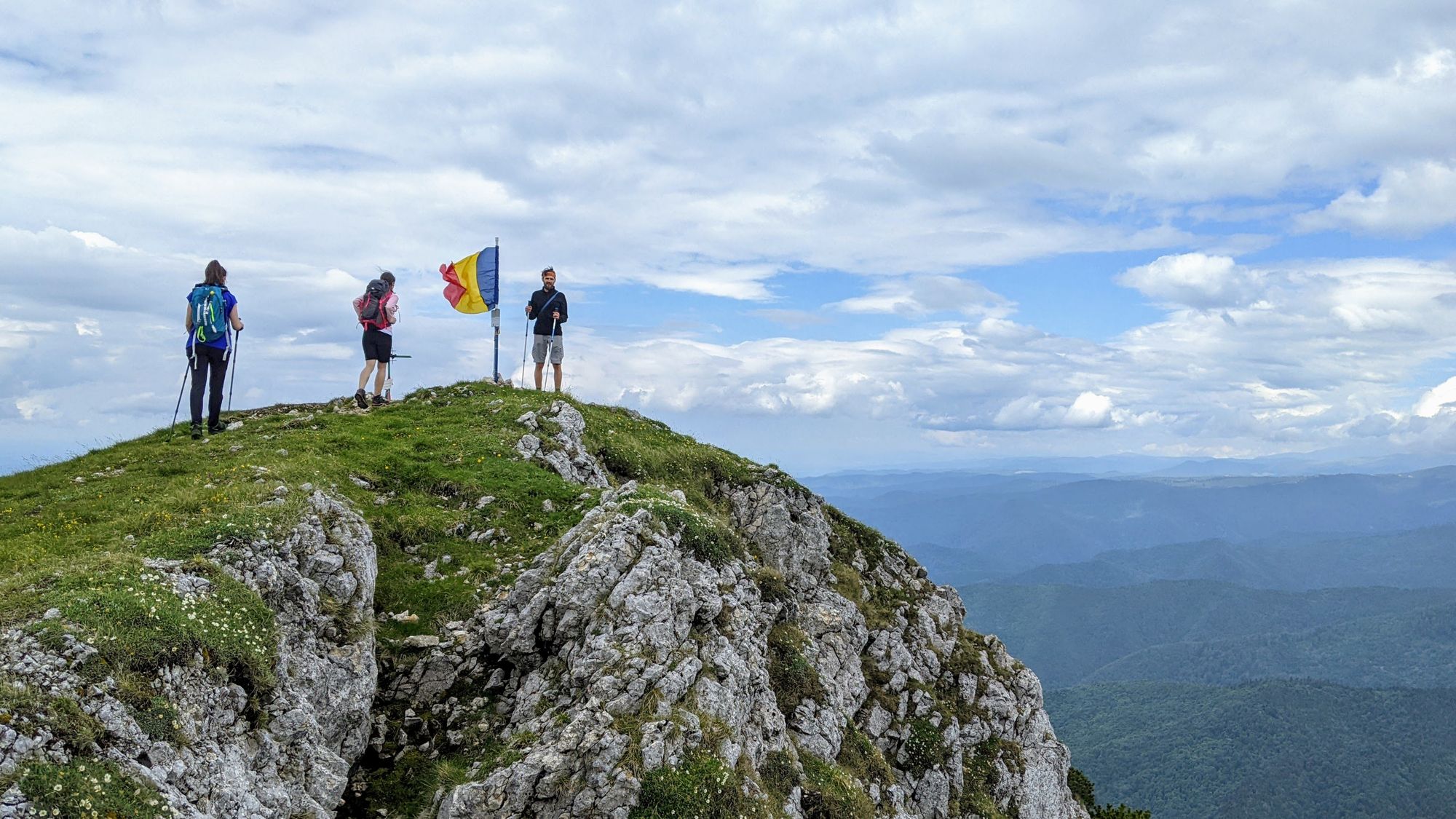
In a few minutes we reach the Buila peak, and we can say that the climb for the day is over. Fortunately, without any rain appearing on the horizon. All we have to do now is relax and enjoy the rest of the route.
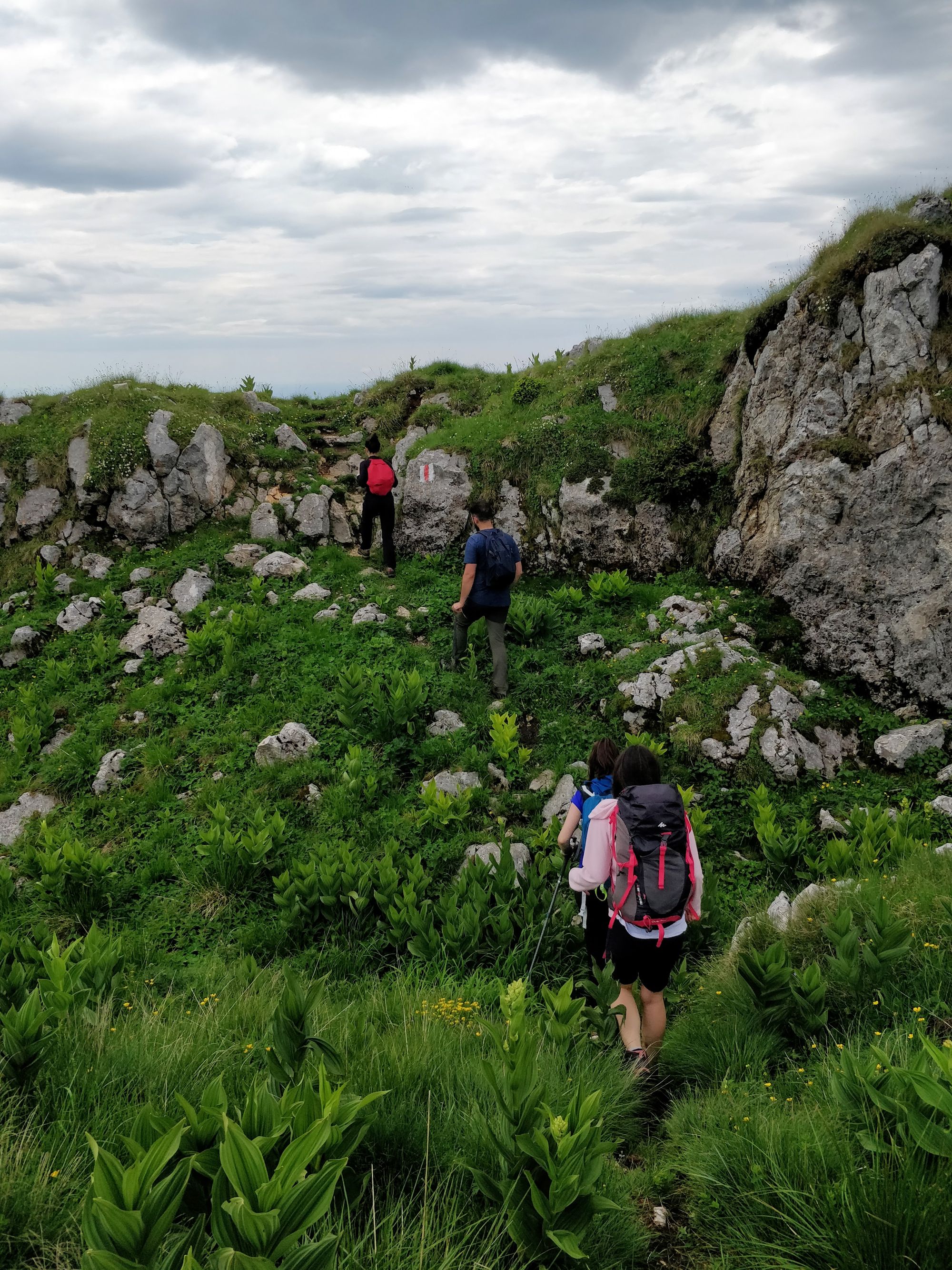
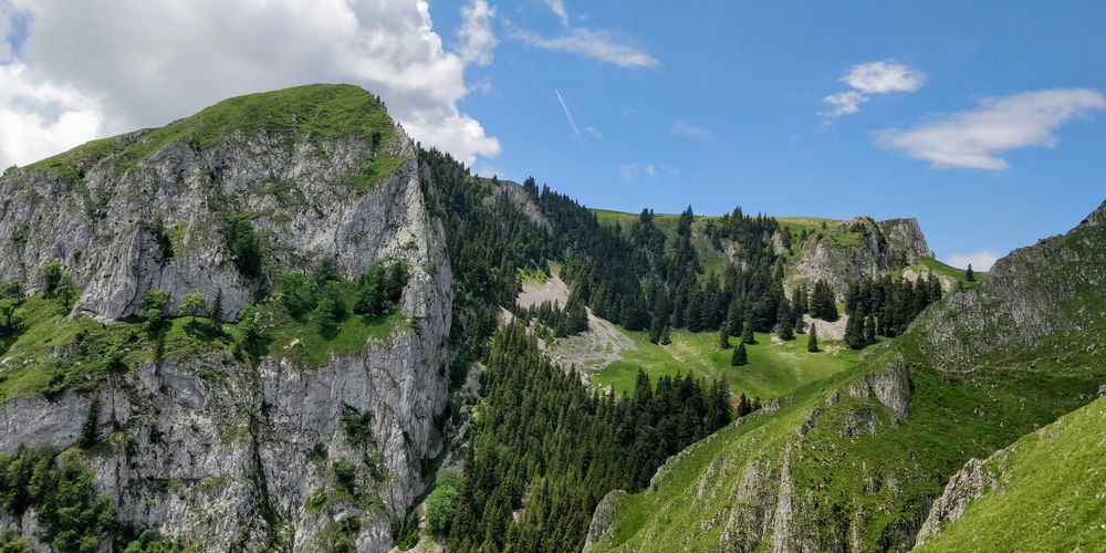
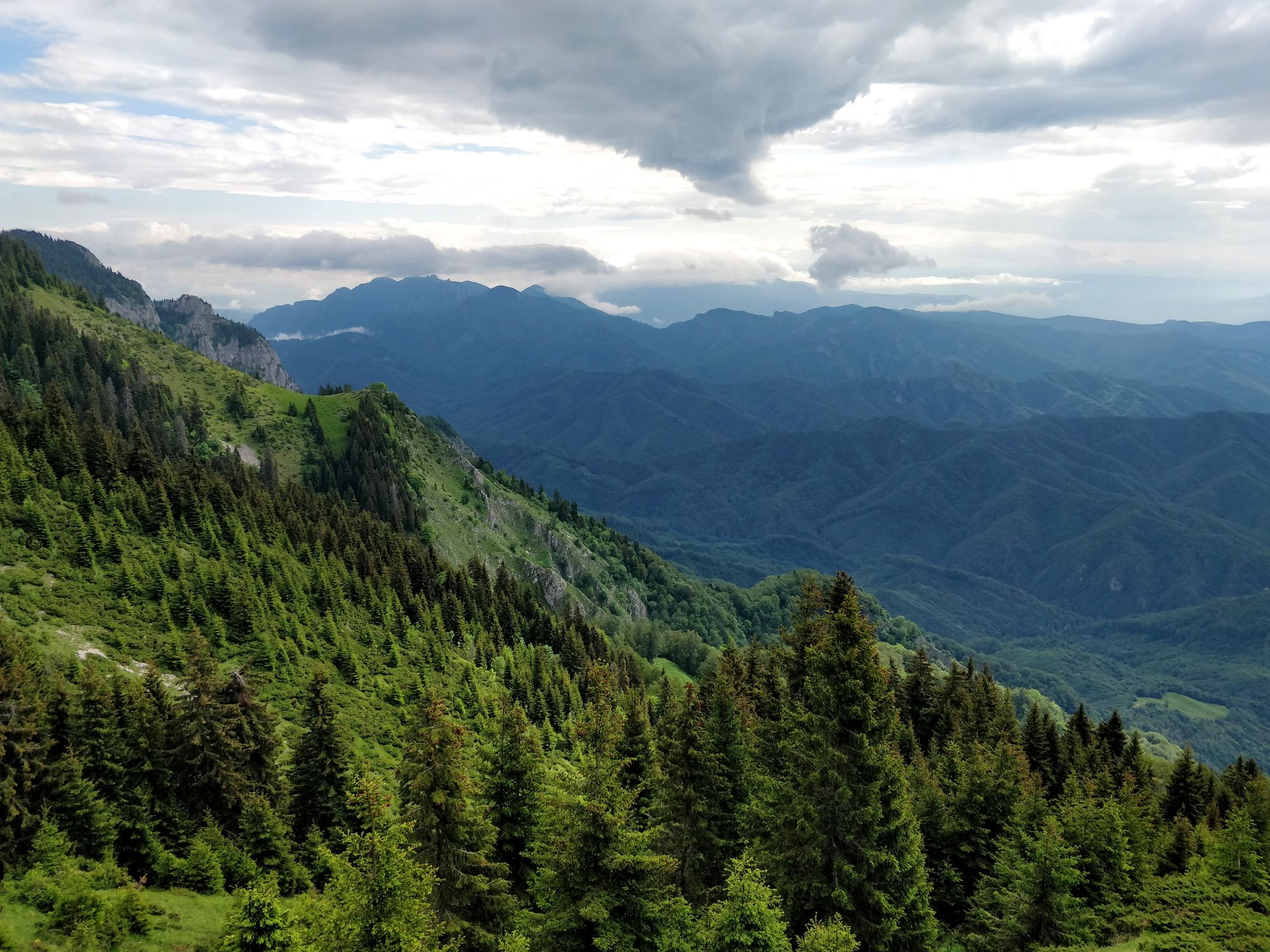
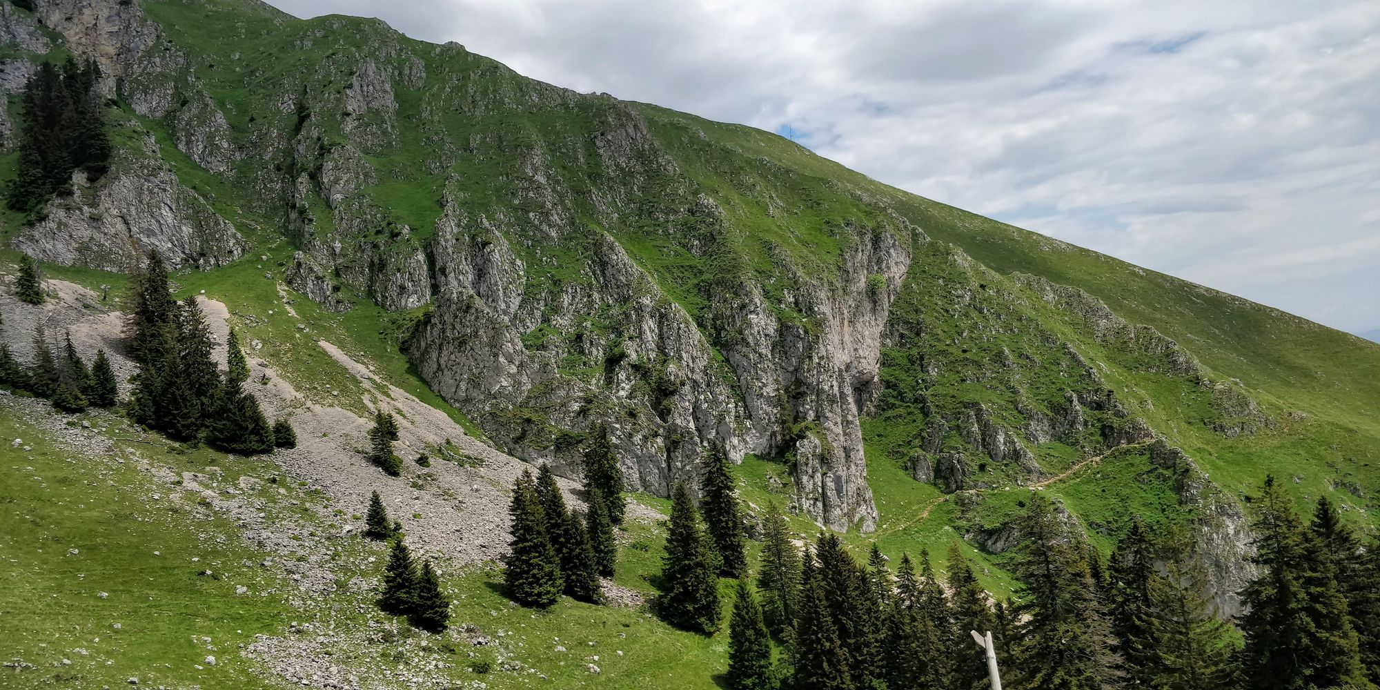
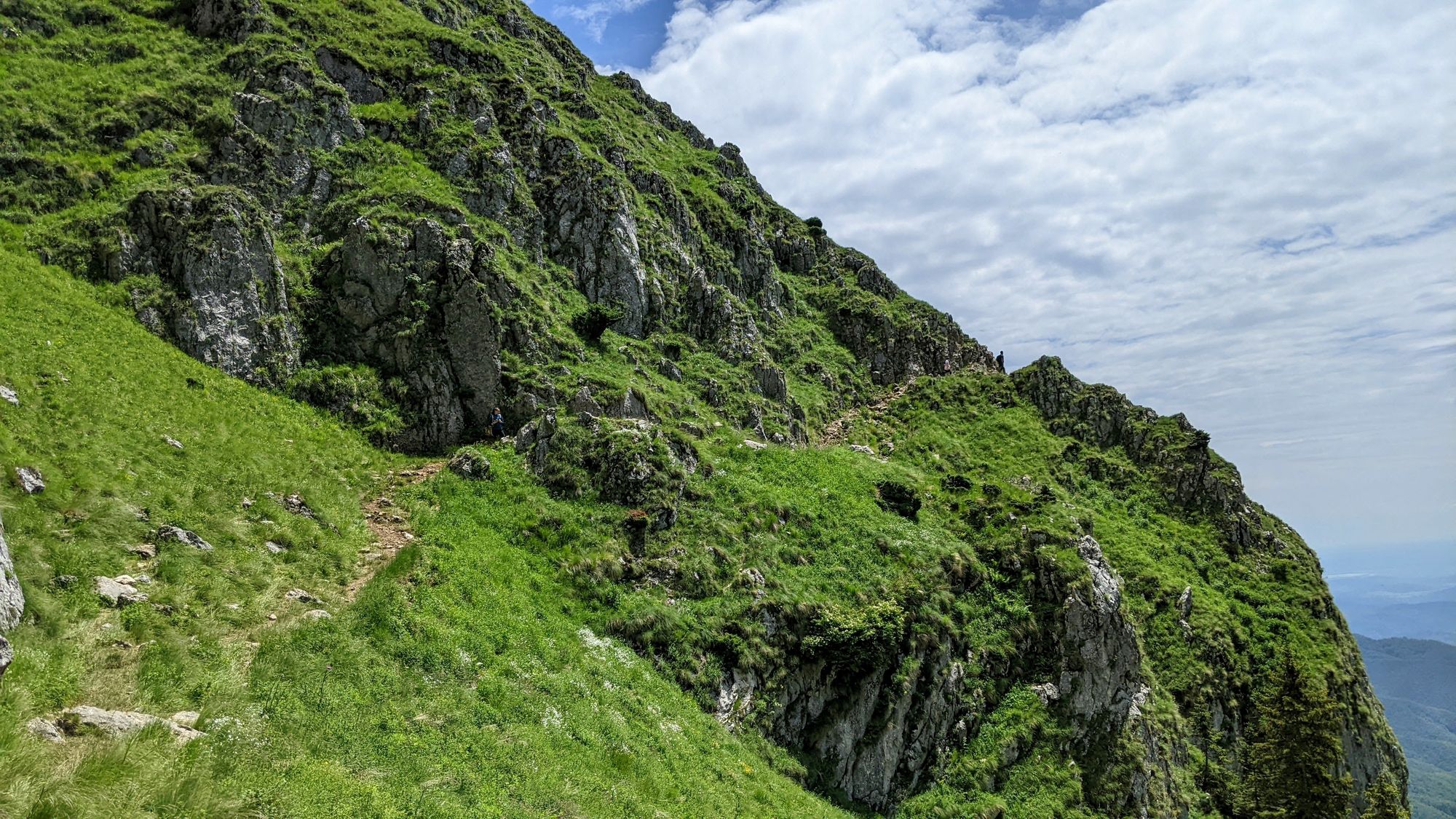
When we approach Curmătura Builei (Buila Saddle), the rocks take the form of fortress walls.
We descend among the stones, and we imagine we walk through ruins of an ancient citadel.
After a steeper descent on boulders, we finally see the refuge from Curmătura Builei. From Ștevioara Saddle to here it took us about an hour.
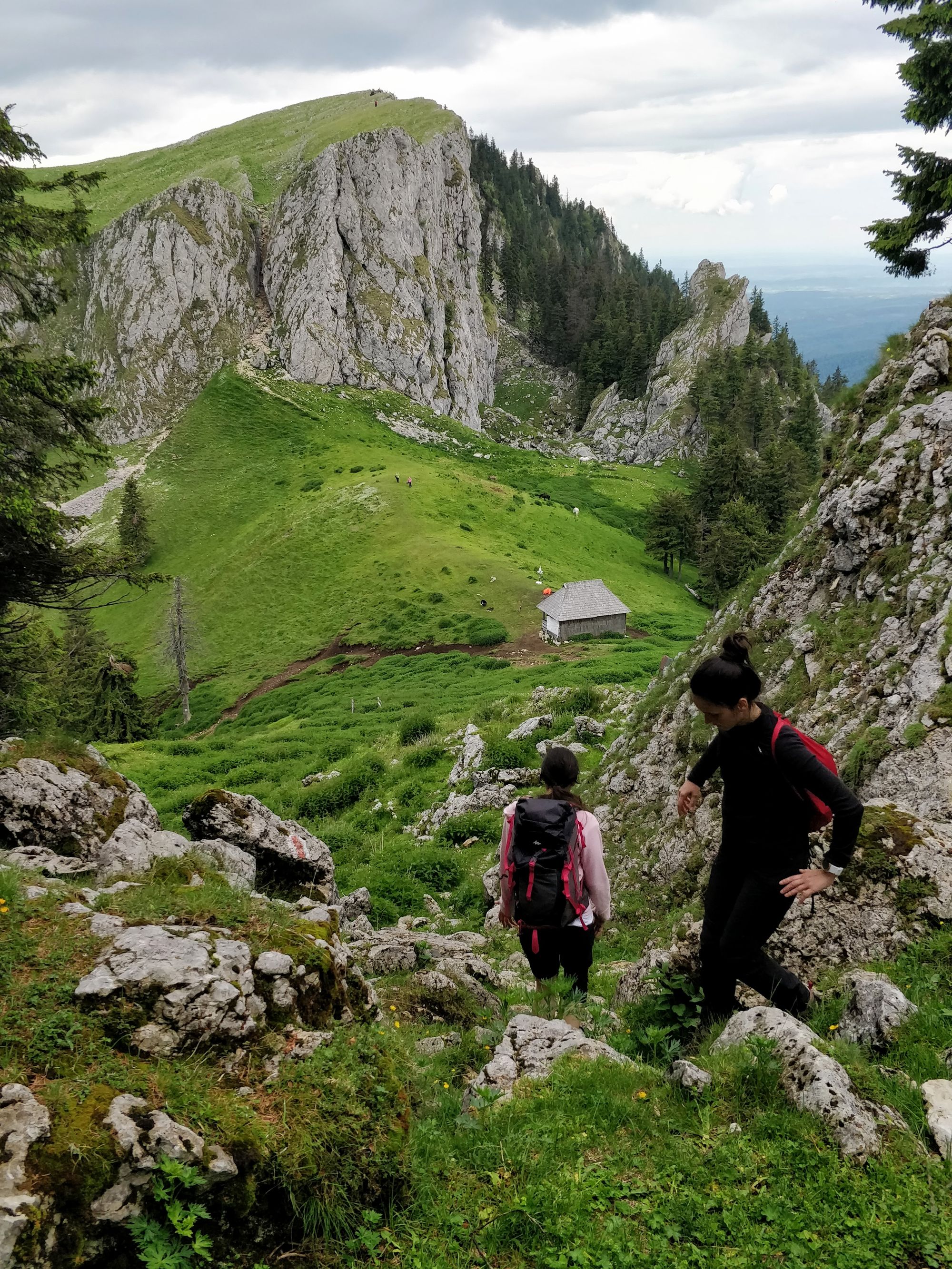
We descend through thick nettle bushes, and hardly find a place to have lunch, because the whole place is marked by sheep and horses.
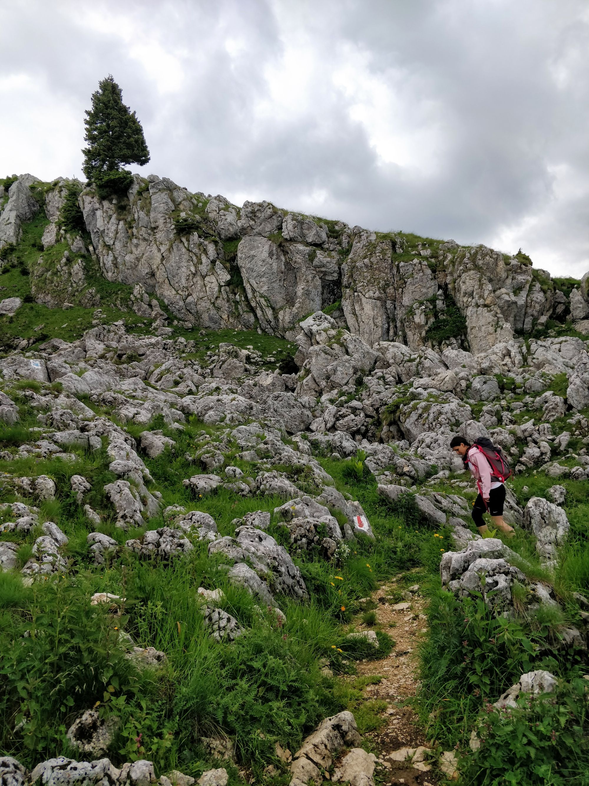
At 12:20 we start to descend on the yellow dot, not knowing that the most beautiful part of the route is still in front of us.
The path marked with the yellow dot is not very well signposted when it separates from the blue cross. We looked for it for a while, then we guided ourselves with the help of the GPS on the phone.
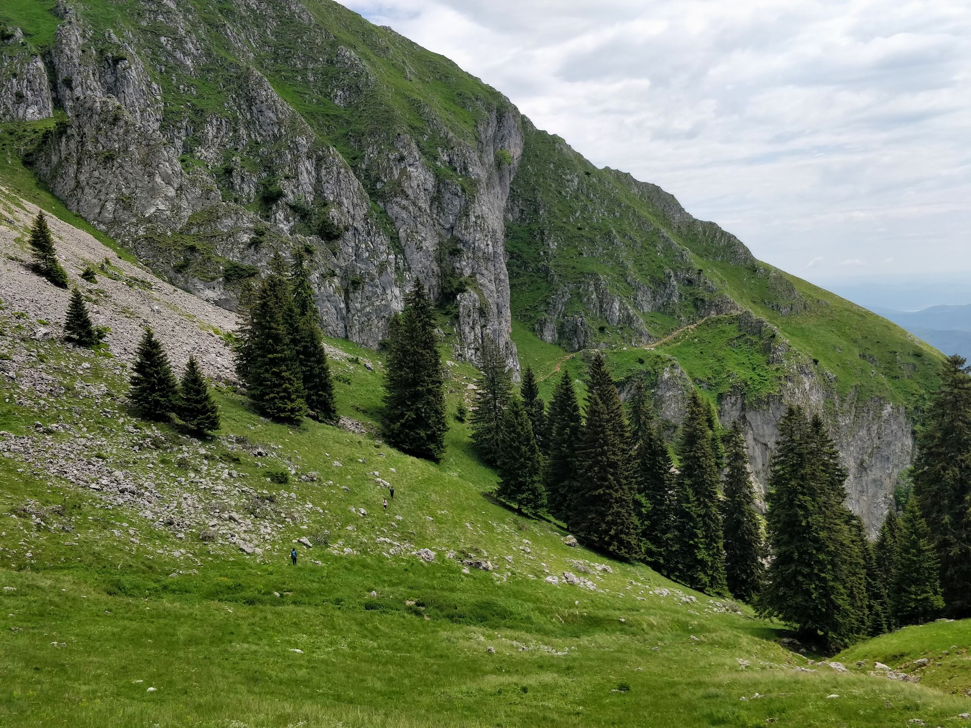
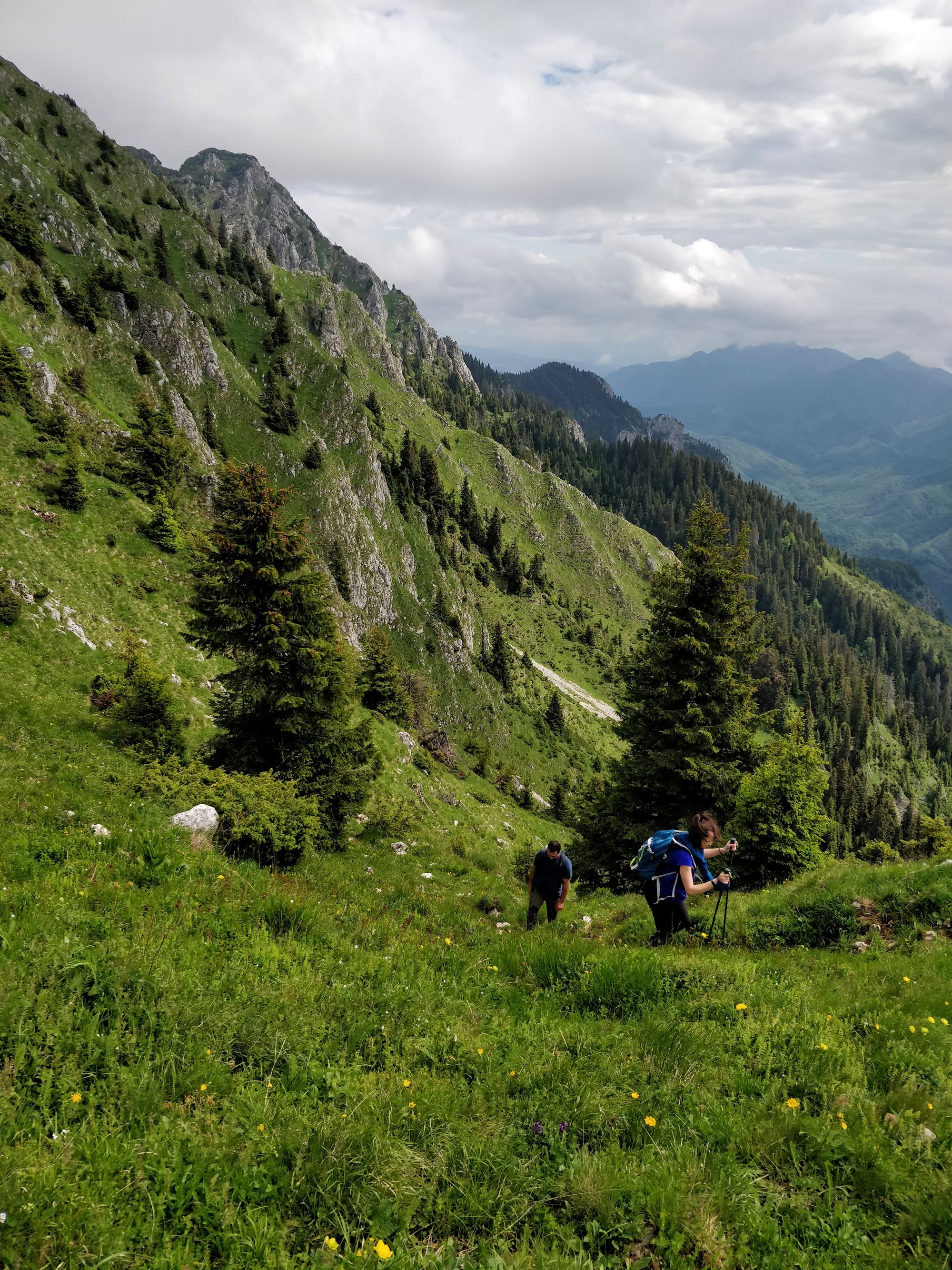
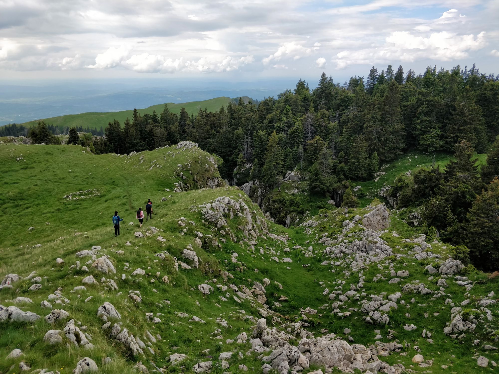
We are about to cross over a mountain shoulder, and get to the other side.
A grassy, steep section follows. I wouldn't want to come here when the grass is wet or, even worse, in the winter. However, in good weather it is nice to climb, because the route gradually opens up towards the valley that flows from Curmătura Builei.
We look back from time to time, because from this place we have the most beautiful perspective on Tucla Peak, Buila Saddle and its valley. Buila-Vânturarița is beautiful!

We continue for good minutes through scorching heat. The path through the grass is beautiful, because it offers wonderful views, but the hot sun before the rain makes us hurry towards the forest.
In a few minutes we reach the forest. It's not hot anymore, but we keep our rapid pace from the descent. So we soon arrive at Pătrunsa Hermitage, where we find, to our delight, fresh and cold water.
It took us almost two hours from the top, from Buila Saddle (Curmătura Builei).
According to the estimate from the signpost, the climb to the yellow dot would take 2h 30m-3h.
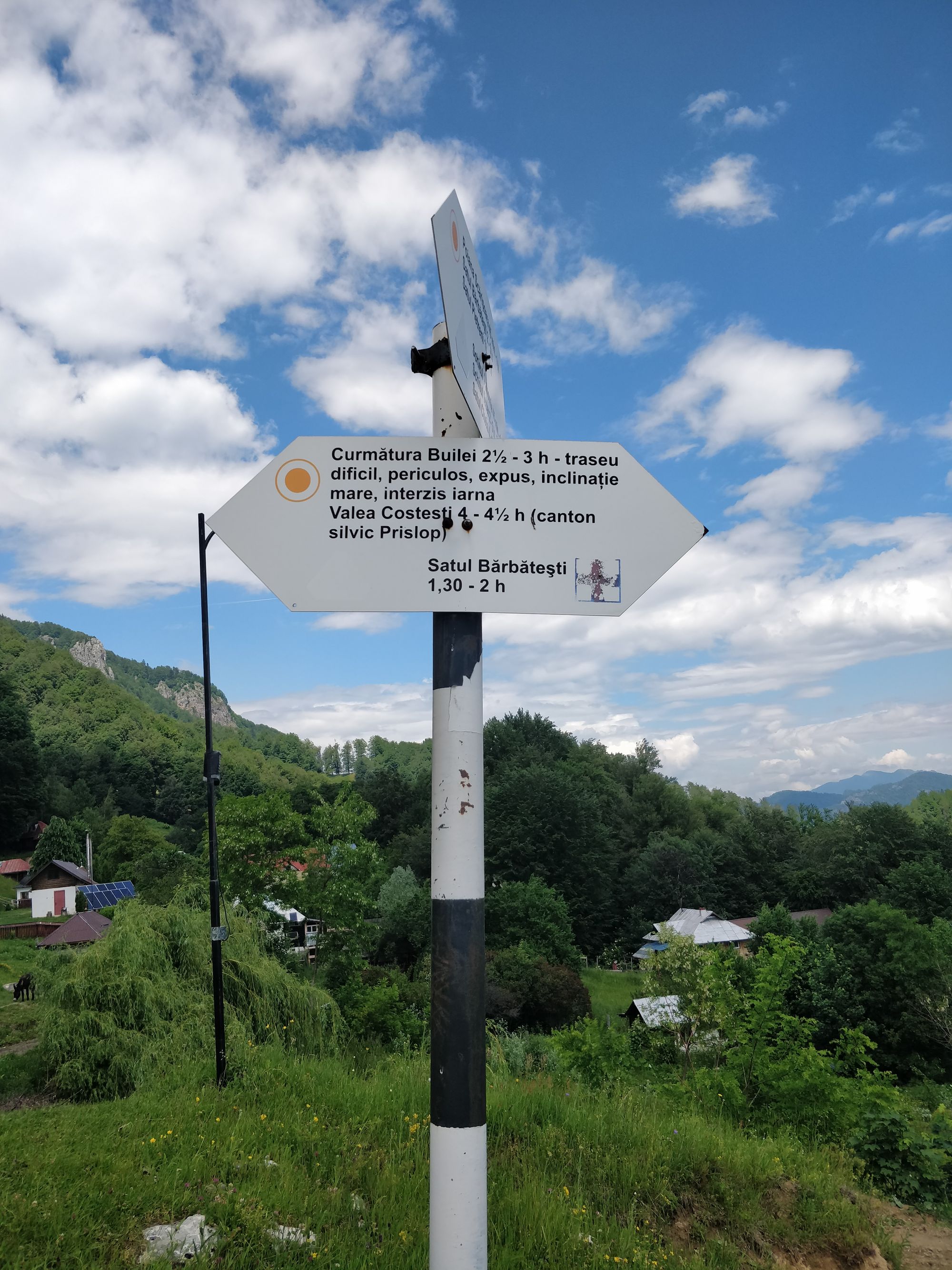
From Pătrunsa Hermitage to Pahomie we first walk on a smooth path, then on the road. Although the indicator says that we would do 45m-1h, we walked at a slow pace, taking many breaks, and reached the car after almost 1h 30m, tired but happy.
Conclusions
The second day in Buila-Vânturarița was superb. The ridge route is not very difficult, and it is particularly beautiful. We highly recommend it!
Have you been to Buila-Vânturarița? What trails did you do? What do you recommend?
Or have you been hiking in smaller, lesser-known national parks and felt like you discovered a treasure? Where was that?
We are looking forward to reading your answers on Facebook/Instagram/Twitter, in the comment section below, or in a private message.
Till’ next time!